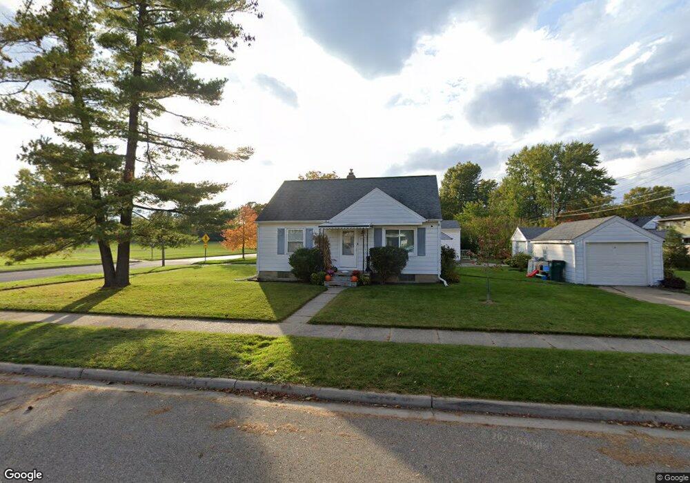
2218 Quentin Ave Lansing, MI 48910
Colonial Village NeighborhoodEstimated Value: $170,176 - $183,000
3
Beds
1
Bath
1,120
Sq Ft
$158/Sq Ft
Est. Value
About This Home
This home is located at 2218 Quentin Ave, Lansing, MI 48910 and is currently estimated at $177,044, approximately $158 per square foot. 2218 Quentin Ave is a home located in Ingham County with nearby schools including Averill Elementary School, Attwood School, and J.W. Sexton High School.
Ownership History
Date
Name
Owned For
Owner Type
Purchase Details
Closed on
Jan 25, 2010
Sold by
Panich Jacqueline A and Cadwell Jacqueline A
Bought by
Scripter Rebecca M
Current Estimated Value
Home Financials for this Owner
Home Financials are based on the most recent Mortgage that was taken out on this home.
Original Mortgage
$91,136
Outstanding Balance
$60,226
Interest Rate
5%
Mortgage Type
VA
Estimated Equity
$116,818
Create a Home Valuation Report for This Property
The Home Valuation Report is an in-depth analysis detailing your home's value as well as a comparison with similar homes in the area
Home Values in the Area
Average Home Value in this Area
Purchase History
| Date | Buyer | Sale Price | Title Company |
|---|---|---|---|
| Scripter Rebecca M | $89,000 | Parks Title |
Source: Public Records
Mortgage History
| Date | Status | Borrower | Loan Amount |
|---|---|---|---|
| Open | Scripter Rebecca M | $91,136 |
Source: Public Records
Tax History Compared to Growth
Tax History
| Year | Tax Paid | Tax Assessment Tax Assessment Total Assessment is a certain percentage of the fair market value that is determined by local assessors to be the total taxable value of land and additions on the property. | Land | Improvement |
|---|---|---|---|---|
| 2025 | $3,188 | $75,200 | $10,700 | $64,500 |
| 2024 | $25 | $69,500 | $10,700 | $58,800 |
| 2023 | $2,989 | $64,500 | $10,700 | $53,800 |
| 2022 | $2,694 | $62,000 | $10,200 | $51,800 |
| 2021 | $2,638 | $57,700 | $7,000 | $50,700 |
| 2020 | $2,622 | $53,300 | $7,000 | $46,300 |
| 2019 | $2,514 | $51,300 | $7,000 | $44,300 |
| 2018 | $2,356 | $46,300 | $7,000 | $39,300 |
| 2017 | $2,255 | $46,300 | $7,000 | $39,300 |
| 2016 | $2,157 | $41,600 | $7,000 | $34,600 |
| 2015 | $2,157 | $40,300 | $13,935 | $26,365 |
| 2014 | $2,157 | $38,800 | $10,451 | $28,349 |
Source: Public Records
Map
Nearby Homes
- 1420 Poxson Ave
- 1618 Loraine Ave
- 1404 Kelsey Ave
- 2118 Marion Ave
- 1312 W Mount Hope Ave
- 1315 Goodrich St
- 1120 Kelsey Ave
- 1740 Wellington Rd Unit 103
- 1607 Holly Way
- 1032 Kelsey Ave
- 2515 S Martin Luther King Junior Blvd
- 1114 Goodrich St
- 2112 Stirling Ave
- 2310 Stirling Ave
- 1116 George St
- 2421 Stirling Ave
- 1913 Stirling Ave
- 2039 Holly Way
- 907 Lenore Ave
- 1309 Hammond St
- 1606 Gordon Ave
- 1610 Gordon Ave
- 2200 Quentin Ave
- 1607 Cooper Ave
- 1616 Gordon Ave
- 2215 Quentin Ave
- 2221 Quentin Ave
- 1611 Cooper Ave
- 2211 Quentin Ave
- 2207 Quentin Ave
- 1617 Cooper Ave
- 1620 Gordon Ave
- 2201 Quentin Ave
- 1621 Cooper Ave
- 1626 Gordon Ave
- 2135 Quentin Ave
- 1600 Cooper Ave
- 2212 Pattengill Ave
- 1625 Cooper Ave
- 1500 Gordon Ave