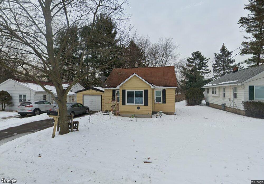
2219 Dawson Ave NE Grand Rapids, MI 49505
Creston NeighborhoodEstimated Value: $225,000 - $248,000
2
Beds
1
Bath
906
Sq Ft
$260/Sq Ft
Est. Value
About This Home
This home is located at 2219 Dawson Ave NE, Grand Rapids, MI 49505 and is currently estimated at $235,932, approximately $260 per square foot. 2219 Dawson Ave NE is a home located in Kent County with nearby schools including Riverside Middle School, Union High School, and Wellspring Preparatory High School.
Ownership History
Date
Name
Owned For
Owner Type
Purchase Details
Closed on
Jun 9, 1999
Sold by
Stites Stites G G and Stites K
Bought by
Dill Dill B and Dill Brent M
Current Estimated Value
Purchase Details
Closed on
Feb 4, 1985
Create a Home Valuation Report for This Property
The Home Valuation Report is an in-depth analysis detailing your home's value as well as a comparison with similar homes in the area
Home Values in the Area
Average Home Value in this Area
Purchase History
| Date | Buyer | Sale Price | Title Company |
|---|---|---|---|
| Dill Dill B | $70,000 | -- | |
| -- | $35,000 | -- |
Source: Public Records
Tax History Compared to Growth
Tax History
| Year | Tax Paid | Tax Assessment Tax Assessment Total Assessment is a certain percentage of the fair market value that is determined by local assessors to be the total taxable value of land and additions on the property. | Land | Improvement |
|---|---|---|---|---|
| 2025 | $1,384 | $95,700 | $0 | $0 |
| 2024 | $1,384 | $86,600 | $0 | $0 |
| 2023 | $1,404 | $77,900 | $0 | $0 |
| 2022 | $1,333 | $73,300 | $0 | $0 |
| 2021 | $1,303 | $63,900 | $0 | $0 |
| 2020 | $1,246 | $58,300 | $0 | $0 |
| 2019 | $1,305 | $51,600 | $0 | $0 |
| 2018 | $1,206 | $43,800 | $0 | $0 |
| 2017 | $1,174 | $38,500 | $0 | $0 |
| 2016 | $1,188 | $36,200 | $0 | $0 |
| 2015 | $1,105 | $36,200 | $0 | $0 |
| 2013 | -- | $32,500 | $0 | $0 |
Source: Public Records
Map
Nearby Homes
- 2100 Dawson Ave NE
- 2027 Joan Ave NE
- 1335 Knapp St NE
- 921 Eleanor St NE
- 1824 Herrick Ave NE
- 1335 Northlawn St NE
- 861 Aberdeen St NE
- 1119 Kentwood Dr NE
- 778 Eleanor St NE
- 1245 Kelsey St NE
- 1848 Emerald Ave NE
- 738 Graceland St NE
- 1237 Dale Ct NE
- 2038 Melita Ave NE
- 1825 Meadowfield Dr NE
- 1666 Carlton Ave NE
- 1050 3 Mile Rd NE
- 2700 Plainfield Ave NE
- 1757 Westlane Dr NE
- 612 Woodridge St NE
- 2221 Dawson Ave NE
- 2211 Dawson Ave NE
- 1215 Alberta St NE
- 1210 Calgary St NE
- 1220 Calgary St NE
- 1208 Calgary St NE
- 2220 Dawson Ave NE
- 2230 Dawson Ave NE
- 2212 Dawson Ave NE
- 2209 Dawson Ave NE
- 2214 Fuller Ave NE
- 2236 Dawson Ave NE
- 2228 Fuller Ave NE
- 1210 Alberta St NE
- 2207 Dawson Ave NE
- 2208 Dawson Ave NE
- 1319 Alberta St NE
- 1316 Calgary St NE
- 1217 Calgary St NE
- 1231 Calgary St NE