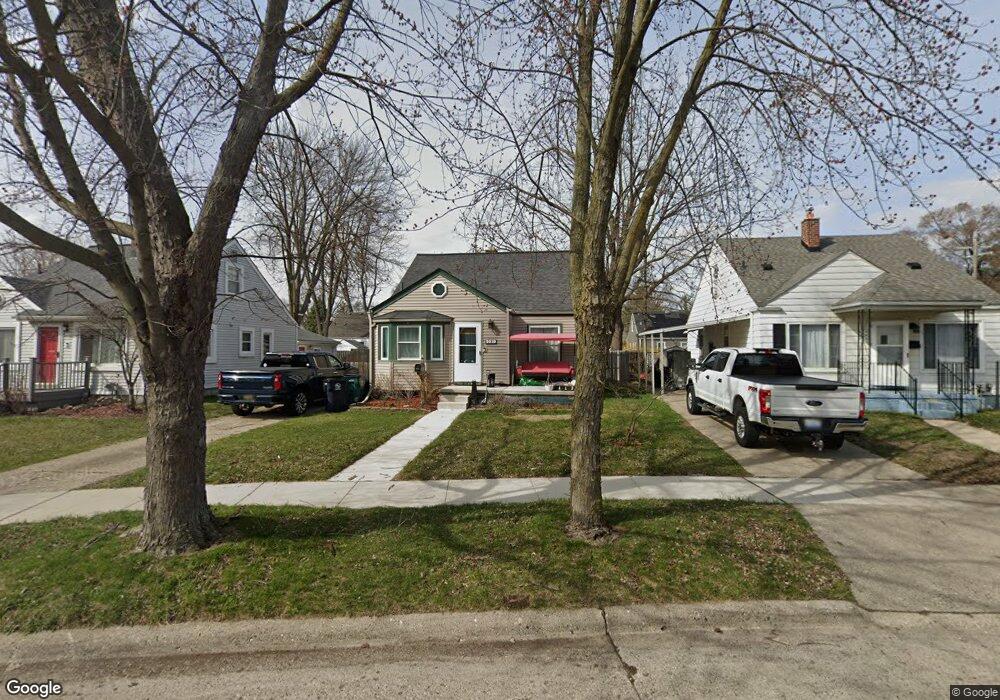
2219 E University Ave Royal Oak, MI 48067
Estimated Value: $279,175 - $331,000
3
Beds
2
Baths
1,100
Sq Ft
$268/Sq Ft
Est. Value
About This Home
This home is located at 2219 E University Ave, Royal Oak, MI 48067 and is currently estimated at $295,294, approximately $268 per square foot. 2219 E University Ave is a home located in Oakland County with nearby schools including Keller Elementary, Royal Oak Middle School, and Royal Oak High School.
Ownership History
Date
Name
Owned For
Owner Type
Purchase Details
Closed on
Jul 20, 2020
Sold by
Chrisom Ruth and Connor Ruth
Bought by
Connor Ruth A
Current Estimated Value
Home Financials for this Owner
Home Financials are based on the most recent Mortgage that was taken out on this home.
Original Mortgage
$20,000
Outstanding Balance
$5,678
Interest Rate
3.2%
Mortgage Type
Stand Alone Second
Estimated Equity
$289,616
Purchase Details
Closed on
Dec 23, 2010
Sold by
Ghiardi Gena L
Bought by
Chrisom Ruth
Home Financials for this Owner
Home Financials are based on the most recent Mortgage that was taken out on this home.
Original Mortgage
$60,000
Interest Rate
4.5%
Mortgage Type
New Conventional
Purchase Details
Closed on
Sep 21, 2010
Sold by
Ghiardi Gena L
Bought by
Federal National Mortgage Association
Create a Home Valuation Report for This Property
The Home Valuation Report is an in-depth analysis detailing your home's value as well as a comparison with similar homes in the area
Home Values in the Area
Average Home Value in this Area
Purchase History
| Date | Buyer | Sale Price | Title Company |
|---|---|---|---|
| Connor Ruth A | -- | Sterling Title Agency | |
| Chrisom Ruth | $75,000 | Multiple | |
| Federal National Mortgage Association | $158,134 | None Available |
Source: Public Records
Mortgage History
| Date | Status | Borrower | Loan Amount |
|---|---|---|---|
| Open | Connor Ruth A | $20,000 | |
| Closed | Chrisom Ruth | $60,000 |
Source: Public Records
Tax History Compared to Growth
Tax History
| Year | Tax Paid | Tax Assessment Tax Assessment Total Assessment is a certain percentage of the fair market value that is determined by local assessors to be the total taxable value of land and additions on the property. | Land | Improvement |
|---|---|---|---|---|
| 2024 | $2,268 | $111,430 | $0 | $0 |
| 2022 | $2,680 | $98,520 | $0 | $0 |
| 2020 | $2,204 | $88,430 | $0 | $0 |
| 2018 | $2,680 | $77,890 | $0 | $0 |
| 2017 | $2,646 | $77,890 | $0 | $0 |
| 2015 | -- | $69,790 | $0 | $0 |
| 2014 | -- | $62,840 | $0 | $0 |
| 2011 | -- | $60,080 | $0 | $0 |
Source: Public Records
Map
Nearby Homes
- 415 N Stephenson Hwy
- 2214 Baxter Ave
- 316 N Edgeworth Ave
- 940 Mace Ave
- 932 Mace Ave
- 306 N Kenwood Ave
- 305 N Kenwood Ave
- 27059 Hampden St
- 303 N Dorchester Ave
- 209 Helene Ave
- 111 N Dorchester Ave
- 116 S Kenwood Ave
- 800 N Dorchester Ave
- 27840 Hampden St
- 800 N Edison Ave
- 27693 Dartmouth St
- 27907 Lenox Ave
- 812 N Edison Ave
- 710 N Campbell Rd
- 400 N Wilson Ave
- 2215 E University Ave
- 2223 E University Ave
- 408 N Minerva Ave
- 410 N Minerva Ave
- 2214 Sprague Ave
- 2218 Sprague Ave
- 2227 E University Ave
- 416 N Minerva Ave
- 416 N Minerva Ave
- 2222 Sprague Ave
- 2206 Sprague Ave
- 400 N Minerva Ave
- 2226 Sprague Ave
- 2218 E University Ave
- 2222 E University Ave
- 401 N Stephenson Hwy
- 411 N Stephenson Hwy
- 2200 Sprague Ave
- 2210 E University Ave
- 405 N Stephenson Hwy