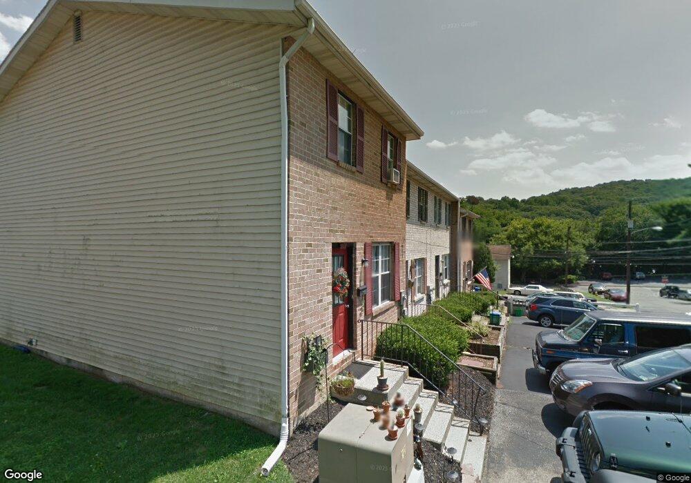
222 9th Ave Bethlehem, PA 18018
West Bethlehem NeighborhoodEstimated Value: $217,290 - $237,000
3
Beds
2
Baths
1,296
Sq Ft
$177/Sq Ft
Est. Value
About This Home
This home is located at 222 9th Ave, Bethlehem, PA 18018 and is currently estimated at $229,097, approximately $176 per square foot. 222 9th Ave is a home located in Lehigh County with nearby schools including Calypso Elementary School, Nitschmann Middle School, and Liberty High School.
Ownership History
Date
Name
Owned For
Owner Type
Purchase Details
Closed on
Jul 22, 2024
Sold by
Fisher Donnita A
Bought by
Orban Renae
Current Estimated Value
Home Financials for this Owner
Home Financials are based on the most recent Mortgage that was taken out on this home.
Original Mortgage
$100,000
Outstanding Balance
$98,796
Interest Rate
6.95%
Mortgage Type
Seller Take Back
Estimated Equity
$130,301
Purchase Details
Closed on
Aug 19, 1999
Sold by
Alesick Traci A
Bought by
Fisher Donnita A
Purchase Details
Closed on
Oct 20, 1994
Sold by
Krawitz and Brill Equity
Bought by
Alesick Traci A
Create a Home Valuation Report for This Property
The Home Valuation Report is an in-depth analysis detailing your home's value as well as a comparison with similar homes in the area
Home Values in the Area
Average Home Value in this Area
Purchase History
| Date | Buyer | Sale Price | Title Company |
|---|---|---|---|
| Orban Renae | $100,000 | None Listed On Document | |
| Fisher Donnita A | $67,900 | -- | |
| Alesick Traci A | $67,000 | -- |
Source: Public Records
Mortgage History
| Date | Status | Borrower | Loan Amount |
|---|---|---|---|
| Open | Orban Renae | $100,000 |
Source: Public Records
Tax History Compared to Growth
Tax History
| Year | Tax Paid | Tax Assessment Tax Assessment Total Assessment is a certain percentage of the fair market value that is determined by local assessors to be the total taxable value of land and additions on the property. | Land | Improvement |
|---|---|---|---|---|
| 2025 | $3,264 | $113,600 | $6,900 | $106,700 |
| 2024 | $3,226 | $113,600 | $6,900 | $106,700 |
| 2023 | $3,198 | $113,600 | $6,900 | $106,700 |
| 2022 | $3,250 | $113,600 | $106,700 | $6,900 |
| 2021 | $3,235 | $113,600 | $6,900 | $106,700 |
| 2020 | $3,132 | $113,600 | $6,900 | $106,700 |
| 2019 | $3,155 | $113,600 | $6,900 | $106,700 |
| 2018 | $3,093 | $113,600 | $6,900 | $106,700 |
| 2017 | $2,956 | $113,600 | $6,900 | $106,700 |
| 2016 | -- | $113,600 | $6,900 | $106,700 |
| 2015 | -- | $113,600 | $6,900 | $106,700 |
| 2014 | -- | $113,600 | $6,900 | $106,700 |
Source: Public Records
Map
Nearby Homes