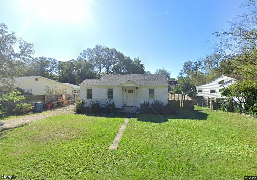
222 Anguilla Ave Saint Simons Island, GA 31522
Estimated Value: $499,000 - $655,047
2
Beds
1
Bath
973
Sq Ft
$615/Sq Ft
Est. Value
About This Home
This home is located at 222 Anguilla Ave, Saint Simons Island, GA 31522 and is currently estimated at $598,762, approximately $615 per square foot. 222 Anguilla Ave is a home located in Glynn County with nearby schools including St. Simons Elementary School, Glynn Middle School, and Glynn Academy.
Ownership History
Date
Name
Owned For
Owner Type
Purchase Details
Closed on
Sep 21, 2018
Sold by
Fouche Gary Walter
Bought by
Taylor Terry Ann and Taylor Bruce Allen
Current Estimated Value
Home Financials for this Owner
Home Financials are based on the most recent Mortgage that was taken out on this home.
Original Mortgage
$22,000
Outstanding Balance
$19,146
Interest Rate
4.5%
Mortgage Type
New Conventional
Estimated Equity
$579,616
Purchase Details
Closed on
Oct 2, 2017
Sold by
Fouche Hazel Walters Estat
Bought by
Fouche Glynn E and Fouche Gary Walter
Create a Home Valuation Report for This Property
The Home Valuation Report is an in-depth analysis detailing your home's value as well as a comparison with similar homes in the area
Home Values in the Area
Average Home Value in this Area
Purchase History
| Date | Buyer | Sale Price | Title Company |
|---|---|---|---|
| Taylor Terry Ann | $275,000 | -- | |
| Fouche Glynn E | -- | -- |
Source: Public Records
Mortgage History
| Date | Status | Borrower | Loan Amount |
|---|---|---|---|
| Open | Taylor Terry Ann | $22,000 |
Source: Public Records
Tax History Compared to Growth
Tax History
| Year | Tax Paid | Tax Assessment Tax Assessment Total Assessment is a certain percentage of the fair market value that is determined by local assessors to be the total taxable value of land and additions on the property. | Land | Improvement |
|---|---|---|---|---|
| 2025 | $6,869 | $273,880 | $200,000 | $73,880 |
| 2024 | $4,757 | $189,680 | $138,520 | $51,160 |
| 2023 | $4,786 | $189,680 | $138,520 | $51,160 |
| 2022 | $4,187 | $161,960 | $110,800 | $51,160 |
| 2021 | $3,580 | $133,600 | $83,120 | $50,480 |
| 2020 | $2,744 | $100,320 | $49,840 | $50,480 |
| 2019 | $2,744 | $100,320 | $49,840 | $50,480 |
| 2018 | $837 | $93,560 | $49,840 | $43,720 |
| 2017 | $2,568 | $93,560 | $49,840 | $43,720 |
| 2016 | $275 | $82,080 | $49,840 | $32,240 |
| 2015 | $275 | $70,320 | $49,840 | $20,480 |
| 2014 | $275 | $70,320 | $49,840 | $20,480 |
Source: Public Records
Map
Nearby Homes
- 413 Ashantilly Ave
- 536 Delegal St
- 533 Timmons St
- 213 Magnolia Ave
- 409 Kelsall Ave
- 805 Mallery St Unit E
- 800 Mallery St Unit 52
- 800 Mallery St Unit 90
- 800 Mallery St Unit C-30
- 800 Mallery St Unit J-89
- 907 Mallery St
- 316 Forest Oaks
- 850 Mallery St Unit 8K
- 850 Mallery St Unit 6A
- 850 Mallery St Unit 4W
- 850 Mallery St Unit S 3
- 850 Mallery St Unit 4O
- 850 Mallery St Unit 13Q
- 850 Mallery St Unit 9W
- 1000 Mallery Street Extension Unit B5
- 224 Anguilla Ave
- 220 Anguilla Ave
- 302 Anguilla Ave
- 218 Anguilla Ave
- 17 Perth Ct
- 15 Perth Ct
- 304 Anguilla Ave
- 216 Anguilla Ave
- 305 Ashantilly Ave
- 301 Anguilla Ave
- 13 Perth Ct
- 303 Ashantilly Ave
- 214 Anguilla Ave
- 302 Kelsall Ave
- 301 Ashantilly Ave
- 306 Anguilla Ave
- 303 Kelsall Ave
- 303 Anguilla Ave
- 212 Anguilla Ave
- 219 Anguilla Ave