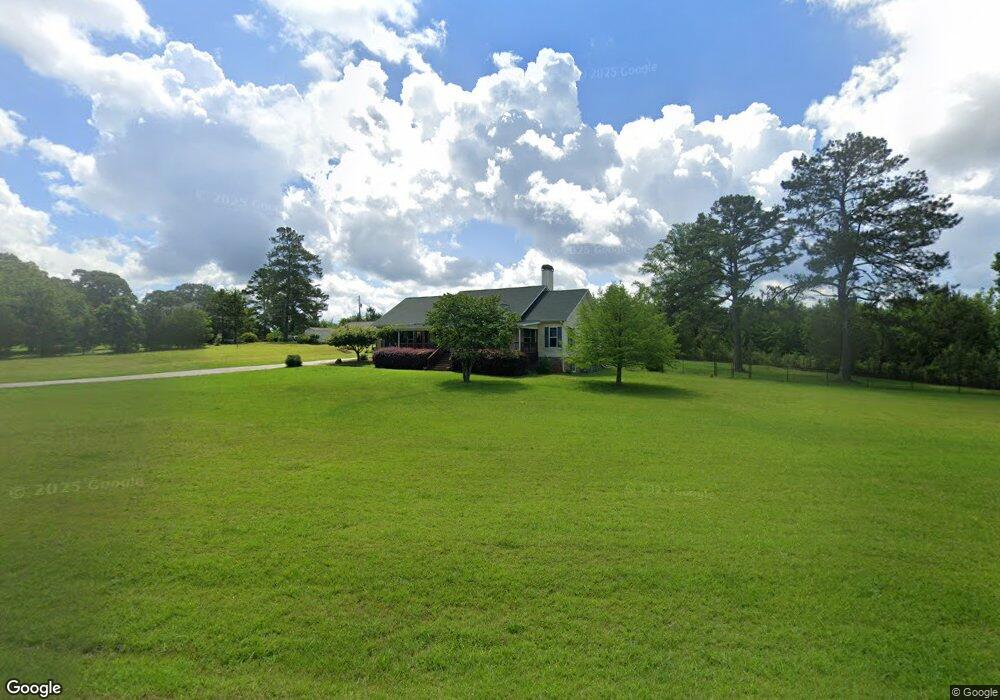
222 Bethlehem Church Rd Moreland, GA 30259
Estimated Value: $561,872 - $773,000
3
Beds
3
Baths
2,430
Sq Ft
$255/Sq Ft
Est. Value
About This Home
This home is located at 222 Bethlehem Church Rd, Moreland, GA 30259 and is currently estimated at $620,718, approximately $255 per square foot. 222 Bethlehem Church Rd is a home located in Coweta County with nearby schools including Moreland Elementary School, Smokey Road Middle School, and Newnan High School.
Ownership History
Date
Name
Owned For
Owner Type
Purchase Details
Closed on
Sep 6, 2011
Sold by
The Bank Of New York Mello
Bought by
The Bank Of New York Mellon Tr
Current Estimated Value
Purchase Details
Closed on
Feb 20, 2005
Sold by
Winkley Dwight E and Winkley Catherine M
Bought by
Winkley Dwight E and Winkley Catherine M.
Create a Home Valuation Report for This Property
The Home Valuation Report is an in-depth analysis detailing your home's value as well as a comparison with similar homes in the area
Home Values in the Area
Average Home Value in this Area
Purchase History
| Date | Buyer | Sale Price | Title Company |
|---|---|---|---|
| The Bank Of New York Mellon Tr | $175,500 | -- | |
| Winkley Dwight E | -- | -- |
Source: Public Records
Tax History Compared to Growth
Tax History
| Year | Tax Paid | Tax Assessment Tax Assessment Total Assessment is a certain percentage of the fair market value that is determined by local assessors to be the total taxable value of land and additions on the property. | Land | Improvement |
|---|---|---|---|---|
| 2025 | $5,128 | $206,863 | $20,106 | $186,758 |
| 2024 | $5,027 | $200,818 | $18,790 | $182,028 |
| 2023 | $5,027 | $202,186 | $17,339 | $184,847 |
| 2022 | $4,132 | $155,430 | $9,908 | $145,522 |
| 2021 | $4,094 | $142,326 | $9,436 | $132,890 |
| 2020 | $4,165 | $142,326 | $9,436 | $132,890 |
| 2019 | $3,659 | $108,722 | $10,232 | $98,490 |
| 2018 | $3,678 | $108,722 | $10,232 | $98,490 |
| 2017 | $3,678 | $108,722 | $10,232 | $98,490 |
| 2016 | $3,662 | $108,722 | $10,232 | $98,490 |
| 2015 | $3,603 | $108,722 | $10,232 | $98,490 |
| 2014 | $3,993 | $108,722 | $10,232 | $98,490 |
Source: Public Records
Map
Nearby Homes
- 61 Main St
- 15 Couch St
- 33 Ball St
- 8 Cameron St
- 145 E Camp St
- 188 Ball St
- 3486 S Highway 29
- 114 Dingler Rd
- 0 Teasley Trail Unit 10600969
- 31 AC Lamb Rd
- 79 Lamb Rd
- 0 Lamb Rd Unit 10571369
- 0 Lamb Rd Unit 24477803
- 485 Polk Rd
- 885 Alex Stephens Rd Unit LOT 1
- 837 Alex Stephens Rd Unit 2
- 757 Alex Stephens Rd Unit 5
- 743 Alex Stephens Rd Unit LOT 6
- 779 Alex Stephens Rd Unit LOT 4
- 803 Alex Stephens Rd Unit LOT 3
- 183 Bethlehem Church Rd
- 185 Bethlehem Church Rd
- 200 Bethlehem Church Rd
- 187 Bethlehem Church Rd
- 1129 Bethlehem Church Rd
- 189 Bethlehem Church Rd
- 277 Bethlehem Church Rd
- 335 Bethlehem Church Rd
- 151 Bethlehem Church Rd
- 68 Bethlehem Church Rd
- 139 Bethlehem Church Rd
- 99 Bethlehem Church Rd
- 10 Last St
- 44 Bethlehem Church Rd
- 62 Bethlehem Church Rd
- 46 Bethlehem Church Rd
- 43 Bethlehem Church Rd
- 18 Bethlehem Church Rd
- 48 Bethlehem Church Rd
- 33 Brannon St