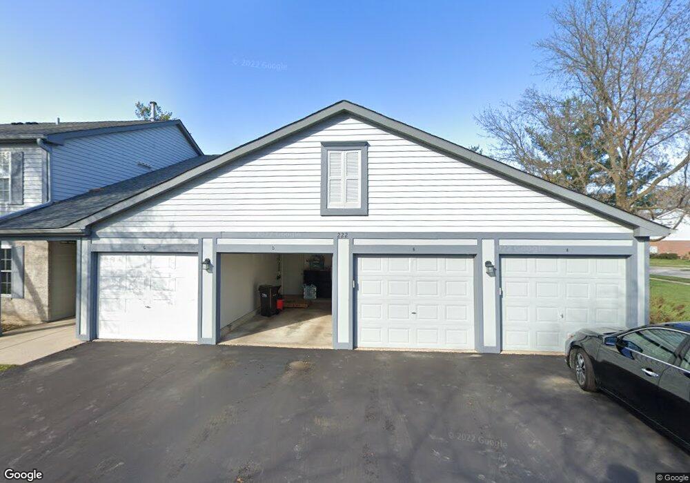
222 Brett Cir Unit 9A22 Wauconda, IL 60084
Estimated Value: $195,000 - $224,000
2
Beds
2
Baths
1,093
Sq Ft
$196/Sq Ft
Est. Value
About This Home
This home is located at 222 Brett Cir Unit 9A22, Wauconda, IL 60084 and is currently estimated at $214,302, approximately $196 per square foot. 222 Brett Cir Unit 9A22 is a home located in Lake County with nearby schools including Wauconda Grade School, Jefferson Elementary School, and Wauconda Middle School.
Ownership History
Date
Name
Owned For
Owner Type
Purchase Details
Closed on
Apr 13, 2021
Sold by
Mitchell Jeffrey S and Mitchell Lisa A
Bought by
Kolev Andoni D
Current Estimated Value
Home Financials for this Owner
Home Financials are based on the most recent Mortgage that was taken out on this home.
Original Mortgage
$122,735
Interest Rate
2.9%
Mortgage Type
FHA
Purchase Details
Closed on
Oct 25, 2005
Sold by
Witt Paul
Bought by
Mitchell Jeffrey S and Mitchell Lisa A
Home Financials for this Owner
Home Financials are based on the most recent Mortgage that was taken out on this home.
Original Mortgage
$120,800
Interest Rate
6.2%
Mortgage Type
Purchase Money Mortgage
Create a Home Valuation Report for This Property
The Home Valuation Report is an in-depth analysis detailing your home's value as well as a comparison with similar homes in the area
Home Values in the Area
Average Home Value in this Area
Purchase History
| Date | Buyer | Sale Price | Title Company |
|---|---|---|---|
| Kolev Andoni D | $125,000 | Heritage Title Company | |
| Mitchell Jeffrey S | $151,000 | Multiple |
Source: Public Records
Mortgage History
| Date | Status | Borrower | Loan Amount |
|---|---|---|---|
| Previous Owner | Kolev Andoni D | $122,735 | |
| Previous Owner | Mitchell Jeffrey S | $120,800 |
Source: Public Records
Tax History Compared to Growth
Tax History
| Year | Tax Paid | Tax Assessment Tax Assessment Total Assessment is a certain percentage of the fair market value that is determined by local assessors to be the total taxable value of land and additions on the property. | Land | Improvement |
|---|---|---|---|---|
| 2024 | $4,861 | $54,125 | $5,852 | $48,273 |
| 2023 | $5,130 | $49,474 | $5,349 | $44,125 |
| 2022 | $5,130 | $47,011 | $4,990 | $42,021 |
| 2021 | $4,917 | $44,421 | $4,715 | $39,706 |
| 2020 | $4,777 | $42,338 | $4,494 | $37,844 |
| 2019 | $4,258 | $40,013 | $4,247 | $35,766 |
| 2018 | $3,728 | $32,404 | $6,088 | $26,316 |
| 2017 | $3,726 | $32,030 | $6,018 | $26,012 |
| 2016 | $3,515 | $30,332 | $5,699 | $24,633 |
| 2015 | $3,330 | $27,846 | $5,232 | $22,614 |
| 2014 | $3,902 | $22,704 | $5,894 | $16,810 |
| 2012 | $3,776 | $33,418 | $5,639 | $27,779 |
Source: Public Records
Map
Nearby Homes
- 303 Stillwater Ct Unit 1106
- 315 Hill St Unit A
- 25570 W High St
- 25578 W High St
- 25586 W High St
- 701 Lake Shore Dr
- 107 Hammond Ave
- 25721 W Lakeview Ave
- 25235 W Hermosa Ave
- 908 Ridge Ave
- 125 E Mill St Unit D103
- 450 N Main St Unit S307A
- 124 Hubbard Ct
- 0 Bonner Rd
- 149 W Church St
- 26290 N Us Highway 12
- 26587 N Cherrywood Ln
- 26220 N Hill Ave
- 23785 W Barnswallow Ln
- 225 Regency Ct Unit A
- 222 Brett Cir Unit 9B22
- 222 Brett Cir Unit 9B12
- 222 Brett Cir Unit 9A12
- 224 Brett Cir Unit 9B21
- 224 Brett Cir Unit 9B11
- 224 Brett Cir Unit 9A21
- 224 Brett Cir Unit 9A11
- 222 Brett Cir Unit C
- 222 Brett Cir Unit 222
- 222 Brett Cir Unit A
- 224 Brett Cir Unit B
- 224 Brett Cir Unit D
- 224 Brett Cir
- 224 Brett Cir Unit C
- 226 Brett Cir Unit 8B22
- 226 Brett Cir Unit 8B12
- 226 Brett Cir Unit 8A22
- 226 Brett Cir Unit 8A12
- 226 Brett Cir Unit C
- 226 Brett Cir Unit A