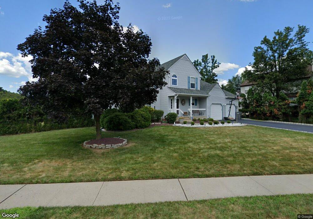
222 Brewster Ave Piscataway, NJ 08854
Estimated Value: $781,197 - $883,000
--
Bed
--
Bath
2,390
Sq Ft
$348/Sq Ft
Est. Value
About This Home
This home is located at 222 Brewster Ave, Piscataway, NJ 08854 and is currently estimated at $832,549, approximately $348 per square foot. 222 Brewster Ave is a home located in Middlesex County with nearby schools including Grandview Elementary School, Arbor Intermediate School, and Theodore Schor Middle School.
Ownership History
Date
Name
Owned For
Owner Type
Purchase Details
Closed on
Dec 16, 2016
Sold by
Mclarnon Scott W and Mclarnon Shelley A
Bought by
Sharma Pankaj and Sharma Heena
Current Estimated Value
Home Financials for this Owner
Home Financials are based on the most recent Mortgage that was taken out on this home.
Original Mortgage
$327,500
Interest Rate
4.12%
Mortgage Type
New Conventional
Purchase Details
Closed on
Sep 6, 1990
Bought by
Mclarnon Scott W and Mclarnon Shelley A
Create a Home Valuation Report for This Property
The Home Valuation Report is an in-depth analysis detailing your home's value as well as a comparison with similar homes in the area
Home Values in the Area
Average Home Value in this Area
Purchase History
| Date | Buyer | Sale Price | Title Company |
|---|---|---|---|
| Sharma Pankaj | $437,500 | Golden Title Agency Llc | |
| Mclarnon Scott W | $189,900 | -- |
Source: Public Records
Mortgage History
| Date | Status | Borrower | Loan Amount |
|---|---|---|---|
| Previous Owner | Sharma Pankaj | $327,500 |
Source: Public Records
Tax History Compared to Growth
Tax History
| Year | Tax Paid | Tax Assessment Tax Assessment Total Assessment is a certain percentage of the fair market value that is determined by local assessors to be the total taxable value of land and additions on the property. | Land | Improvement |
|---|---|---|---|---|
| 2025 | $12,120 | $638,200 | $258,800 | $379,400 |
| 2024 | $11,679 | $628,000 | $166,900 | $461,100 |
| 2023 | $11,679 | $565,300 | $166,900 | $398,400 |
| 2022 | $11,061 | $496,900 | $166,900 | $330,000 |
| 2021 | $10,686 | $461,200 | $166,900 | $294,300 |
| 2020 | $10,721 | $463,700 | $146,900 | $316,800 |
| 2019 | $8,791 | $373,600 | $146,900 | $226,700 |
| 2018 | $9,726 | $415,300 | $201,900 | $213,400 |
| 2017 | $9,095 | $335,500 | $136,900 | $198,600 |
| 2016 | $8,931 | $335,500 | $136,900 | $198,600 |
| 2015 | $8,797 | $335,500 | $136,900 | $198,600 |
| 2014 | $8,602 | $335,500 | $136,900 | $198,600 |
Source: Public Records
Map
Nearby Homes
- 191 Dunellen Ave
- 36 E Burgess Dr
- 2 Hendrick Place
- 316 Ventnor Ct
- 392 Keswick Dr
- 116 Doyle St
- 41 Chicago Ave
- 277 Grandview Ave
- 221 Bexley Ln
- 226 Bexley Ln
- 3 Lexington Dr
- 99 Exeter Ct
- 125 Exeter Ct
- 24 Baltimore Ave
- 357 Hamilton Blvd
- 54 Kensington Dr
- 73 Kensington Dr
- 37 N Randolphville Rd
- 7 Chelsea Dr
- 380 Bowler Ct
- 206 Brewster Ave
- 198 Brewster Ave
- 223 Brewster Ave
- 196 Middlesex Ave
- 219 Brewster Ave
- 187 Dunellen Ave
- 191 Middlesex Ave
- 194 Brewster Ave
- 186 Dunellen Ave
- 192 Middlesex Ave
- 201 Brewster Ave
- 215 Brewster Ave
- 197 Brewster Ave
- 205 Brewster Ave
- 30 E Burgess Dr
- 29 E Burgess Dr
- 28 E Burgess Dr Unit 28
- 183 Dunellen Ave
- 31 E Burgess Dr
- 23 E Burgess Dr