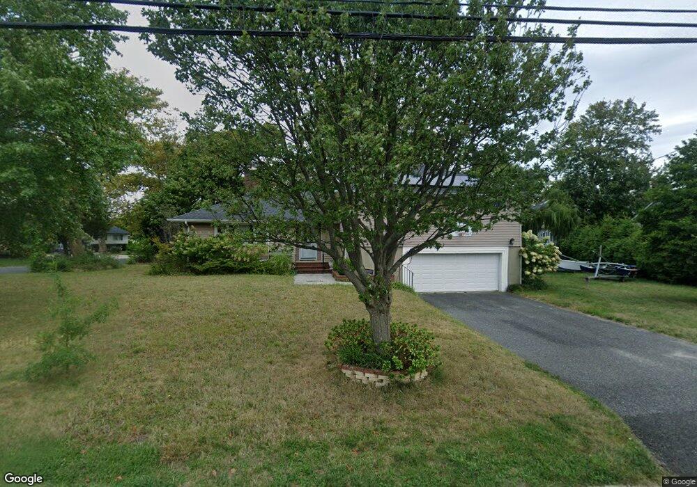
222 Comanche Dr Oceanport, NJ 07757
Estimated Value: $845,000 - $1,214,000
4
Beds
2
Baths
2,138
Sq Ft
$466/Sq Ft
Est. Value
About This Home
This home is located at 222 Comanche Dr, Oceanport, NJ 07757 and is currently estimated at $995,643, approximately $465 per square foot. 222 Comanche Dr is a home located in Monmouth County with nearby schools including Wolf Hill Elementary School, Maple Place Elementary and Middle School, and Shore Regional High School.
Ownership History
Date
Name
Owned For
Owner Type
Purchase Details
Closed on
Feb 15, 2008
Sold by
Corrente John D
Bought by
Weir Christopher J and Weir Marianne
Current Estimated Value
Home Financials for this Owner
Home Financials are based on the most recent Mortgage that was taken out on this home.
Original Mortgage
$308,000
Outstanding Balance
$192,645
Interest Rate
5.9%
Mortgage Type
Purchase Money Mortgage
Estimated Equity
$802,998
Purchase Details
Closed on
Jun 30, 2006
Sold by
Scavone Marjorie Mcfaddin
Bought by
Corrente John D
Home Financials for this Owner
Home Financials are based on the most recent Mortgage that was taken out on this home.
Original Mortgage
$435,000
Interest Rate
6.83%
Create a Home Valuation Report for This Property
The Home Valuation Report is an in-depth analysis detailing your home's value as well as a comparison with similar homes in the area
Home Values in the Area
Average Home Value in this Area
Purchase History
| Date | Buyer | Sale Price | Title Company |
|---|---|---|---|
| Weir Christopher J | $385,000 | Transnation Title Ins Co | |
| Corrente John D | $545,000 | -- |
Source: Public Records
Mortgage History
| Date | Status | Borrower | Loan Amount |
|---|---|---|---|
| Open | Weir Christopher J | $308,000 | |
| Previous Owner | Corrente John D | $435,000 |
Source: Public Records
Tax History
| Year | Tax Paid | Tax Assessment Tax Assessment Total Assessment is a certain percentage of the fair market value that is determined by local assessors to be the total taxable value of land and additions on the property. | Land | Improvement |
|---|---|---|---|---|
| 2025 | $9,755 | $674,700 | $457,900 | $216,800 |
| 2024 | $9,633 | $617,800 | $410,400 | $207,400 |
| 2023 | $9,633 | $578,900 | $381,900 | $197,000 |
| 2022 | $9,735 | $545,900 | $372,400 | $173,500 |
| 2021 | $9,735 | $537,500 | $367,600 | $169,900 |
| 2020 | $9,685 | $529,800 | $362,900 | $166,900 |
| 2019 | $9,351 | $519,200 | $358,100 | $161,100 |
| 2018 | $9,255 | $517,300 | $358,100 | $159,200 |
| 2017 | $8,859 | $410,700 | $232,000 | $178,700 |
| 2016 | $8,728 | $407,300 | $232,000 | $175,300 |
| 2015 | $8,354 | $402,800 | $232,000 | $170,800 |
| 2014 | $8,331 | $407,400 | $255,800 | $151,600 |
Source: Public Records
Map
Nearby Homes
- 5 Marine Place
- 6 Cordelia Ct
- 8 Pocahontas Ave
- 580 Patten Ave Unit 72
- 580 Patten Ave Unit 14
- 6 Ellis Ct
- 25 Spaulding Place
- 28 Patten Ln
- 16 Shore Dr
- 29 Shore Dr
- 15 Bayview Ct
- 491 Patten Ave
- 165 Kingsley St
- 3 Bayonne Ave
- 568 Shrewsbury Ave
- 66 Shrewsbury Ave
- 68 Seneca Place
- 66 Seneca Place
- 164 Airsdale Ave
- 1 Foggia Way
- 228 Comanche Dr
- 11 Oneida Ave
- 6 Ticonderoga Ave
- 6 Oneida Ave
- 216 Comanche Dr
- 15 Oneida Ave
- 223 Comanche Dr
- 230 Comanche Dr
- 219 Comanche Dr
- 12 Ticonderoga Ave
- 14 Oneida Ave
- 227 Comanche Dr
- 11 Genessee Ave
- 9 Ticonderoga Ave
- 215 Comanche Dr
- 11 Ticonderoga Ave
- 15 Genessee Ave
- 13 Ticonderoga Ave
- 18 Ticonderoga Ave
- 19 Oneida Ave
Your Personal Tour Guide
Ask me questions while you tour the home.