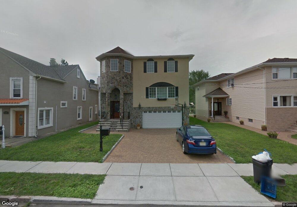
222 Copeland Ave Lyndhurst, NJ 07071
Estimated Value: $967,000 - $1,338,000
--
Bed
--
Bath
3,500
Sq Ft
$324/Sq Ft
Est. Value
About This Home
This home is located at 222 Copeland Ave, Lyndhurst, NJ 07071 and is currently estimated at $1,132,328, approximately $323 per square foot. 222 Copeland Ave is a home located in Bergen County with nearby schools including Lyndhurst High School and Sacred Heart School.
Ownership History
Date
Name
Owned For
Owner Type
Purchase Details
Closed on
May 7, 2019
Sold by
Perri Francesco and Perri Frank
Bought by
Perri Francesco
Current Estimated Value
Home Financials for this Owner
Home Financials are based on the most recent Mortgage that was taken out on this home.
Original Mortgage
$272,000
Interest Rate
4.1%
Mortgage Type
New Conventional
Purchase Details
Closed on
Jul 10, 2012
Sold by
Perri Frank and Perri Rose
Bought by
Perri Frank
Purchase Details
Closed on
Dec 4, 2003
Sold by
Pugh Anthony
Bought by
Perri Frank and Perri Rose
Home Financials for this Owner
Home Financials are based on the most recent Mortgage that was taken out on this home.
Original Mortgage
$240,000
Interest Rate
5.88%
Purchase Details
Closed on
Jul 21, 2000
Sold by
Clemente Rose
Bought by
Pugh Anthony and Pugh Laura
Create a Home Valuation Report for This Property
The Home Valuation Report is an in-depth analysis detailing your home's value as well as a comparison with similar homes in the area
Home Values in the Area
Average Home Value in this Area
Purchase History
| Date | Buyer | Sale Price | Title Company |
|---|---|---|---|
| Perri Francesco | -- | -- | |
| Perri Frank | -- | -- | |
| Perri Frank | $360,000 | -- | |
| Pugh Anthony | -- | -- |
Source: Public Records
Mortgage History
| Date | Status | Borrower | Loan Amount |
|---|---|---|---|
| Previous Owner | Perri Francesco | $272,000 | |
| Previous Owner | Perri Frank | $240,000 |
Source: Public Records
Tax History Compared to Growth
Tax History
| Year | Tax Paid | Tax Assessment Tax Assessment Total Assessment is a certain percentage of the fair market value that is determined by local assessors to be the total taxable value of land and additions on the property. | Land | Improvement |
|---|---|---|---|---|
| 2025 | $18,545 | $895,500 | $282,500 | $613,000 |
| 2024 | $17,827 | $889,000 | $280,000 | $609,000 |
| 2023 | $17,345 | $877,300 | $272,500 | $604,800 |
| 2022 | $17,345 | $546,800 | $168,500 | $378,300 |
| 2021 | $16,623 | $546,800 | $168,500 | $378,300 |
| 2020 | $16,262 | $546,800 | $168,500 | $378,300 |
| 2019 | $16,142 | $546,800 | $168,500 | $378,300 |
| 2018 | $16,273 | $546,800 | $168,500 | $378,300 |
| 2017 | $15,863 | $546,800 | $168,500 | $378,300 |
| 2016 | $15,507 | $546,800 | $168,500 | $378,300 |
| 2015 | $15,021 | $546,800 | $168,500 | $378,300 |
| 2014 | $14,824 | $546,800 | $168,500 | $378,300 |
Source: Public Records
Map
Nearby Homes
- 258 Kingsland Ave
- 474 Willow Ave
- 510 Anthony Ct
- 168 Forest Ave
- 614 10th St
- 609 Chase Ave
- 416 Kingsland Ave
- 307 Jauncey Ave
- 446 Alder St
- 14 River Rd Unit F
- 14 River Rd Unit G
- 518 8th St
- 459 Riverside Ave
- 138 Fern Ave
- 25 River Rd Unit A-12
- 471 Harding Ave
- 524 Octavia Place
- 506 Park Place
- 448 Fern Ave
- 824 Main St Unit j
- 218 Copeland Ave
- 226 Copeland Ave
- 230 Copeland Ave
- 214 Copeland Ave
- 234 Copeland Ave
- 225 Sanford Ave
- 221 Sanford Ave
- 221 Sanford Ave Unit 2
- 210 Copeland Ave
- 229 Sanford Ave
- 229 Sanford Ave Unit 2
- 217 Sanford Ave
- 236 Copeland Ave
- 233 Sanford Ave
- 223 Copeland Ave
- 227 Copeland Ave
- 219 Copeland Ave
- 206 Copeland Ave
- 211 Sanford Ave Unit 213
- 240 Copeland Ave