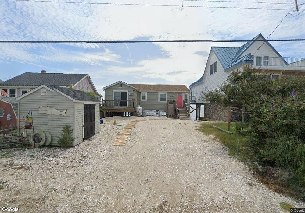
222 Cove Rd Newport, NJ 08345
Estimated Value: $299,000 - $488,053
2
Beds
1
Bath
864
Sq Ft
$472/Sq Ft
Est. Value
About This Home
This home is located at 222 Cove Rd, Newport, NJ 08345 and is currently estimated at $407,513, approximately $471 per square foot. 222 Cove Rd is a home located in Cumberland County with nearby schools including Downe Township Elementary School.
Ownership History
Date
Name
Owned For
Owner Type
Purchase Details
Closed on
Jun 24, 2021
Sold by
Mcgovern Paul C and Sullivan Elizabeth
Bought by
Sammis Lauren C
Current Estimated Value
Home Financials for this Owner
Home Financials are based on the most recent Mortgage that was taken out on this home.
Original Mortgage
$147,000
Outstanding Balance
$133,090
Interest Rate
2.9%
Mortgage Type
Purchase Money Mortgage
Estimated Equity
$274,423
Purchase Details
Closed on
Nov 23, 2004
Sold by
Bertram Bonnie A
Bought by
Lieb Thomas and Lieb Rebecca
Home Financials for this Owner
Home Financials are based on the most recent Mortgage that was taken out on this home.
Original Mortgage
$279,600
Interest Rate
5.75%
Create a Home Valuation Report for This Property
The Home Valuation Report is an in-depth analysis detailing your home's value as well as a comparison with similar homes in the area
Home Values in the Area
Average Home Value in this Area
Purchase History
| Date | Buyer | Sale Price | Title Company |
|---|---|---|---|
| Sammis Lauren C | $268,622 | None Available | |
| Lieb Thomas | $349,500 | -- |
Source: Public Records
Mortgage History
| Date | Status | Borrower | Loan Amount |
|---|---|---|---|
| Open | Sammis Lauren C | $147,000 | |
| Previous Owner | Lieb Thomas | $279,600 |
Source: Public Records
Tax History Compared to Growth
Tax History
| Year | Tax Paid | Tax Assessment Tax Assessment Total Assessment is a certain percentage of the fair market value that is determined by local assessors to be the total taxable value of land and additions on the property. | Land | Improvement |
|---|---|---|---|---|
| 2025 | $6,215 | $215,500 | $150,000 | $65,500 |
| 2024 | $6,215 | $215,500 | $150,000 | $65,500 |
| 2023 | $5,668 | $215,500 | $150,000 | $65,500 |
| 2022 | $5,525 | $215,500 | $150,000 | $65,500 |
| 2021 | $5,260 | $215,500 | $150,000 | $65,500 |
| 2020 | $5,183 | $215,500 | $150,000 | $65,500 |
| 2019 | $5,097 | $215,500 | $150,000 | $65,500 |
| 2018 | $5,163 | $215,500 | $150,000 | $65,500 |
| 2017 | $6,109 | $265,500 | $200,000 | $65,500 |
| 2016 | $6,104 | $265,500 | $200,000 | $65,500 |
| 2015 | $5,724 | $265,500 | $200,000 | $65,500 |
| 2014 | $5,302 | $265,500 | $200,000 | $65,500 |
Source: Public Records
Map
Nearby Homes
- 167 Cove Rd
- 510 Bay Point Rd
- 91 Landis Ave
- 184 Landing Rd
- 281 Fortescue Rd
- 13 Hall St
- 94 Delaware Ave
- 116 Delaware Ave
- 102 Garrison Ave
- 114 Delaware Ave
- 12 Lores Ln
- 184 New Jersey Ave
- 873 875 Downe Ave
- 7 Princeton Ave
- 212 New Jersey Ave
- 18 Vassar Ave
- 21 Vassar Ave
- 870 Downe Ave
- 205 Pennsylvania Ave
- 860 Downe Ave