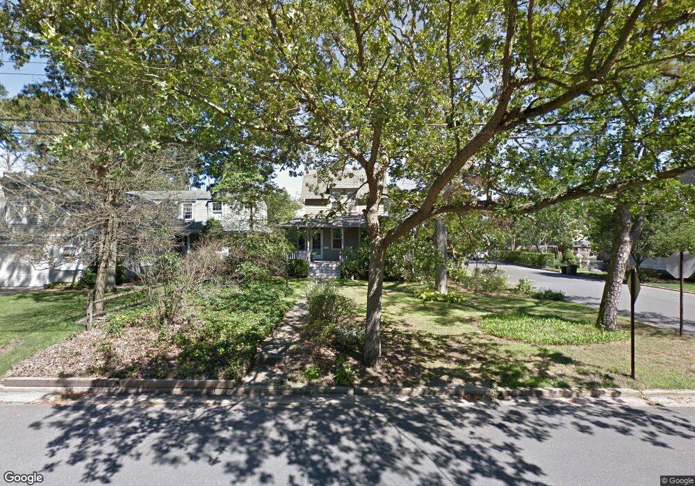
222 Curtis Ave Point Pleasant Beach, NJ 08742
Point Pleasant Beach NeighborhoodEstimated Value: $672,473 - $1,231,000
3
Beds
2
Baths
1,120
Sq Ft
$851/Sq Ft
Est. Value
About This Home
This home is located at 222 Curtis Ave, Point Pleasant Beach, NJ 08742 and is currently estimated at $952,868, approximately $850 per square foot. 222 Curtis Ave is a home located in Ocean County with nearby schools including G Harold Antrim Elementary School, Point Pleasant Beach High School, and St. Peter School.
Ownership History
Date
Name
Owned For
Owner Type
Purchase Details
Closed on
Dec 27, 2000
Sold by
White Robert
Bought by
Paglia John and Paglia Mary Ellen
Current Estimated Value
Home Financials for this Owner
Home Financials are based on the most recent Mortgage that was taken out on this home.
Original Mortgage
$230,000
Outstanding Balance
$82,335
Interest Rate
7.13%
Estimated Equity
$870,533
Create a Home Valuation Report for This Property
The Home Valuation Report is an in-depth analysis detailing your home's value as well as a comparison with similar homes in the area
Home Values in the Area
Average Home Value in this Area
Purchase History
| Date | Buyer | Sale Price | Title Company |
|---|---|---|---|
| Paglia John | $290,000 | -- | |
| Paglia John | $290,000 | -- |
Source: Public Records
Mortgage History
| Date | Status | Borrower | Loan Amount |
|---|---|---|---|
| Open | Paglia John | $230,000 | |
| Closed | Paglia John | $230,000 |
Source: Public Records
Tax History Compared to Growth
Tax History
| Year | Tax Paid | Tax Assessment Tax Assessment Total Assessment is a certain percentage of the fair market value that is determined by local assessors to be the total taxable value of land and additions on the property. | Land | Improvement |
|---|---|---|---|---|
| 2025 | $7,044 | $410,000 | $307,300 | $102,700 |
| 2024 | $6,749 | $410,000 | $307,300 | $102,700 |
| 2023 | $6,559 | $405,100 | $307,300 | $97,800 |
| 2022 | $6,559 | $405,100 | $307,300 | $97,800 |
| 2021 | $6,413 | $405,100 | $307,300 | $97,800 |
| 2020 | $6,405 | $405,100 | $307,300 | $97,800 |
| 2019 | $6,316 | $405,100 | $307,300 | $97,800 |
| 2018 | $6,218 | $405,100 | $307,300 | $97,800 |
| 2017 | $6,121 | $405,100 | $307,300 | $97,800 |
| 2016 | $6,149 | $405,100 | $307,300 | $97,800 |
| 2015 | $6,101 | $405,100 | $307,300 | $97,800 |
| 2014 | $6,072 | $405,100 | $307,300 | $97,800 |
Source: Public Records
Map
Nearby Homes
- 204 Curtis Ave
- 328 Curtis Ave Unit Lot 28
- 326 Curtis Ave Unit Lot 27
- 109 Griffiths Ave
- 325 Hawthorne Ave Unit 327
- 303 Cooks Ln
- 800 Grove St
- 202 Yale Ave
- 845 Arnold Ave Unit 3
- 728 Arnold Ave
- 606 Bay Ave Unit 2
- 606 Bay Ave Unit 3
- 607 Richmond Ave Unit 4
- 842 Arnold Ave Unit 2
- 842 Arnold Ave Unit 3
- 704 Forman Ave
- 804 Clark St
- 503 Atlantic Ave
- 806 Riverview Dr
- 818 Atlantic Ave
- 220 Curtis Ave
- 202 Curtis Ave
- 218 Curtis Ave
- 709 Cedar Ave
- 211 Curtis Ave
- 302 Curtis Ave
- 712 Cedar Ave
- 707 Cedar Ave
- 800 Cedar Ave
- 212 Curtis Ave
- 706 Cedar Ave
- 303 Curtis Ave
- 705 Cedar Ave
- 304 Curtis Ave
- 304 Curtis Ave
- 304 Curtis Ave Unit Rear
- 304 Curtis Ave Unit Front
- 308 Curtis Ave
- 308 Curtis Ave
- 801 Long Point Ln