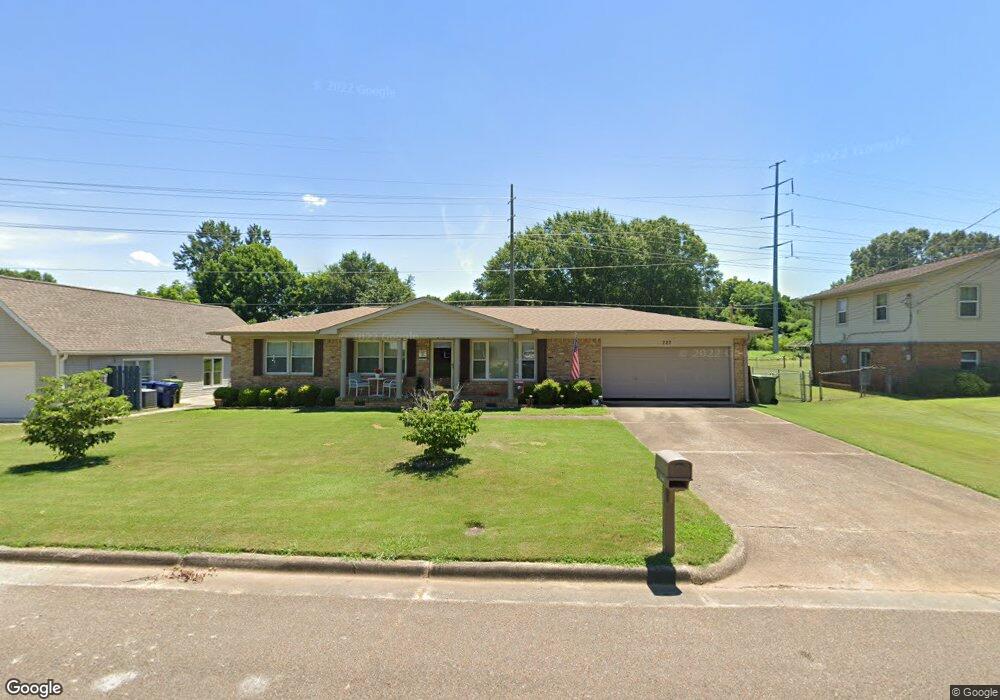
222 Curtis Dr SE Huntsville, AL 35803
Weatherly Heights NeighborhoodEstimated Value: $211,000 - $295,000
--
Bed
--
Bath
1,470
Sq Ft
$172/Sq Ft
Est. Value
About This Home
This home is located at 222 Curtis Dr SE, Huntsville, AL 35803 and is currently estimated at $253,439, approximately $172 per square foot. 222 Curtis Dr SE is a home located in Madison County with nearby schools including Weatherly Heights Elementary School, Mt. Gap Middle School, and Virgil Grissom High School.
Ownership History
Date
Name
Owned For
Owner Type
Purchase Details
Closed on
Jan 24, 2009
Sold by
Nobrega Anthony T
Bought by
Nobrega Henry F
Current Estimated Value
Home Financials for this Owner
Home Financials are based on the most recent Mortgage that was taken out on this home.
Original Mortgage
$88,600
Interest Rate
4.95%
Mortgage Type
New Conventional
Purchase Details
Closed on
Oct 17, 2008
Sold by
Nobrega Anthony T
Bought by
Nobrega Henry F
Purchase Details
Closed on
Mar 20, 2008
Sold by
Nobrega Henry F
Bought by
Nobrega Anthony T
Purchase Details
Closed on
Sep 29, 2006
Sold by
Wells Fargo Bank Na
Bought by
Nobrega Henry F
Home Financials for this Owner
Home Financials are based on the most recent Mortgage that was taken out on this home.
Original Mortgage
$88,000
Interest Rate
6.48%
Mortgage Type
New Conventional
Create a Home Valuation Report for This Property
The Home Valuation Report is an in-depth analysis detailing your home's value as well as a comparison with similar homes in the area
Home Values in the Area
Average Home Value in this Area
Purchase History
| Date | Buyer | Sale Price | Title Company |
|---|---|---|---|
| Nobrega Henry F | -- | -- | |
| Nobrega Henry F | -- | -- | |
| Nobrega Anthony T | -- | -- | |
| Nobrega Henry F | -- | -- |
Source: Public Records
Mortgage History
| Date | Status | Borrower | Loan Amount |
|---|---|---|---|
| Closed | Nobrega Henry F | $88,600 | |
| Previous Owner | Nobrega Henry F | $88,000 |
Source: Public Records
Tax History Compared to Growth
Tax History
| Year | Tax Paid | Tax Assessment Tax Assessment Total Assessment is a certain percentage of the fair market value that is determined by local assessors to be the total taxable value of land and additions on the property. | Land | Improvement |
|---|---|---|---|---|
| 2024 | $1,220 | $21,860 | $6,000 | $15,860 |
| 2023 | $1,220 | $20,340 | $5,000 | $15,340 |
| 2022 | $845 | $15,400 | $2,080 | $13,320 |
| 2021 | $749 | $13,740 | $1,560 | $12,180 |
| 2020 | $694 | $12,800 | $1,380 | $11,420 |
| 2019 | $694 | $12,800 | $1,380 | $11,420 |
| 2018 | $651 | $12,060 | $0 | $0 |
| 2017 | $641 | $11,880 | $0 | $0 |
| 2016 | $641 | $11,880 | $0 | $0 |
| 2015 | $641 | $11,880 | $0 | $0 |
| 2014 | $631 | $11,700 | $0 | $0 |
Source: Public Records
Map
Nearby Homes
- 11026 Crestfield Dr SE
- 10015 Strong Dr SE
- 11007 Louis Dr SE
- 301 Belvidere Rd SE
- 418 Curtis Dr SE
- 11 Hidden Grove Cir SW
- 11211 Dellcrest Dr SE
- 409 Cumberland Dr SE
- 105 Strong Cir SE
- 600 Ronald Dr SE
- 413 Cumberland Dr SE
- 623 Valley View Terrace SE
- 511 Bain Dr SE
- 11402 Hillwood Dr SE
- 10016 Conrad Dr SE
- 11406 Maplecrest Dr SE
- 9534 Hemlock Dr SE
- 903 Lane Dr SE
- 2041 Wayland Walk SW
- 1907 Lynnbrook Dr SW
- 220 Curtis Dr SE
- 224 Curtis Dr SE
- 218 Curtis Dr SE
- 221 Curtis Dr SE
- 223 Curtis Dr SE
- 11006 Strong Dr SE
- 11002 Strong Dr SE
- 11004 Strong Dr SE
- 225 Curtis Dr SE
- 226 Curtis Dr SE
- 11008 Strong Dr SE
- 214 Curtis Dr SE
- 227 Curtis Dr SE
- 217 Curtis Dr SE
- 229 Curtis Dr SE
- 210 Curtis Dr SE
- 11010 Strong Dr SE
- 11005 Strong Dr SE
- 11003 Strong Dr SE
- 215 Curtis Dr SE