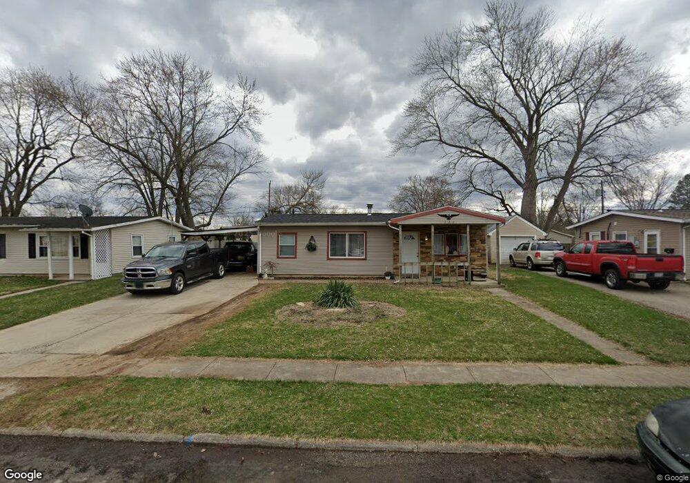
222 Drake Ave New Carlisle, OH 45344
Estimated Value: $105,000 - $145,000
3
Beds
1
Bath
864
Sq Ft
$144/Sq Ft
Est. Value
About This Home
This home is located at 222 Drake Ave, New Carlisle, OH 45344 and is currently estimated at $124,616, approximately $144 per square foot. 222 Drake Ave is a home located in Clark County with nearby schools including New Carlisle Elementary School, Park Layne Elementary School, and Donnelsville Elementary School.
Ownership History
Date
Name
Owned For
Owner Type
Purchase Details
Closed on
Feb 11, 2016
Sold by
Balli Tolanda and Balli Alberto
Bought by
Aguirre Alfonso and Aguirre Cutberto
Current Estimated Value
Purchase Details
Closed on
Aug 13, 2013
Sold by
Weaver Jaclyn L
Bought by
Francis Edwin J
Purchase Details
Closed on
Feb 6, 2003
Sold by
Gossett Joshua D and Gossett Shannon
Bought by
Weaver Jaclyn L
Home Financials for this Owner
Home Financials are based on the most recent Mortgage that was taken out on this home.
Original Mortgage
$75,423
Interest Rate
6.01%
Mortgage Type
Purchase Money Mortgage
Purchase Details
Closed on
Dec 6, 1999
Sold by
Brock Thomas D and Brock Shirley A
Bought by
Gossett Joshua D
Create a Home Valuation Report for This Property
The Home Valuation Report is an in-depth analysis detailing your home's value as well as a comparison with similar homes in the area
Home Values in the Area
Average Home Value in this Area
Purchase History
| Date | Buyer | Sale Price | Title Company |
|---|---|---|---|
| Aguirre Alfonso | -- | None Available | |
| Francis Edwin J | $16,700 | None Available | |
| Weaver Jaclyn L | $75,000 | -- | |
| Gossett Joshua D | $67,500 | -- |
Source: Public Records
Mortgage History
| Date | Status | Borrower | Loan Amount |
|---|---|---|---|
| Previous Owner | Weaver Jaclyn L | $75,423 |
Source: Public Records
Tax History Compared to Growth
Tax History
| Year | Tax Paid | Tax Assessment Tax Assessment Total Assessment is a certain percentage of the fair market value that is determined by local assessors to be the total taxable value of land and additions on the property. | Land | Improvement |
|---|---|---|---|---|
| 2024 | $1,691 | $20,660 | $5,800 | $14,860 |
| 2023 | $1,083 | $20,660 | $5,800 | $14,860 |
| 2022 | $554 | $20,660 | $5,800 | $14,860 |
| 2021 | $921 | $15,890 | $4,460 | $11,430 |
| 2020 | $923 | $15,890 | $4,460 | $11,430 |
| 2019 | $938 | $15,890 | $4,460 | $11,430 |
| 2018 | $1,050 | $16,630 | $5,510 | $11,120 |
| 2017 | $978 | $18,883 | $5,509 | $13,374 |
| 2016 | $973 | $18,883 | $5,509 | $13,374 |
| 2015 | $1,705 | $18,088 | $5,796 | $12,292 |
| 2014 | $1,090 | $18,088 | $5,796 | $12,292 |
| 2013 | $1,227 | $20,286 | $5,796 | $14,490 |
Source: Public Records
Map
Nearby Homes
- 222 Rawson Dr
- 1204 N Scott St
- 1211 N Scott St
- 1207 N Scott St
- 315 Fenwick Dr
- 202 Fenwick Dr
- 201 Monroe Way
- Palmetto Plan at Monroe Meadows
- Cooper Plan at Monroe Meadows
- Norway Plan at Monroe Meadows
- Chestnut Plan at Monroe Meadows
- Bradford Plan at Monroe Meadows
- Spruce Plan at Monroe Meadows
- Ironwood Plan at Monroe Meadows
- Ashton Plan at Monroe Meadows
- Aspen II Plan at Monroe Meadows
- Empress Plan at Monroe Meadows
- Walnut Plan at Monroe Meadows
- Juniper Plan at Monroe Meadows
- 225 Prentice Dr