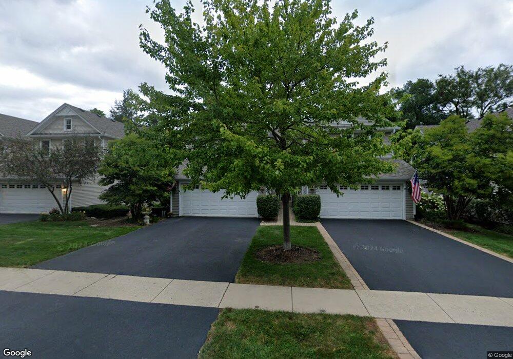
222 E Church St Unit 222 Libertyville, IL 60048
Estimated Value: $483,000 - $629,000
3
Beds
4
Baths
1,628
Sq Ft
$350/Sq Ft
Est. Value
About This Home
This home is located at 222 E Church St Unit 222, Libertyville, IL 60048 and is currently estimated at $570,537, approximately $350 per square foot. 222 E Church St Unit 222 is a home located in Lake County with nearby schools including Butterfield School, Highland Middle School, and Libertyville High School.
Ownership History
Date
Name
Owned For
Owner Type
Purchase Details
Closed on
Aug 25, 2016
Sold by
Grindel Jason
Bought by
The Patricia F Bleck Trust
Current Estimated Value
Purchase Details
Closed on
Nov 5, 2009
Sold by
Arzer Anne Maureen
Bought by
Grindel Jason
Home Financials for this Owner
Home Financials are based on the most recent Mortgage that was taken out on this home.
Original Mortgage
$140,000
Interest Rate
4.95%
Mortgage Type
New Conventional
Purchase Details
Closed on
May 27, 2008
Sold by
Declarati Tibbals Anne Maureen
Bought by
Tibbals Anne Maureen and Maureen Tibbals Declaration Of Trust
Purchase Details
Closed on
Jul 10, 2006
Sold by
Deuring William N and Doyle Diane L
Bought by
Declarati Tibbals Anne Maureen and Anne Maureen Tibbals Declaration Of Tr
Purchase Details
Closed on
Jun 18, 2004
Sold by
Comerford James R and Comerford Susan J
Bought by
Deuring William N and Doyle Diane L
Home Financials for this Owner
Home Financials are based on the most recent Mortgage that was taken out on this home.
Original Mortgage
$311,920
Interest Rate
4.62%
Mortgage Type
Unknown
Purchase Details
Closed on
Dec 13, 2002
Sold by
Comerford James R and Comerford Susan J
Bought by
Comerford James R and Comerford Susan J
Home Financials for this Owner
Home Financials are based on the most recent Mortgage that was taken out on this home.
Original Mortgage
$150,000
Interest Rate
4.87%
Purchase Details
Closed on
Nov 12, 2002
Sold by
Comerford James R
Bought by
Comerford James R and Comerford Susan J
Home Financials for this Owner
Home Financials are based on the most recent Mortgage that was taken out on this home.
Original Mortgage
$150,000
Interest Rate
4.87%
Purchase Details
Closed on
Nov 18, 2000
Sold by
Comerford James R and Comerford Susan J
Bought by
Comerford James R and Comerford Susan J
Purchase Details
Closed on
Sep 10, 1998
Sold by
Bank Of Waukegan
Bought by
Comerford James R and Comerford Susan J
Create a Home Valuation Report for This Property
The Home Valuation Report is an in-depth analysis detailing your home's value as well as a comparison with similar homes in the area
Home Values in the Area
Average Home Value in this Area
Purchase History
| Date | Buyer | Sale Price | Title Company |
|---|---|---|---|
| The Patricia F Bleck Trust | $410,000 | Ct | |
| Grindel Jason | $390,000 | None Available | |
| Tibbals Anne Maureen | -- | None Available | |
| Declarati Tibbals Anne Maureen | $430,000 | First American Title | |
| Deuring William N | $390,000 | -- | |
| Comerford James R | -- | -- | |
| Comerford James R | -- | -- | |
| Comerford James R | -- | -- | |
| Comerford James R | $226,000 | Chicago Title Insurance Co |
Source: Public Records
Mortgage History
| Date | Status | Borrower | Loan Amount |
|---|---|---|---|
| Previous Owner | Grindel Jason | $140,000 | |
| Previous Owner | Deuring William N | $311,920 | |
| Previous Owner | Comerford James R | $150,000 |
Source: Public Records
Tax History Compared to Growth
Tax History
| Year | Tax Paid | Tax Assessment Tax Assessment Total Assessment is a certain percentage of the fair market value that is determined by local assessors to be the total taxable value of land and additions on the property. | Land | Improvement |
|---|---|---|---|---|
| 2024 | $12,209 | $173,041 | $50,968 | $122,073 |
| 2023 | $11,781 | $159,603 | $47,010 | $112,593 |
| 2022 | $11,781 | $153,307 | $45,185 | $108,122 |
| 2021 | $11,342 | $150,007 | $44,212 | $105,795 |
| 2020 | $10,914 | $147,485 | $43,469 | $104,016 |
| 2019 | $10,643 | $146,083 | $43,056 | $103,027 |
| 2018 | $10,334 | $144,757 | $42,908 | $101,849 |
| 2017 | $10,049 | $140,187 | $41,553 | $98,634 |
| 2016 | $9,713 | $132,917 | $39,398 | $93,519 |
| 2015 | $9,621 | $124,233 | $36,824 | $87,409 |
| 2014 | $7,883 | $102,550 | $33,648 | $68,902 |
| 2012 | $8,779 | $116,109 | $33,940 | $82,169 |
Source: Public Records
Map
Nearby Homes
- 217 E Church St
- 224 Newberry Ave
- 212 Elm Ct
- 601 Broadway St
- 112 3rd St
- 121 4th St
- 505 Lange Ct
- 420 W Cook Ave
- 308 Mckinley Ave
- 922 N Milwaukee Ave Unit A
- 1754 Glenmore Rd
- 426 S Milwaukee Ave
- 204 W Ellis Ave
- 208 W Ellis Ave
- 212 W Ellis Ave
- 401 S 4th Ave
- 1211 Parliament Ct
- 551 W Park Ave Unit E
- 619 Parkside Ct
- 785 Meadow Ln
- 226 E Church St Unit 226
- 220 E Church St Unit 220
- 218 E Church St Unit 218
- 224 E Church St Unit 224
- 228 E Church St Unit 228
- 527 N 1st St
- 201 E Cook Ave
- 201 E Cook Ave
- 211 E Church St
- 223 E Church St
- 205 E Church St
- 225 E Church St
- 194 Yorktown Ct Unit 16078
- 150 Yorktown Ct
- 160 Yorktown Ct
- 178 Yorktown Ct
- 184 Yorktown Ct
- 174 Yorktown Ct
- 186 Yorktown Ct
- 125 Yorktown Ct Unit 15073