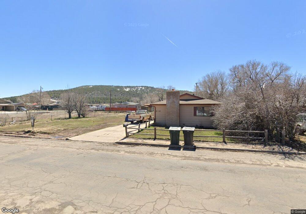
222 E Edison Ave Williams, AZ 86046
Estimated Value: $52,836 - $397,000
Studio
--
Bath
--
Sq Ft
6,970
Sq Ft Lot
About This Home
This home is located at 222 E Edison Ave, Williams, AZ 86046 and is currently estimated at $224,918. 222 E Edison Ave is a home located in Coconino County with nearby schools including Williams Elementary/Middle School, Williams High School, and Heritage Elementary - Williams.
Ownership History
Date
Name
Owned For
Owner Type
Purchase Details
Closed on
Apr 16, 2019
Sold by
Reyes Frankie F and Reyes Joan
Bought by
Ramirez Eladio and Ramirez Debbie
Current Estimated Value
Home Financials for this Owner
Home Financials are based on the most recent Mortgage that was taken out on this home.
Original Mortgage
$15,000
Outstanding Balance
$13,161
Interest Rate
4.3%
Mortgage Type
Purchase Money Mortgage
Estimated Equity
$211,757
Purchase Details
Closed on
Dec 11, 2015
Sold by
Reyes Judy I
Bought by
Reyes Frankie F
Purchase Details
Closed on
Sep 5, 2007
Sold by
Reyes Raymond
Bought by
Reyes Raymond and Reyes Judy
Create a Home Valuation Report for This Property
The Home Valuation Report is an in-depth analysis detailing your home's value as well as a comparison with similar homes in the area
Home Values in the Area
Average Home Value in this Area
Purchase History
| Date | Buyer | Sale Price | Title Company |
|---|---|---|---|
| Ramirez Eladio | $30,000 | Pioneer Title Agency | |
| Reyes Frankie F | -- | Pioneer Title Agency | |
| Reyes Frankie F | -- | None Available | |
| Reyes Raymond | -- | None Available |
Source: Public Records
Mortgage History
| Date | Status | Borrower | Loan Amount |
|---|---|---|---|
| Open | Ramirez Eladio | $15,000 |
Source: Public Records
Tax History
| Year | Tax Paid | Tax Assessment Tax Assessment Total Assessment is a certain percentage of the fair market value that is determined by local assessors to be the total taxable value of land and additions on the property. | Land | Improvement |
|---|---|---|---|---|
| 2025 | $500 | $9,114 | -- | -- |
| 2024 | $500 | $9,114 | -- | -- |
| 2023 | $486 | $6,626 | $0 | $0 |
| 2022 | $462 | $5,303 | $0 | $0 |
| 2021 | $468 | $5,303 | $0 | $0 |
| 2020 | $473 | $5,303 | $0 | $0 |
| 2019 | $459 | $5,303 | $0 | $0 |
| 2018 | $444 | $4,725 | $0 | $0 |
| 2017 | $436 | $4,515 | $0 | $0 |
| 2016 | $434 | $4,515 | $0 | $0 |
| 2015 | $468 | $4,816 | $0 | $0 |
Source: Public Records
Map
Nearby Homes
- 218 E Edison Ave
- 701 N Airport Rd
- 1124 N Grand Canyon Blvd Unit C
- 00 S Pine St
- 344 E Route 66
- 241 W Grant Ave
- 1105 W Morse Ave
- 401 S 1st St
- 304 S 4th St
- 1258 W Morse Ave
- 216 Pinecrest Trail
- 162 Pinecrest Trail
- 118 Pinecrest Trail
- 224 N Morse Ave
- 147 Pinecrest Trail
- 500 W Meade Ave
- 215 W Hancock Ave
- 901 Wells Fargo Dr
- 920 W Sheridan Ave
- 1011 W Sheridan Ave
- 222 E Edison Ave Unit 3
- 610 N Newton St Unit C
- 610 N Newton St Unit D
- 610 N Newton St
- 233 E Edison Ave
- 202 E Edison Ave
- 605 N Newton St
- 622 N Newton St
- 609 N Newton St
- 242 E Edison Ave
- 615 N Humbolt St
- 246 E Edison Ave
- 621 N Newton St
- 612 N Humbolt St
- 702 N Newton St
- 209 E Fulton Ave
- 211 E Fulton Ave
- 506 N Newton St
- 300 E Edison Ave
- 300 E Edison Ave Unit b & f
Your Personal Tour Guide
Ask me questions while you tour the home.