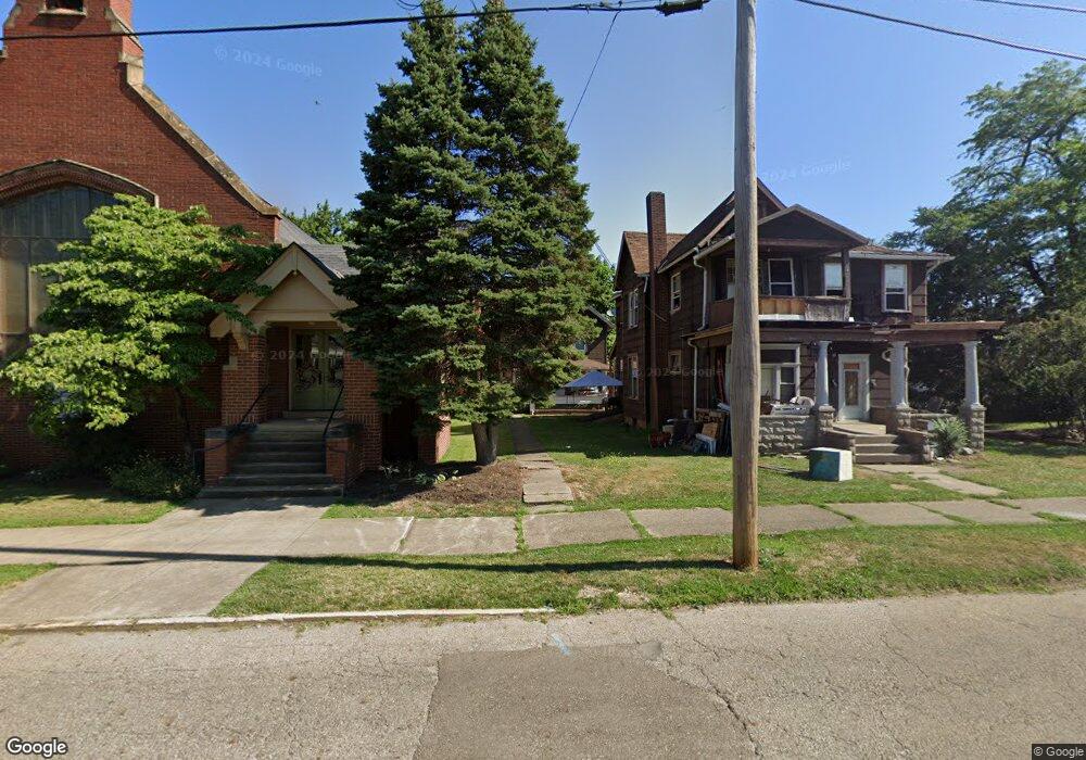
222 E Oxford St Alliance, OH 44601
Estimated Value: $43,000 - $104,000
3
Beds
1
Bath
1,350
Sq Ft
$59/Sq Ft
Est. Value
About This Home
This home is located at 222 E Oxford St, Alliance, OH 44601 and is currently estimated at $79,000, approximately $58 per square foot. 222 E Oxford St is a home located in Stark County with nearby schools including Alliance Intermediate School at Northside, Alliance Elementary School at Rockhill, and Alliance Middle School.
Ownership History
Date
Name
Owned For
Owner Type
Purchase Details
Closed on
Feb 20, 2024
Sold by
Tcz Properties Llc
Bought by
Ohsw Ventures Llc
Current Estimated Value
Home Financials for this Owner
Home Financials are based on the most recent Mortgage that was taken out on this home.
Original Mortgage
$1,050,000
Interest Rate
6.66%
Mortgage Type
Construction
Purchase Details
Closed on
Sep 28, 2022
Sold by
Zeusangel Investment Properties Ltd
Bought by
Tcz Properties Llc
Purchase Details
Closed on
Dec 24, 2014
Sold by
Kirven Robert and Kirven Nicole L
Bought by
Zeusangel Investment Properties Ltd
Purchase Details
Closed on
Jun 9, 2009
Sold by
Kirven Patricia
Bought by
Kirven Robert
Create a Home Valuation Report for This Property
The Home Valuation Report is an in-depth analysis detailing your home's value as well as a comparison with similar homes in the area
Home Values in the Area
Average Home Value in this Area
Purchase History
| Date | Buyer | Sale Price | Title Company |
|---|---|---|---|
| Ohsw Ventures Llc | $660,000 | None Listed On Document | |
| Tcz Properties Llc | $200,200 | -- | |
| Zeusangel Investment Properties Ltd | $6,000 | None Available | |
| Kirven Robert | -- | None Available |
Source: Public Records
Mortgage History
| Date | Status | Borrower | Loan Amount |
|---|---|---|---|
| Closed | Ohsw Ventures Llc | $1,050,000 |
Source: Public Records
Tax History Compared to Growth
Tax History
| Year | Tax Paid | Tax Assessment Tax Assessment Total Assessment is a certain percentage of the fair market value that is determined by local assessors to be the total taxable value of land and additions on the property. | Land | Improvement |
|---|---|---|---|---|
| 2025 | -- | $13,520 | $1,650 | $11,870 |
| 2024 | -- | $13,520 | $1,650 | $11,870 |
| 2023 | $388 | $9,420 | $910 | $8,510 |
| 2022 | $390 | $9,420 | $910 | $8,510 |
| 2021 | $391 | $9,420 | $910 | $8,510 |
| 2020 | $350 | $7,880 | $770 | $7,110 |
| 2019 | $346 | $7,880 | $770 | $7,110 |
| 2018 | $347 | $7,880 | $770 | $7,110 |
| 2017 | $306 | $6,810 | $680 | $6,130 |
| 2016 | $308 | $6,810 | $680 | $6,130 |
| 2015 | $311 | $6,810 | $680 | $6,130 |
| 2014 | $235 | $5,050 | $530 | $4,520 |
| 2013 | $117 | $5,050 | $530 | $4,520 |
Source: Public Records
Map
Nearby Homes
- 432 S Linden Ave
- 356 E Broadway St
- 427 S Union Ave
- V/L S Fredeom Ave
- 452 E Summit St
- 361 E Main St
- 442 S Liberty Ave
- 807 S Union Ave
- 140 W Summit St
- 132 S Haines Ave
- 163 W Market St
- 1005 S Freedom Ave
- 608 N Freedom Ave
- 1175 S Freedom Ave
- 1044 S Liberty Ave
- 814 Milner St
- 831 Wade Ave
- 345 W Market St
- 710 N Freedom Ave
- 505 N Union Ave
- 224 E Oxford St
- 223 E High St
- 431 S Arch Ave
- 437 S Arch Ave
- 215 E High St
- 413 S Arch Ave
- 205 E Oxford St
- 171 E High St
- 435 S Arch Ave
- 215 E Oxford St
- 223 E Oxford St
- 173 E Oxford St
- 163 E Oxford St
- 224 E Cambridge St
- 519 S Mechanic Ave
- 530 S Mechanic Ave
- 153 E Oxford St
- 153 E Oxford St Unit 2
- 153 E Oxford St Unit 1
- 531 S Arch Ave