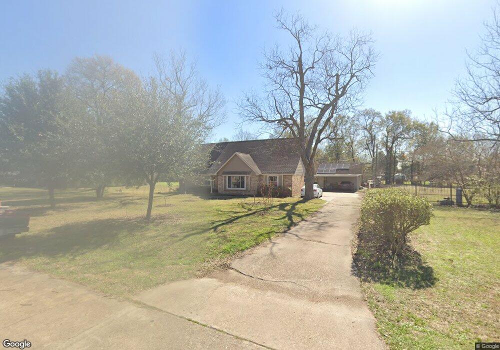
222 E Thornton Rd Houston, TX 77022
Independence Heights NeighborhoodEstimated Value: $411,706 - $492,000
3
Beds
2
Baths
2,727
Sq Ft
$162/Sq Ft
Est. Value
About This Home
This home is located at 222 E Thornton Rd, Houston, TX 77022 and is currently estimated at $442,177, approximately $162 per square foot. 222 E Thornton Rd is a home located in Harris County with nearby schools including Kennedy Elementary School, Williams Middle, and Booker T Washington Sr High.
Ownership History
Date
Name
Owned For
Owner Type
Purchase Details
Closed on
Jul 19, 2013
Sold by
Fernisse Tammy D and Fernisse Jeffrey M
Bought by
Eernisse Tammy D and Eernisse Jeffrey M
Current Estimated Value
Home Financials for this Owner
Home Financials are based on the most recent Mortgage that was taken out on this home.
Original Mortgage
$127,000
Outstanding Balance
$30,133
Interest Rate
3.99%
Mortgage Type
New Conventional
Estimated Equity
$412,044
Purchase Details
Closed on
Apr 24, 2007
Sold by
U S Bank Na
Bought by
Eernisse Tammy D and Eernisse Jeffrey M
Home Financials for this Owner
Home Financials are based on the most recent Mortgage that was taken out on this home.
Original Mortgage
$101,600
Interest Rate
6.13%
Mortgage Type
Purchase Money Mortgage
Purchase Details
Closed on
Oct 3, 2006
Sold by
Fowler Dennistene
Bought by
Us Bank Na and Home Equity Loan Trust 2004-He5
Create a Home Valuation Report for This Property
The Home Valuation Report is an in-depth analysis detailing your home's value as well as a comparison with similar homes in the area
Home Values in the Area
Average Home Value in this Area
Purchase History
| Date | Buyer | Sale Price | Title Company |
|---|---|---|---|
| Eernisse Tammy D | -- | None Available | |
| Eernisse Tammy D | -- | Fidelity National Title | |
| Us Bank Na | $170,000 | None Available | |
| Us Bank Na | $170,000 | None Available |
Source: Public Records
Mortgage History
| Date | Status | Borrower | Loan Amount |
|---|---|---|---|
| Open | Eernisse Tammy D | $127,000 | |
| Previous Owner | Eernisse Tammy D | $101,600 |
Source: Public Records
Tax History
| Year | Tax Paid | Tax Assessment Tax Assessment Total Assessment is a certain percentage of the fair market value that is determined by local assessors to be the total taxable value of land and additions on the property. | Land | Improvement |
|---|---|---|---|---|
| 2025 | $4,571 | $379,716 | $182,025 | $197,691 |
| 2024 | $4,571 | $415,893 | $182,025 | $233,868 |
| 2023 | $4,571 | $381,753 | $145,620 | $236,133 |
| 2022 | $7,028 | $355,423 | $145,620 | $209,803 |
| 2021 | $6,762 | $331,336 | $145,620 | $185,716 |
| 2020 | $5,273 | $247,802 | $72,810 | $174,992 |
| 2019 | $5,009 | $243,403 | $72,810 | $170,593 |
| 2018 | $3,359 | $201,863 | $42,473 | $159,390 |
| 2017 | $4,137 | $201,863 | $42,473 | $159,390 |
| 2016 | $3,761 | $199,588 | $30,338 | $169,250 |
| 2015 | $2,361 | $149,568 | $30,338 | $119,230 |
| 2014 | $2,361 | $125,683 | $30,338 | $95,345 |
Source: Public Records
Map
Nearby Homes
- 4510 Trevor Park Ln
- 144 Knightsbridge Park Ln
- 148 W Whitney St
- 126 Knightsbridge Park Ln
- 115 E Thornton Rd
- 108 Knightsbridge Park Ln
- 241 Norview Dr
- 107 W Whitney St Unit E
- 218 Victoria Dr
- 4516 Werner St
- 4510 Old Yale St Unit A
- 4423 Yale St
- 121 Norview Dr
- 0 Victoria Unit 54691087
- 4711 Yale St
- 315 E Whitney St
- 316 C Walthall Dr Unit D
- 316 C Walthall Dr Unit B
- 316 C Walthall Dr Unit A
- 316 C Walthall Dr Unit E
- 214 E Thornton Rd
- 230 E Thornton Rd
- 223 E Thornton Rd
- 227 E Thornton Rd
- 234 E Thornton Rd
- 210 E Thornton Rd
- 219 E Thornton Rd
- 4554 Lelay Cir
- 4550 Lelay Cir
- 4555 Lelay Cir
- 231 E Thornton Rd
- 215 E Thornton Rd
- 4551 Lelay Cir
- 4550 Pecan Park Cir
- 4546 Lelay Cir
- 4508 Trevor Park Ln
- 206 E Thornton Rd
- 4554 Pecan Park Cir
- 4506 Trevor Park Ln
- 235 E Thornton Rd
Your Personal Tour Guide
Ask me questions while you tour the home.