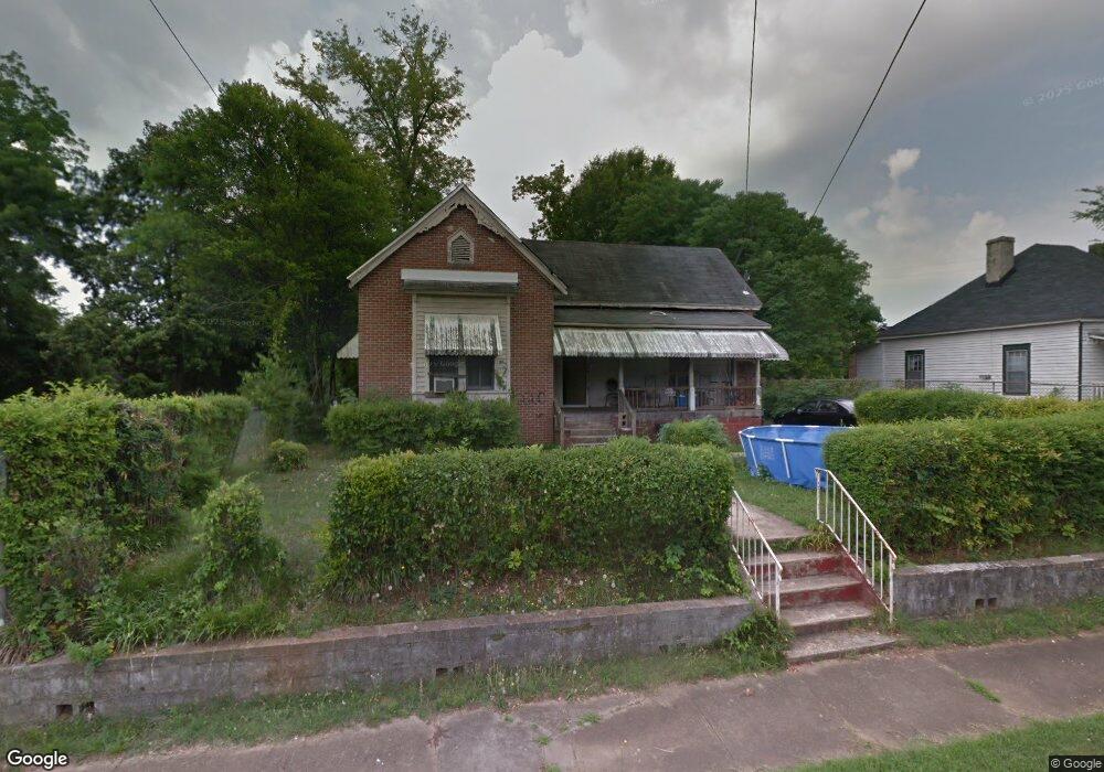
222 Fannin St Lagrange, GA 30241
Estimated Value: $15,618 - $286,000
--
Bed
1
Bath
--
Sq Ft
5,227
Sq Ft Lot
About This Home
This home is located at 222 Fannin St, Lagrange, GA 30241 and is currently estimated at $131,905. 222 Fannin St is a home located in Troup County with nearby schools including Hollis Hand Elementary School, Franklin Forest Elementary School, and Ethel W. Kight Elementary School.
Ownership History
Date
Name
Owned For
Owner Type
Purchase Details
Closed on
Jul 14, 2014
Sold by
Martin Wendell
Bought by
Dexter Patterson
Current Estimated Value
Purchase Details
Closed on
Oct 7, 1996
Sold by
Joseph Allen Etal
Bought by
Martin Wendell
Purchase Details
Closed on
Aug 1, 1995
Sold by
James Joseph Allen
Bought by
Joseph Allen Etal
Purchase Details
Closed on
Nov 4, 1994
Sold by
James Joseph Allen
Bought by
James Joseph Allen
Purchase Details
Closed on
Oct 3, 1974
Sold by
Epps
Bought by
James Joseph Allen
Purchase Details
Closed on
Jan 1, 1958
Sold by
Mcdowell Louis and Mcdowell Doyle
Bought by
Epps
Create a Home Valuation Report for This Property
The Home Valuation Report is an in-depth analysis detailing your home's value as well as a comparison with similar homes in the area
Home Values in the Area
Average Home Value in this Area
Purchase History
| Date | Buyer | Sale Price | Title Company |
|---|---|---|---|
| Dexter Patterson | $7,000 | -- | |
| Martin Wendell | -- | -- | |
| Joseph Allen Etal | -- | -- | |
| James Joseph Allen | -- | -- | |
| James Joseph Allen | -- | -- | |
| Epps | -- | -- |
Source: Public Records
Tax History Compared to Growth
Tax History
| Year | Tax Paid | Tax Assessment Tax Assessment Total Assessment is a certain percentage of the fair market value that is determined by local assessors to be the total taxable value of land and additions on the property. | Land | Improvement |
|---|---|---|---|---|
| 2024 | $61 | $2,240 | $2,240 | $0 |
| 2023 | $61 | $2,240 | $2,240 | $0 |
| 2022 | $63 | $2,240 | $2,240 | $0 |
| 2021 | $40 | $1,320 | $1,320 | $0 |
| 2020 | $40 | $1,320 | $1,320 | $0 |
| 2019 | $40 | $1,320 | $1,320 | $0 |
| 2018 | $43 | $1,440 | $1,440 | $0 |
| 2017 | $43 | $1,440 | $1,440 | $0 |
| 2016 | $43 | $1,440 | $1,440 | $0 |
| 2015 | $41 | $1,359 | $1,359 | $0 |
| 2014 | $145 | $4,806 | $1,352 | $3,454 |
| 2013 | -- | $7,258 | $1,352 | $5,906 |
Source: Public Records
Map
Nearby Homes