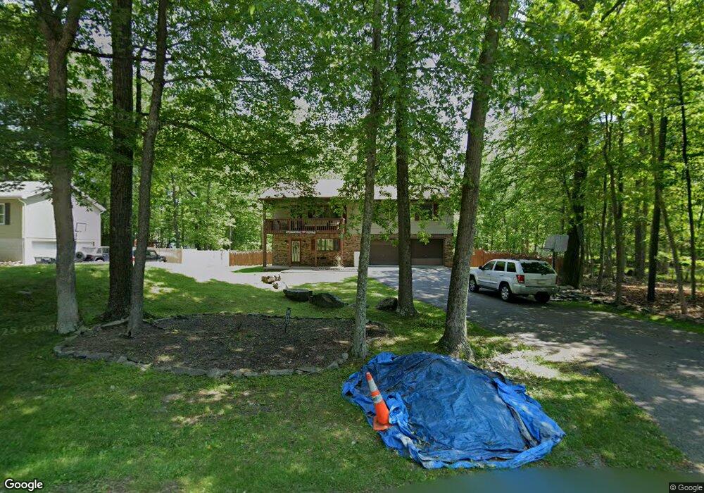
222 Footprint Rd East Stroudsburg, PA 18302
Estimated Value: $285,268 - $350,000
3
Beds
3
Baths
1,344
Sq Ft
$232/Sq Ft
Est. Value
About This Home
This home is located at 222 Footprint Rd, East Stroudsburg, PA 18302 and is currently estimated at $312,317, approximately $232 per square foot. 222 Footprint Rd is a home located in Monroe County with nearby schools including East Stroudsburg Elementary School, J.T. Lambert Intermediate School, and East Stroudsburg Senior High School South.
Ownership History
Date
Name
Owned For
Owner Type
Purchase Details
Closed on
Jun 1, 2010
Sold by
Hsbc Bank Usa National Association
Bought by
Husbands Eami and Husbands Kenya
Current Estimated Value
Home Financials for this Owner
Home Financials are based on the most recent Mortgage that was taken out on this home.
Original Mortgage
$143,073
Outstanding Balance
$95,935
Interest Rate
4.98%
Mortgage Type
FHA
Estimated Equity
$216,382
Purchase Details
Closed on
Jun 19, 2008
Sold by
Graham Marcia
Bought by
Hsbc Bank Usa National Association
Purchase Details
Closed on
Mar 2, 2005
Sold by
Husbands Eami and Husbands Kenya
Bought by
Graham Marcia
Home Financials for this Owner
Home Financials are based on the most recent Mortgage that was taken out on this home.
Original Mortgage
$142,200
Interest Rate
8.05%
Mortgage Type
Adjustable Rate Mortgage/ARM
Create a Home Valuation Report for This Property
The Home Valuation Report is an in-depth analysis detailing your home's value as well as a comparison with similar homes in the area
Home Values in the Area
Average Home Value in this Area
Purchase History
| Date | Buyer | Sale Price | Title Company |
|---|---|---|---|
| Husbands Eami | $145,000 | None Available | |
| Hsbc Bank Usa National Association | $1,404 | None Available | |
| Graham Marcia | $158,000 | Heavyweight Title Co |
Source: Public Records
Mortgage History
| Date | Status | Borrower | Loan Amount |
|---|---|---|---|
| Open | Husbands Eami | $143,073 | |
| Previous Owner | Graham Marcia | $142,200 |
Source: Public Records
Tax History Compared to Growth
Tax History
| Year | Tax Paid | Tax Assessment Tax Assessment Total Assessment is a certain percentage of the fair market value that is determined by local assessors to be the total taxable value of land and additions on the property. | Land | Improvement |
|---|---|---|---|---|
| 2025 | $815 | $127,560 | $25,480 | $102,080 |
| 2024 | $624 | $127,560 | $25,480 | $102,080 |
| 2023 | $4,425 | $127,560 | $25,480 | $102,080 |
| 2022 | $4,486 | $127,560 | $25,480 | $102,080 |
| 2021 | $4,416 | $127,560 | $25,480 | $102,080 |
| 2020 | $4,043 | $127,560 | $25,480 | $102,080 |
| 2019 | $4,538 | $22,330 | $2,000 | $20,330 |
| 2018 | $4,538 | $22,330 | $2,000 | $20,330 |
| 2017 | $4,538 | $22,330 | $2,000 | $20,330 |
| 2016 | $4,111 | $22,330 | $2,000 | $20,330 |
| 2015 | -- | $22,330 | $2,000 | $20,330 |
| 2014 | -- | $22,330 | $2,000 | $20,330 |
Source: Public Records
Map
Nearby Homes
- Lot 17 Footprint Rd
- 430 Indian Way
- 237 Footprint Rd
- Lot 31 & 32 Lenape Dr
- Lot18 Lenape Dr
- Lot 36 Lenape Dr
- 0 Lenape Dr Unit Lot 31 & 32 763518
- 529 Highland Dr
- 84 Lenape Dr
- 0 Lace Dr 24 Dr
- 28 Lenape Dr
- 0 Way
- 53 Barren Rd
- 0 Green Meadow Dr
- Lot 24 Green Meadow Dr
- 630 Wooddale Rd
- 30 Ledgewood Ct
- 6 Westridge Ct
- Lot 4 Adams Dr
- 12723 Magnolia Dr
- 224 Footprint Rd
- 17H Footprint Rd
- 8 Footprint Rd
- Lot 19 Footprint Rd
- 221 Footprint Rd
- 433 Indian Way
- 219 Footprint Rd
- 223 Footprint Rd
- 228 Footprint Rd
- 217 Footprint Rd
- 225 Footprint Rd
- 441 Indian Way
- 215 Footprint Rd
- 103 Lenape Dr
- 105 Lenape Dr
- 101 Lenape Dr
- 438 Indian Way
- 107 Lenape Dr
- 432 Indian Way
- 443 Indian Way