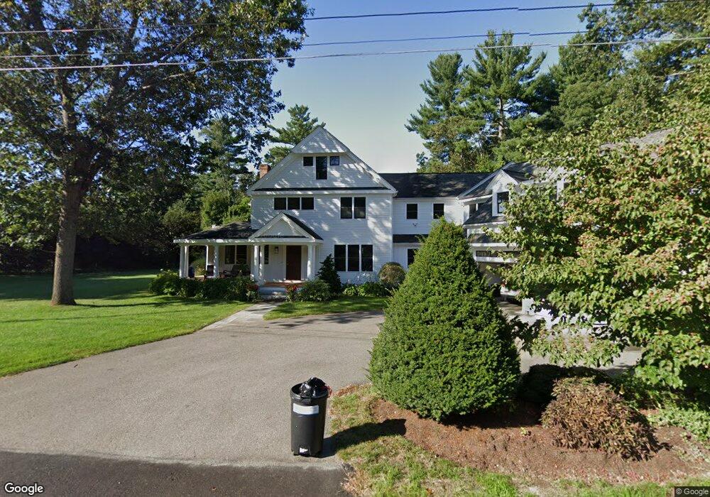
222 Independence Rd Concord, MA 01742
Estimated Value: $2,981,000 - $3,231,000
5
Beds
5
Baths
5,136
Sq Ft
$610/Sq Ft
Est. Value
About This Home
This home is located at 222 Independence Rd, Concord, MA 01742 and is currently estimated at $3,133,697, approximately $610 per square foot. 222 Independence Rd is a home located in Middlesex County with nearby schools including Alcott Elementary School, Concord Middle School, and Concord Carlisle High School.
Ownership History
Date
Name
Owned For
Owner Type
Purchase Details
Closed on
Dec 2, 1988
Sold by
Nichols Elise B
Bought by
Barrett Charles W
Current Estimated Value
Home Financials for this Owner
Home Financials are based on the most recent Mortgage that was taken out on this home.
Original Mortgage
$202,800
Interest Rate
10.19%
Mortgage Type
Purchase Money Mortgage
Create a Home Valuation Report for This Property
The Home Valuation Report is an in-depth analysis detailing your home's value as well as a comparison with similar homes in the area
Home Values in the Area
Average Home Value in this Area
Purchase History
| Date | Buyer | Sale Price | Title Company |
|---|---|---|---|
| Barrett Charles W | $253,500 | -- |
Source: Public Records
Mortgage History
| Date | Status | Borrower | Loan Amount |
|---|---|---|---|
| Open | Barrett Charles W | $357,500 | |
| Closed | Barrett Charles W | $302,000 | |
| Closed | Barrett Charles W | $325,000 | |
| Closed | Barrett Charles W | $202,800 |
Source: Public Records
Tax History
| Year | Tax Paid | Tax Assessment Tax Assessment Total Assessment is a certain percentage of the fair market value that is determined by local assessors to be the total taxable value of land and additions on the property. | Land | Improvement |
|---|---|---|---|---|
| 2025 | $383 | $2,888,900 | $1,006,400 | $1,882,500 |
| 2024 | $37,649 | $2,867,400 | $1,006,400 | $1,861,000 |
| 2023 | $29,755 | $2,295,900 | $823,400 | $1,472,500 |
| 2022 | $28,766 | $1,948,900 | $658,600 | $1,290,300 |
| 2021 | $28,692 | $1,949,200 | $658,600 | $1,290,600 |
| 2020 | $28,333 | $1,991,100 | $658,600 | $1,332,500 |
| 2019 | $27,697 | $1,951,900 | $686,700 | $1,265,200 |
| 2018 | $26,539 | $1,857,200 | $608,800 | $1,248,400 |
| 2017 | $24,946 | $1,773,000 | $558,300 | $1,214,700 |
| 2016 | $24,949 | $1,792,300 | $558,300 | $1,234,000 |
| 2015 | $23,423 | $1,639,100 | $517,000 | $1,122,100 |
Source: Public Records
Map
Nearby Homes
- 96 Independence Rd
- 612 Lexington Rd
- 50 Wayside Rd
- 97 Hawthorne Ln
- 212 Hawthorne Ln
- 105 Lexington Rd
- 181 Stow St
- 646 Cambridge Turnpike
- 143 Everett St
- 61B Walden St
- 165 Everett St
- 46 Sudbury Rd
- 150 Hubbard St Unit B
- 7 Blue Heron Way
- 6 Parker Rd
- 6 Smith Hill Rd
- 34 Thoreau St
- 34 Thoreau St Unit 34
- 32 Thoreau St Unit 32
- 22 Belknap Ct
- 244 Independence Rd
- 204 Independence Rd
- 221 Independence Rd
- 126 Alcott Rd
- 233 Independence Rd
- 118 Alcott Rd
- 258 Independence Rd
- 247 Independence Rd
- 134 Alcott Rd
- 188 Independence Rd
- 201 Independence Rd
- 100 Alcott Rd
- 259 Independence Rd
- 199 Independence Rd
- 121 Alcott Rd
- 144 Alcott Rd
- 174 Independence Rd
- 276 Independence Rd
- 179 Independence Rd
- 92 Alcott Rd
Your Personal Tour Guide
Ask me questions while you tour the home.