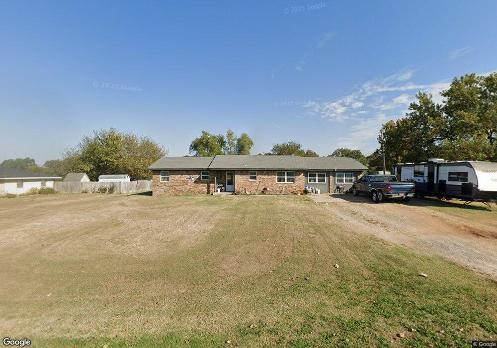
222 Jones Rd Shawnee, OK 74801
Estimated Value: $167,000 - $284,000
3
Beds
2
Baths
1,598
Sq Ft
$136/Sq Ft
Est. Value
About This Home
This home is located at 222 Jones Rd, Shawnee, OK 74801 and is currently estimated at $216,922, approximately $135 per square foot. 222 Jones Rd is a home located in Pottawatomie County with nearby schools including South Rock Creek Public School.
Ownership History
Date
Name
Owned For
Owner Type
Purchase Details
Closed on
Sep 28, 2017
Sold by
Dagiva Enterprises Inc
Bought by
Pottawatomie County Investment Propertie
Current Estimated Value
Purchase Details
Closed on
Mar 23, 2017
Sold by
Stewart Twila F
Bought by
Dagiva Enterprises Inc
Home Financials for this Owner
Home Financials are based on the most recent Mortgage that was taken out on this home.
Original Mortgage
$106,400
Interest Rate
4.16%
Mortgage Type
Commercial
Purchase Details
Closed on
Jul 6, 2004
Sold by
Anderson Ruth A
Bought by
Stewart Twila and Stewart Robert
Purchase Details
Closed on
Aug 12, 1991
Sold by
Anderson Ruth and Anderson Johnny
Bought by
Anderson Ruth
Create a Home Valuation Report for This Property
The Home Valuation Report is an in-depth analysis detailing your home's value as well as a comparison with similar homes in the area
Home Values in the Area
Average Home Value in this Area
Purchase History
| Date | Buyer | Sale Price | Title Company |
|---|---|---|---|
| Pottawatomie County Investment Propertie | -- | None Available | |
| Dagiva Enterprises Inc | $83,000 | First American Title | |
| Stewart Twila | $54,000 | -- | |
| Anderson Ruth | -- | -- |
Source: Public Records
Mortgage History
| Date | Status | Borrower | Loan Amount |
|---|---|---|---|
| Previous Owner | Dagiva Enterprises Inc | $106,400 |
Source: Public Records
Tax History Compared to Growth
Tax History
| Year | Tax Paid | Tax Assessment Tax Assessment Total Assessment is a certain percentage of the fair market value that is determined by local assessors to be the total taxable value of land and additions on the property. | Land | Improvement |
|---|---|---|---|---|
| 2025 | $1,130 | $15,042 | $1,193 | $13,849 |
| 2024 | $1,260 | $14,326 | $1,193 | $13,133 |
| 2023 | $1,260 | $13,644 | $1,193 | $12,451 |
| 2022 | $1,249 | $13,644 | $1,193 | $12,451 |
| 2021 | $1,076 | $13,644 | $1,193 | $12,451 |
| 2020 | $942 | $9,652 | $1,193 | $8,459 |
| 2019 | $963 | $9,854 | $1,193 | $8,661 |
| 2018 | $996 | $9,960 | $1,193 | $8,767 |
| 2017 | $746 | $7,501 | $398 | $7,103 |
| 2016 | $668 | $7,145 | $372 | $6,773 |
| 2015 | $653 | $6,804 | $325 | $6,479 |
| 2014 | $621 | $6,480 | $280 | $6,200 |
Source: Public Records
Map
Nearby Homes
- 00 Hardesty Rd 15 Acres
- 44303 Hardesty Rd
- 17701 S Rock Creek Rd
- 45210 Hardesty Rd
- 00 S Rock Creek Rd
- 45201 Hardesty Rd
- 18509 Brangus Rd
- 00 Allyson Ln
- 44630 Kingsbury
- 44508 Kingsbury Ln
- 00 Charleston Pointe
- 16710 Kings Rd
- 16504 Kings Rd
- 000 E Highland St
- 4 Hillcrest Dr
- 15809 S Rock Creek Rd
- 00 Benson Park Rd
- 301 Clubhouse Dr
- 1600 E Farrall
- 601 Pool Ln