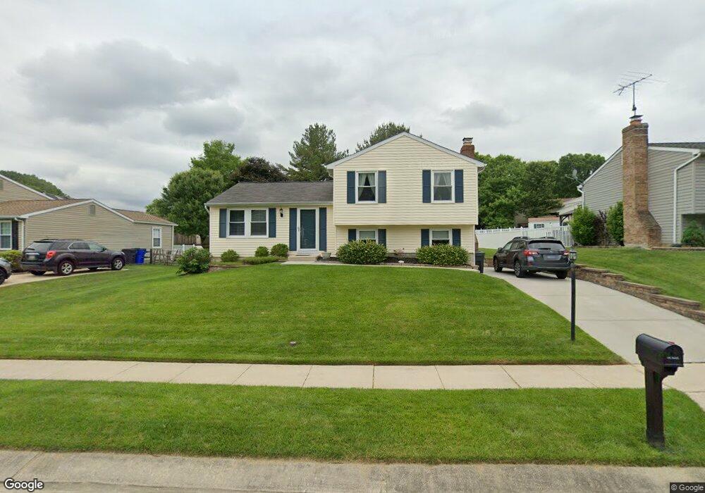
222 Kensington Pkwy Abingdon, MD 21009
Estimated Value: $386,064 - $491,000
--
Bed
2
Baths
2,040
Sq Ft
$209/Sq Ft
Est. Value
About This Home
This home is located at 222 Kensington Pkwy, Abingdon, MD 21009 and is currently estimated at $426,766, approximately $209 per square foot. 222 Kensington Pkwy is a home located in Harford County with nearby schools including William S. James Elementary School, Patterson Mill Middle School, and Patterson Mill High School.
Ownership History
Date
Name
Owned For
Owner Type
Purchase Details
Closed on
Aug 27, 1981
Bought by
Chrest Carl G and Chrest Gail E
Current Estimated Value
Home Financials for this Owner
Home Financials are based on the most recent Mortgage that was taken out on this home.
Original Mortgage
$48,000
Interest Rate
17.26%
Create a Home Valuation Report for This Property
The Home Valuation Report is an in-depth analysis detailing your home's value as well as a comparison with similar homes in the area
Home Values in the Area
Average Home Value in this Area
Purchase History
| Date | Buyer | Sale Price | Title Company |
|---|---|---|---|
| Chrest Carl G | $70,800 | -- |
Source: Public Records
Mortgage History
| Date | Status | Borrower | Loan Amount |
|---|---|---|---|
| Closed | Chrest Carl G | $48,000 |
Source: Public Records
Tax History Compared to Growth
Tax History
| Year | Tax Paid | Tax Assessment Tax Assessment Total Assessment is a certain percentage of the fair market value that is determined by local assessors to be the total taxable value of land and additions on the property. | Land | Improvement |
|---|---|---|---|---|
| 2025 | $2,634 | $332,267 | $0 | $0 |
| 2024 | $2,634 | $305,633 | $0 | $0 |
| 2023 | $2,495 | $279,000 | $82,900 | $196,100 |
| 2022 | $2,964 | $271,933 | $0 | $0 |
| 2021 | $2,975 | $264,867 | $0 | $0 |
| 2020 | $2,975 | $257,800 | $82,900 | $174,900 |
| 2019 | $2,932 | $254,100 | $0 | $0 |
| 2018 | $2,864 | $250,400 | $0 | $0 |
| 2017 | $2,821 | $246,700 | $0 | $0 |
| 2016 | -- | $242,867 | $0 | $0 |
| 2015 | $3,025 | $239,033 | $0 | $0 |
| 2014 | $3,025 | $235,200 | $0 | $0 |
Source: Public Records
Map
Nearby Homes
- 741 Burgh Westra Way
- 2853 Browning Ct
- 2916 Carlyle Ct
- 2932 Carlyle Ct
- 2910 Ruskin Ct
- 2921 Shelley Ct
- 2931 Shelley Ct
- Augusta Plan at Laurel Oaks
- Woodford Plan at Laurel Oaks
- Savannah Plan at Laurel Oaks
- Hawthorne Plan at Laurel Oaks
- Sebastian Plan at Laurel Oaks
- Devonshire Plan at Laurel Oaks
- Addison Plan at Laurel Oaks
- Arcadia Plan at Laurel Oaks
- Nottingham Plan at Laurel Oaks
- Ethan Plan at Laurel Oaks
- Magnolia Plan at Laurel Oaks
- Kipling Plan at Laurel Oaks
- Covington Plan at Laurel Oaks
- 224 Kensington Pkwy
- 220 Kensington Pkwy
- 2903 Craigston Ln
- 216 Kensington Pkwy
- 2937 Craigston Ln
- 214 Kensington Pkwy
- 2951 Burnt Oak Ct
- 2950 Sunderland Ct
- 2905 Craigston Ln
- 2935 Craigston Ln
- 228 Kensington Pkwy
- 2939 Craigston Ln
- 2933 Craigston Ln
- 2952 Sunderland Ct
- 225 Kensington Pkwy
- 2907 Craigston Ln
- 2953 Burnt Oak Ct
- 2951 Sunderland Ct
- 230 Kensington Pkwy
- 2902 Craigston Ln