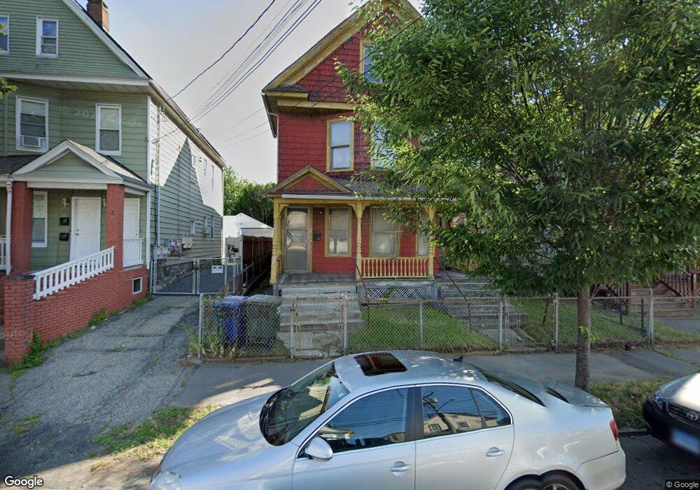
222 Lindley St Unit 224 Bridgeport, CT 06604
Reservoir-Whiskey Hill NeighborhoodEstimated Value: $347,850 - $577,000
6
Beds
2
Baths
3,039
Sq Ft
$153/Sq Ft
Est. Value
About This Home
This home is located at 222 Lindley St Unit 224, Bridgeport, CT 06604 and is currently estimated at $466,463, approximately $153 per square foot. 222 Lindley St Unit 224 is a home located in Fairfield County with nearby schools including Read School, Harding High School, and Achievement First Bridgeport Academy Elementary School.
Ownership History
Date
Name
Owned For
Owner Type
Purchase Details
Closed on
Apr 27, 2007
Sold by
Thompson Eva
Bought by
Thompson Gary
Current Estimated Value
Home Financials for this Owner
Home Financials are based on the most recent Mortgage that was taken out on this home.
Original Mortgage
$163,800
Outstanding Balance
$99,689
Interest Rate
6.18%
Estimated Equity
$366,774
Create a Home Valuation Report for This Property
The Home Valuation Report is an in-depth analysis detailing your home's value as well as a comparison with similar homes in the area
Home Values in the Area
Average Home Value in this Area
Purchase History
| Date | Buyer | Sale Price | Title Company |
|---|---|---|---|
| Thompson Gary | $252,000 | -- | |
| Thompson Gary | $252,000 | -- |
Source: Public Records
Mortgage History
| Date | Status | Borrower | Loan Amount |
|---|---|---|---|
| Open | Thompson Gary | $163,800 | |
| Closed | Thompson Gary | $163,800 |
Source: Public Records
Tax History Compared to Growth
Tax History
| Year | Tax Paid | Tax Assessment Tax Assessment Total Assessment is a certain percentage of the fair market value that is determined by local assessors to be the total taxable value of land and additions on the property. | Land | Improvement |
|---|---|---|---|---|
| 2025 | $6,524 | $150,157 | $28,737 | $121,420 |
| 2024 | $6,524 | $150,157 | $28,737 | $121,420 |
| 2023 | $6,524 | $150,157 | $28,737 | $121,420 |
| 2022 | $6,524 | $150,157 | $28,737 | $121,420 |
| 2021 | $6,524 | $150,157 | $28,737 | $121,420 |
| 2020 | $6,101 | $113,000 | $13,620 | $99,380 |
| 2019 | $6,101 | $113,000 | $13,620 | $99,380 |
| 2018 | $6,144 | $113,000 | $13,620 | $99,380 |
| 2017 | $6,144 | $113,000 | $13,620 | $99,380 |
| 2016 | $6,144 | $113,000 | $13,620 | $99,380 |
| 2015 | $6,965 | $165,050 | $28,340 | $136,710 |
| 2014 | $6,965 | $165,050 | $28,340 | $136,710 |
Source: Public Records
Map
Nearby Homes
- 152 River St
- 178 Island Brook Ave
- 957 William St Unit A
- 76 Porter St
- 604 William St
- 1014 Noble Ave
- 2395 Main St Unit 2397
- 330 French St
- 438 Park St
- 369 Park St
- 39 Jane St
- 90 Tom Thumb St
- 291 Stillman St
- 1218 Kossuth St
- 40 Jane St
- 502 Berkshire Ave
- 5 William Place
- 627 Noble Ave
- 78 Fairmount Ave
- 274 Park St
- 218 Lindley St
- 228 Lindley St Unit 230
- 216 Lindley St Unit 218
- 236 Lindley St Unit 236
- 236 Lindley St Unit 238
- 236 Lindley St
- 236-240 Lindley St Unit 240
- 20 Ives Ct Unit 22
- 223 Lindley St Unit 225
- 235 Lindley St
- 26 Ives Ct Unit 28
- 205 Lindley St Unit 207
- 215 Lindley St Unit 217
- 211 Merriam St Unit 213
- 237 Lindley St Unit 239
- 38 Ives Ct Unit 1
- 252 Lindley St
- 32 Ives Ct Unit 34
- 36 Ives Ct Unit 38
- 36 Ives Ct Unit 1