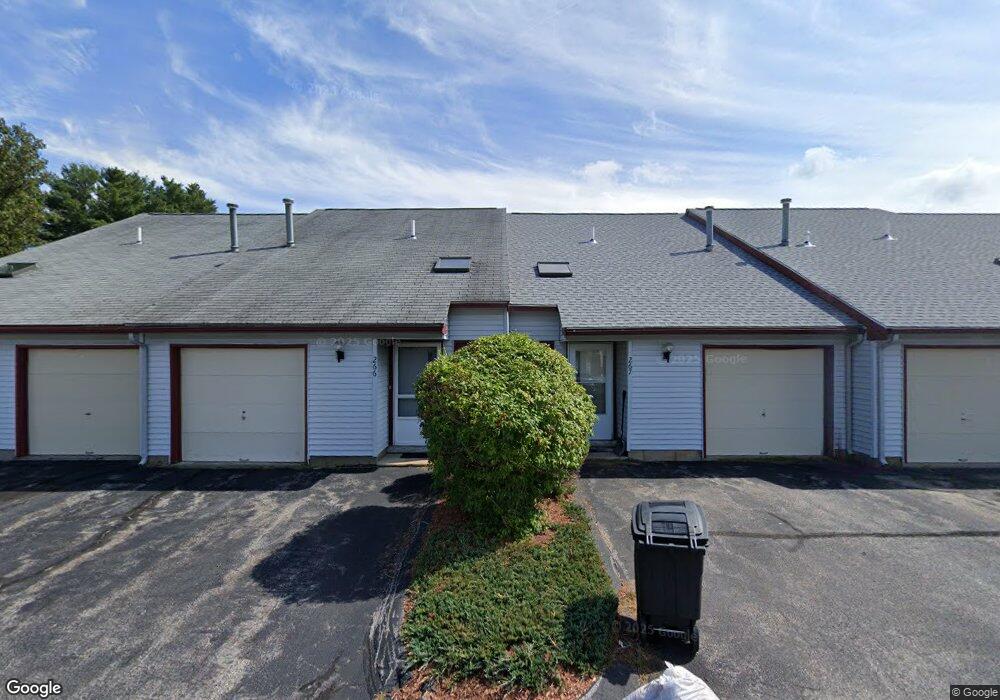
222 Millwright Dr Nashua, NH 03063
Northwest Nashua NeighborhoodEstimated Value: $272,000 - $307,351
2
Beds
1
Bath
1,072
Sq Ft
$272/Sq Ft
Est. Value
About This Home
This home is located at 222 Millwright Dr, Nashua, NH 03063 and is currently estimated at $291,588, approximately $272 per square foot. 222 Millwright Dr is a home located in Hillsborough County with nearby schools including Birch Hill Elementary School, Pennichuck Middle School, and Nashua High School North.
Ownership History
Date
Name
Owned For
Owner Type
Purchase Details
Closed on
Aug 20, 2020
Sold by
Whitestone Realty Assoc
Bought by
Bombard David S and Bombard Rhonda J
Current Estimated Value
Purchase Details
Closed on
Oct 30, 2018
Sold by
Gagnon Timothy J
Bought by
Bombard David S and Bombard Rhonda J
Home Financials for this Owner
Home Financials are based on the most recent Mortgage that was taken out on this home.
Original Mortgage
$98,325
Interest Rate
4.6%
Mortgage Type
Purchase Money Mortgage
Purchase Details
Closed on
Oct 8, 2013
Sold by
Cardinale Louis A and Drift Joseph W
Bought by
Peterson Stephanie
Create a Home Valuation Report for This Property
The Home Valuation Report is an in-depth analysis detailing your home's value as well as a comparison with similar homes in the area
Home Values in the Area
Average Home Value in this Area
Purchase History
| Date | Buyer | Sale Price | Title Company |
|---|---|---|---|
| Bombard David S | $47,000 | None Available | |
| Bombard David S | $131,133 | -- | |
| Peterson Stephanie | $78,500 | -- |
Source: Public Records
Mortgage History
| Date | Status | Borrower | Loan Amount |
|---|---|---|---|
| Previous Owner | Bombard David S | $98,325 |
Source: Public Records
Tax History
| Year | Tax Paid | Tax Assessment Tax Assessment Total Assessment is a certain percentage of the fair market value that is determined by local assessors to be the total taxable value of land and additions on the property. | Land | Improvement |
|---|---|---|---|---|
| 2025 | $4,547 | $270,200 | $0 | $270,200 |
| 2024 | $4,296 | $270,200 | $0 | $270,200 |
| 2023 | $3,650 | $200,200 | $0 | $200,200 |
| 2022 | $3,618 | $200,200 | $0 | $200,200 |
| 2021 | $3,464 | $149,200 | $0 | $149,200 |
| 2020 | $2,530 | $111,900 | $0 | $111,900 |
| 2019 | $2,515 | $115,600 | $0 | $115,600 |
| 2018 | $1,424 | $115,600 | $0 | $115,600 |
| 2017 | $1,798 | $69,700 | $0 | $69,700 |
| 2016 | $1,747 | $69,700 | $0 | $69,700 |
| 2015 | $1,710 | $69,700 | $0 | $69,700 |
| 2014 | $1,676 | $69,700 | $0 | $69,700 |
Source: Public Records
Map
Nearby Homes
- 3 Knights Bridge Dr Unit UL302
- 1133 Blackstone Dr Unit 33
- 4 Knights Bridge Dr Unit UI206
- 5 Dumaine Ave Unit N
- 7 Dumaine Ave Unit H
- 7 Bradford St
- 6 Duckford Cir Unit U19
- 35 Albury Stone Cir Unit U201
- 103 Jay Rd
- 47 Lamson Dr
- 1 Cambridge Dr
- 4 Wasserman Heights
- 63 Cannongate III Unit 3
- 189 Coburn Woods
- 206 S Merrimack Rd
- 5 Ivy Ln Unit U131
- 53 Seaverns Bridge Rd
- 21 Todd Rd
- 111 Coburn Ave Unit 187
- 9 Rugby Rd
- 222 Millwright Dr
- 222 Millwright Dr Unit 222
- 223 Millwright Dr
- 223 Millwright Dr
- 223 Millwright Dr Unit 223
- 220 Millwright Dr
- 220 Millwright Dr
- 220 Millwright Dr Unit 220
- 221 Millwright Dr
- 221 Millwright Dr
- 224 Millwright Dr
- 224 Millwright Dr
- 224 Millwright Dr Unit 224
- 219 Millwright Dr
- 219 Millwright Dr
- 219 Millwright Dr Unit 219
- 218 Millwright Dr
- 218 Millwright Dr
- 214 Millwright Dr
- 214 Millwright Dr
Your Personal Tour Guide
Ask me questions while you tour the home.