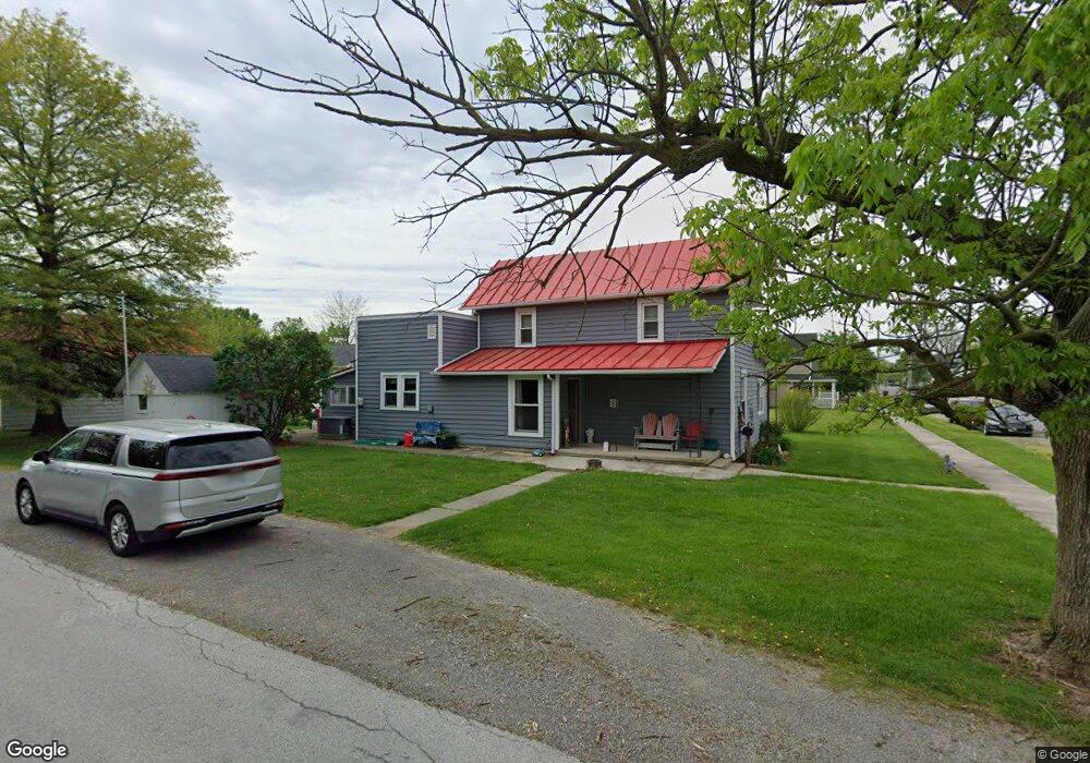
222 N College St Spencerville, OH 45887
Estimated Value: $100,000 - $156,000
3
Beds
2
Baths
1,733
Sq Ft
$74/Sq Ft
Est. Value
About This Home
This home is located at 222 N College St, Spencerville, OH 45887 and is currently estimated at $128,691, approximately $74 per square foot. 222 N College St is a home located in Allen County with nearby schools including Spencerville Elementary School, Spencerville Middle School, and Spencerville High School.
Ownership History
Date
Name
Owned For
Owner Type
Purchase Details
Closed on
Jan 12, 2015
Sold by
Zimpher Robert Clyde and The Huntington National Bank
Bought by
O Neill Construction Service Inc
Current Estimated Value
Purchase Details
Closed on
Mar 9, 2005
Sold by
Kimmey Rita J and Kimmey Rita
Bought by
Zimpher Robert C and Zimpher Marilyn K
Purchase Details
Closed on
Feb 16, 1988
Bought by
Zimpher Robert C
Create a Home Valuation Report for This Property
The Home Valuation Report is an in-depth analysis detailing your home's value as well as a comparison with similar homes in the area
Home Values in the Area
Average Home Value in this Area
Purchase History
| Date | Buyer | Sale Price | Title Company |
|---|---|---|---|
| O Neill Construction Service Inc | $31,000 | None Available | |
| Zimpher Robert C | $20,000 | None Available | |
| Zimpher Robert C | $21,500 | -- |
Source: Public Records
Mortgage History
| Date | Status | Borrower | Loan Amount |
|---|---|---|---|
| Open | O Neill Construction Service Inc | $41,600 | |
| Previous Owner | Zimpher Robert C | $44,819 | |
| Previous Owner | Zimpher Robert C | $48,750 |
Source: Public Records
Tax History Compared to Growth
Tax History
| Year | Tax Paid | Tax Assessment Tax Assessment Total Assessment is a certain percentage of the fair market value that is determined by local assessors to be the total taxable value of land and additions on the property. | Land | Improvement |
|---|---|---|---|---|
| 2024 | $1,089 | $32,170 | $5,460 | $26,710 |
| 2023 | $954 | $26,360 | $4,480 | $21,880 |
| 2022 | $958 | $26,360 | $4,480 | $21,880 |
| 2021 | $951 | $26,360 | $4,480 | $21,880 |
| 2020 | $853 | $22,720 | $4,240 | $18,480 |
| 2019 | $853 | $22,720 | $4,240 | $18,480 |
| 2018 | $795 | $22,720 | $4,240 | $18,480 |
| 2017 | $729 | $19,290 | $4,240 | $15,050 |
| 2016 | $713 | $19,290 | $4,240 | $15,050 |
| 2015 | $526 | $19,290 | $4,240 | $15,050 |
| 2014 | $526 | $14,670 | $4,450 | $10,220 |
| 2013 | $535 | $14,670 | $4,450 | $10,220 |
Source: Public Records
Map
Nearby Homes
- 213 N Pearl St
- 316 N Broadway St
- 123 Oakland Ave
- 425 N Main St
- 221 S Broadway St
- 309 W North St
- 220 S Mulberry St
- 336 W 4th St
- 714 Briggs Ave Unit 1
- 409 W 4th St
- 440 W 4th St
- 00 Kleinoeder Rd
- 1015 N Acadia Rd
- 9770 Agerter Rd
- 21108 State Route 116
- 0 Agerter Rd
- 6177 Agerter Rd
- 6915 Poling Rd
- 5653 Fort Amanda Rd
- 8640 van Wert-Allen County Line Rd
- 222 N College St
- 218 N College St
- 218 N College St
- 304 N College St
- 214 N College St
- 219 N Elizabeth St
- 215 N Elizabeth St
- 215 N Elizabeth St
- 221 N College St
- 308 N College St
- 303 N Elizabeth St
- 210 N College St
- 210 N College St
- 217 N College St
- 211 N Elizabeth St
- 213 N College St
- 305 N College St
- 307 N Elizabeth St
- 307 N Elizabeth St