Estimated Value: $232,427 - $394,000
--
Bed
--
Bath
1,152
Sq Ft
$272/Sq Ft
Est. Value
About This Home
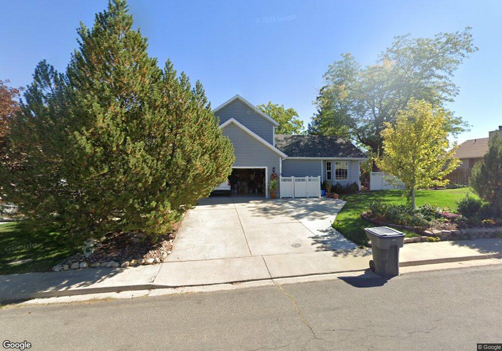
This home is located at 222 N Ranch Rd, Price, UT 84501 and is currently estimated at $313,107, approximately $271 per square foot. 222 N Ranch Rd is a home located in Carbon County with nearby schools including Creekview School, Mont Harmon Junior High School, and Carbon High School.
Ownership History
Date
Name
Owned For
Owner Type
Purchase Details
Closed on
Oct 18, 2024
Sold by
Gust And Vale Himonas Trust and Himonas Valeria
Bought by
Rudy And Michelle Madrigal Revocable Living T and Madrigal
Current Estimated Value
Home Financials for this Owner
Home Financials are based on the most recent Mortgage that was taken out on this home.
Original Mortgage
$60,850
Interest Rate
6.35%
Mortgage Type
Seller Take Back
Purchase Details
Closed on
Jun 27, 2019
Sold by
Himonas Brothers Partnership
Bought by
Himonas George G and The George G Himonas Trust
Purchase Details
Closed on
Jan 5, 2018
Sold by
Himonas Gust G and Himonas Valerie
Bought by
Utah Department Of Transportation
Purchase Details
Closed on
Sep 24, 2013
Sold by
Himonas Gust
Bought by
Himonas Gust G and Himonas Valeria
Create a Home Valuation Report for This Property
The Home Valuation Report is an in-depth analysis detailing your home's value as well as a comparison with similar homes in the area
Home Values in the Area
Average Home Value in this Area
Purchase History
| Date | Buyer | Sale Price | Title Company |
|---|---|---|---|
| Rudy And Michelle Madrigal Revocable Living T | -- | None Listed On Document | |
| Himonas George G | -- | None Available | |
| Utah Department Of Transportation | -- | None Available | |
| Himonas Gust G | -- | None Available |
Source: Public Records
Mortgage History
| Date | Status | Borrower | Loan Amount |
|---|---|---|---|
| Previous Owner | Rudy And Michelle Madrigal Revocable Living T | $60,850 |
Source: Public Records
Tax History Compared to Growth
Tax History
| Year | Tax Paid | Tax Assessment Tax Assessment Total Assessment is a certain percentage of the fair market value that is determined by local assessors to be the total taxable value of land and additions on the property. | Land | Improvement |
|---|---|---|---|---|
| 2025 | $495 | $100,305 | $73,095 | $27,210 |
| 2024 | $635 | $103,107 | $62,993 | $40,114 |
| 2023 | $1,222 | $153,184 | $65,184 | $88,000 |
| 2022 | $1,241 | $133,954 | $55,605 | $78,349 |
| 2021 | $1,153 | $211,411 | $96,530 | $114,881 |
| 2020 | $882 | $52,824 | $0 | $0 |
| 2019 | $650 | $47,645 | $0 | $0 |
| 2018 | $632 | $47,904 | $0 | $0 |
| 2017 | $576 | $44,066 | $0 | $0 |
| 2016 | $514 | $43,955 | $0 | $0 |
| 2015 | $514 | $43,955 | $0 | $0 |
| 2014 | $510 | $44,232 | $0 | $0 |
| 2013 | $514 | $44,232 | $0 | $0 |
Source: Public Records
Map
Nearby Homes
- 1335 W Evergreen Dr
- 1189 W 290 N
- 126 N Balsam Way
- 109 N 1470 (Balsam Way) W
- 420 N Josephine Ln W
- 401 N Fairgrounds Rd
- 830 N 2140 W
- 702 W 1150 N Unit 4
- 670 W 1150 N
- 275 N 500 W
- 2 Hilltop
- 495 S Fairgrounds Rd
- 82 W 200 N
- 1643 N Mountain States Rd
- 240 N Carbon Ave
- 280 W 500 S
- 260 W 500 S
- 7700 Us Highway 6
- 175 N 100 E
- 320 N 100 E