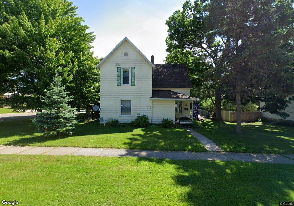
222 N Stewart Ave Fremont, MI 49412
Estimated Value: $188,107 - $223,000
--
Bed
1
Bath
--
Sq Ft
9,148
Sq Ft Lot
About This Home
This home is located at 222 N Stewart Ave, Fremont, MI 49412 and is currently estimated at $200,777. 222 N Stewart Ave is a home located in Newaygo County with nearby schools including Daisy Brook Elementary School, Pathfinder Elementary School, and Quest High School.
Ownership History
Date
Name
Owned For
Owner Type
Purchase Details
Closed on
Dec 17, 2003
Sold by
Ligtenberg Mark H
Bought by
Mcdonald Nicholas
Current Estimated Value
Purchase Details
Closed on
May 15, 2000
Sold by
Abendroth Joel D
Bought by
Ligtenberg Mark H
Purchase Details
Closed on
Apr 26, 1996
Sold by
Henning Anne M Mclean
Bought by
Abendroth Joel D
Create a Home Valuation Report for This Property
The Home Valuation Report is an in-depth analysis detailing your home's value as well as a comparison with similar homes in the area
Home Values in the Area
Average Home Value in this Area
Purchase History
| Date | Buyer | Sale Price | Title Company |
|---|---|---|---|
| Mcdonald Nicholas | $86,000 | -- | |
| Ligtenberg Mark H | $78,000 | -- | |
| Abendroth Joel D | $53,000 | -- |
Source: Public Records
Tax History Compared to Growth
Tax History
| Year | Tax Paid | Tax Assessment Tax Assessment Total Assessment is a certain percentage of the fair market value that is determined by local assessors to be the total taxable value of land and additions on the property. | Land | Improvement |
|---|---|---|---|---|
| 2025 | $1,861 | $81,800 | $0 | $0 |
| 2024 | $14 | $72,200 | $0 | $0 |
| 2023 | $1,368 | $63,900 | $0 | $0 |
| 2022 | $1,705 | $57,900 | $0 | $0 |
| 2021 | $1,654 | $52,600 | $0 | $0 |
| 2020 | $1,636 | $48,000 | $0 | $0 |
| 2019 | $1,565 | $43,800 | $0 | $0 |
| 2018 | $1,529 | $39,400 | $0 | $0 |
| 2017 | $1,501 | $37,800 | $0 | $0 |
| 2016 | $1,393 | $35,500 | $0 | $0 |
| 2015 | -- | $33,700 | $0 | $0 |
| 2014 | -- | $31,200 | $0 | $0 |
Source: Public Records
Map
Nearby Homes
- 412 N Darling Ave
- Integrity 2061 V8.1a Plan at Hillcrest
- Integrity 2000 Plan at Hillcrest
- integrity 2280 Plan at Hillcrest
- Integrity 1605 Plan at Hillcrest
- Integrity 1610 Plan at Hillcrest
- Integrity 2085 Plan at Hillcrest
- Integrity 1910 Plan at Hillcrest
- Integrity 2060 Plan at Hillcrest
- Integrity 1750 Plan at Hillcrest
- integrity 1830 Plan at Hillcrest
- Integrity 1880 Plan at Hillcrest
- integrity 1800 Plan at Hillcrest
- Integrity 2080 Plan at Hillcrest
- Integrity 2190 Plan at Hillcrest
- 116 E Sheridan St
- 734 N Stewart Ave
- 415 Vista Ln
- 305 E Pine St
- 347 E Pine St
- 216 N Stewart Ave
- 316 E Cherry St
- 214 N Stewart Ave Unit 1
- 234 E Cherry St
- 322 E Cherry St
- 303 E Cherry St
- 315 E Cherry St
- 301 E Elm St
- 228 E Cherry St
- 321 E Elm St
- 328 E Cherry St
- 307 E Cherry St
- 233 E Elm St
- 237 E Cherry St
- 327 E Elm St
- 321 E Cherry St
- 227 E Elm St
- 222 E Cherry St
- 0 E Elm St
- 318 N Stewart Ave