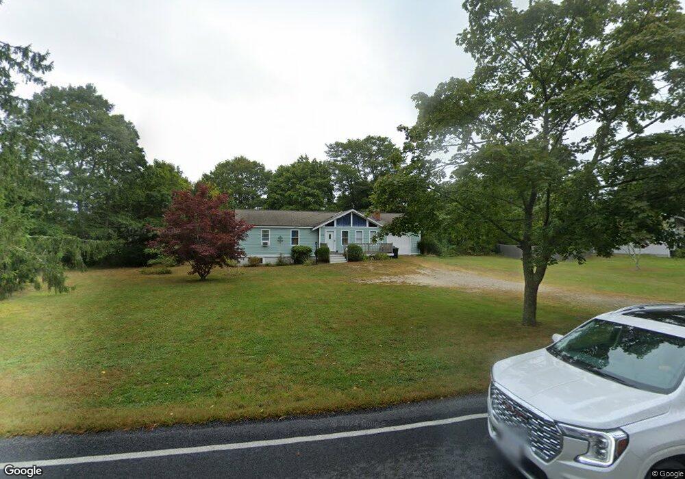
222 Old Barnstable Rd East Falmouth, MA 02536
Estimated Value: $527,000 - $611,000
3
Beds
2
Baths
800
Sq Ft
$715/Sq Ft
Est. Value
About This Home
This home is located at 222 Old Barnstable Rd, East Falmouth, MA 02536 and is currently estimated at $572,226, approximately $715 per square foot. 222 Old Barnstable Rd is a home located in Barnstable County with nearby schools including Teaticket Elementary School, Morse Pond School, and Lawrence School.
Ownership History
Date
Name
Owned For
Owner Type
Purchase Details
Closed on
Dec 20, 1996
Sold by
Parent Phillip J and Parent Joan P
Bought by
Geggatt Jason H and Gomes Mary Jo
Current Estimated Value
Create a Home Valuation Report for This Property
The Home Valuation Report is an in-depth analysis detailing your home's value as well as a comparison with similar homes in the area
Home Values in the Area
Average Home Value in this Area
Purchase History
| Date | Buyer | Sale Price | Title Company |
|---|---|---|---|
| Geggatt Jason H | $78,000 | -- | |
| Geggatt Jason H | $78,000 | -- |
Source: Public Records
Mortgage History
| Date | Status | Borrower | Loan Amount |
|---|---|---|---|
| Open | Geggatt Jason H | $80,300 | |
| Closed | Geggatt Jason H | $6,000 | |
| Closed | Geggatt Jason H | $5,000 | |
| Closed | Geggatt Jason H | $74,100 |
Source: Public Records
Tax History Compared to Growth
Tax History
| Year | Tax Paid | Tax Assessment Tax Assessment Total Assessment is a certain percentage of the fair market value that is determined by local assessors to be the total taxable value of land and additions on the property. | Land | Improvement |
|---|---|---|---|---|
| 2025 | $2,730 | $465,000 | $173,300 | $291,700 |
| 2024 | $2,650 | $421,900 | $156,800 | $265,100 |
| 2023 | $2,363 | $341,500 | $156,800 | $184,700 |
| 2022 | $2,119 | $263,200 | $98,700 | $164,500 |
| 2021 | $2,058 | $242,100 | $94,400 | $147,700 |
| 2020 | $2,006 | $233,500 | $85,800 | $147,700 |
| 2019 | $1,933 | $225,800 | $85,800 | $140,000 |
| 2018 | $1,869 | $217,300 | $85,800 | $131,500 |
| 2017 | $1,815 | $212,800 | $85,800 | $127,000 |
| 2016 | $1,781 | $212,800 | $85,800 | $127,000 |
| 2015 | $1,743 | $212,800 | $85,800 | $127,000 |
| 2014 | $1,768 | $216,900 | $90,200 | $126,700 |
Source: Public Records
Map
Nearby Homes
- 25 Mill Farm Way Unit 25
- 25 Mill Farm Way
- 22 Mill Farm Way Unit 22
- 22 Mill Farm Way Unit 2
- 67 Vidal Ave
- 336 Old Barnstable Rd
- 14 Old Meeting House Rd
- 24 Putter Dr
- 25 Mill Pond Way
- 0 Elsies Way Unit 73443603
- 0 Elsies Way Unit 22505181
- 35 Old Barnstable Rd
- 14 Sharon Dr
- 16 Annette Ave
- 33 John Parker Rd
- 27 Emerald Ln
- 8 Dylans Way
- 45 Green Pond Rd
- 28 Chilmark Dr
- 33 Chilmark Dr Unit 33
- 0 Old Waquoit Rd
- 5 Windswept Rd
- 234 Old Barnstable Rd
- 17 Windswept Rd
- 23 Windswept Rd
- 233 Old Barnstable Rd
- 1 Lodengreen Dr
- 2 Lodengreen Dr
- 27 Windswept Rd
- 10 Old Waquoit Rd
- 240 Old Barnstable Rd
- 39 Crocker Rd
- 8 Lodengreen Dr
- 10 Windswept Rd
- 10 Windswept Rd Unit 10B
- 16 Windswept Rd
- 12 Windswept Rd
- 14 Windswept Rd
- 9 Lodengreen Dr
- 206 Old Barnstable Rd