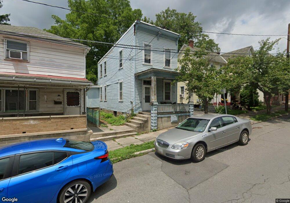
222 Pear St Cumberland, MD 21502
Estimated Value: $77,000 - $109,000
2
Beds
2
Baths
1,140
Sq Ft
$87/Sq Ft
Est. Value
About This Home
This home is located at 222 Pear St, Cumberland, MD 21502 and is currently estimated at $99,743, approximately $87 per square foot. 222 Pear St is a home located in Allegany County with nearby schools including Northeast Elementary School, Braddock Middle School, and Allegany High School.
Ownership History
Date
Name
Owned For
Owner Type
Purchase Details
Closed on
Dec 6, 2022
Sold by
Mayor And City Council Of Cumberland
Bought by
C Corp Leasing Inc
Current Estimated Value
Purchase Details
Closed on
Jun 16, 2022
Sold by
Bennett Jason M
Bought by
Mayor And City Council Of Cumberland
Purchase Details
Closed on
Jul 7, 1992
Sold by
Durst Synda Ann
Bought by
Deaton Margaret
Create a Home Valuation Report for This Property
The Home Valuation Report is an in-depth analysis detailing your home's value as well as a comparison with similar homes in the area
Purchase History
| Date | Buyer | Sale Price | Title Company |
|---|---|---|---|
| C Corp Leasing Inc | $1,022 | -- | |
| Mayor And City Council Of Cumberland | -- | None Listed On Document | |
| Deaton Margaret | $17,500 | -- |
Source: Public Records
Tax History
| Year | Tax Paid | Tax Assessment Tax Assessment Total Assessment is a certain percentage of the fair market value that is determined by local assessors to be the total taxable value of land and additions on the property. | Land | Improvement |
|---|---|---|---|---|
| 2025 | $759 | $82,800 | $0 | $0 |
| 2024 | $197 | $21,000 | $6,000 | $15,000 |
| 2023 | $211 | $22,700 | $6,000 | $16,700 |
| 2022 | $207 | $22,333 | $0 | $0 |
| 2021 | $205 | $21,967 | $0 | $0 |
| 2020 | $199 | $21,600 | $6,000 | $15,600 |
| 2019 | $202 | $21,600 | $6,000 | $15,600 |
| 2018 | $204 | $21,600 | $6,000 | $15,600 |
| 2017 | $244 | $26,800 | $0 | $0 |
| 2016 | $247 | $25,733 | $0 | $0 |
| 2015 | $228 | $24,667 | $0 | $0 |
| 2014 | $228 | $23,600 | $0 | $0 |
Source: Public Records
Map
Nearby Homes
- 516 Shriver Ave
- 501 Columbia Ave
- 535 N Mechanic St
- 632 Fairview Ave
- 444 Columbia St
- 449 Columbia St
- 412 Furnace St
- 840 Columbia Ave
- 408 Chestnut St
- 825 Shawnee Ave
- 415 Independence St
- 219 Carroll St
- 313 Independence St
- 119 N Allegany St
- 308 Cumberland St
- 520 Cumberland St
- 123 Cumberland St
- 121 Independence St
- 20 N Lee St
- 13 N Allegany St
Your Personal Tour Guide
Ask me questions while you tour the home.