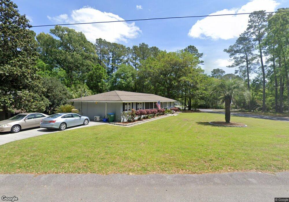
222 Pointer Dr Summerville, SC 29485
Estimated Value: $29,000 - $599,000
3
Beds
3
Baths
2,000
Sq Ft
$157/Sq Ft
Est. Value
About This Home
This home is located at 222 Pointer Dr, Summerville, SC 29485 and is currently estimated at $314,000, approximately $157 per square foot. 222 Pointer Dr is a home located in Dorchester County with nearby schools including Summerville Elementary School, Alston Middle School, and Summerville High School.
Ownership History
Date
Name
Owned For
Owner Type
Purchase Details
Closed on
Jun 17, 2021
Sold by
Fogarty Rosemary A
Bought by
Fogarty Rosemary A and Fogarty Rosemary A
Current Estimated Value
Purchase Details
Closed on
Oct 27, 2006
Sold by
Fogarty Rosemary A
Bought by
Fogarty Rosemary A and Fogarty Eugene
Purchase Details
Closed on
Jun 12, 2006
Sold by
Rabun William H and Rabun Anna
Bought by
Fogarty Rosemary A
Home Financials for this Owner
Home Financials are based on the most recent Mortgage that was taken out on this home.
Original Mortgage
$110,000
Interest Rate
6.49%
Mortgage Type
New Conventional
Create a Home Valuation Report for This Property
The Home Valuation Report is an in-depth analysis detailing your home's value as well as a comparison with similar homes in the area
Home Values in the Area
Average Home Value in this Area
Purchase History
| Date | Buyer | Sale Price | Title Company |
|---|---|---|---|
| Fogarty Rosemary A | -- | None Available | |
| Fogarty Rosemary A | -- | None Available | |
| Fogarty Rosemary A | $210,000 | None Available |
Source: Public Records
Mortgage History
| Date | Status | Borrower | Loan Amount |
|---|---|---|---|
| Previous Owner | Fogarty Rosemary A | $110,000 |
Source: Public Records
Tax History
| Year | Tax Paid | Tax Assessment Tax Assessment Total Assessment is a certain percentage of the fair market value that is determined by local assessors to be the total taxable value of land and additions on the property. | Land | Improvement |
|---|---|---|---|---|
| 2025 | $2,413 | $82 | $82 | $0 |
| 2024 | $2,413 | $82 | $82 | $0 |
| 2023 | $2,413 | $82 | $82 | $0 |
| 2022 | $2,067 | $80 | $80 | $0 |
| 2021 | $2,027 | $10,240 | $1,480 | $8,760 |
| 2020 | $1,889 | $8,910 | $1,290 | $7,620 |
| 2019 | $1,844 | $8,910 | $1,290 | $7,620 |
| 2018 | $1,588 | $8,910 | $1,290 | $7,620 |
| 2017 | $1,557 | $8,910 | $1,290 | $7,620 |
| 2016 | $1,538 | $8,910 | $1,290 | $7,620 |
Source: Public Records
Map
Nearby Homes
- 108 Quail Ln
- 210 Pointer Dr
- 115 Harolee Ln
- 107 Brittany Ct
- 421 Grouse Rd
- 800 Essex Dr
- 117 Newington Rd
- 405 Grouse Rd
- 101 Spring St
- 210 Jimbo Rd
- 110 Harter Dr
- 107 Sumners Aly
- 203 Jimbo Rd
- 120 Savannah Round
- 1511 Bacons Bridge Rd
- 115 Bloomsbury Place
- 105 Cynthia Ln
- 0 Pointer Ln
- 104 Jedi Ln
- 100 Medway Square
- 223 Pointer Dr
- 221 Pointer Dr
- 101 Wellington Rd
- 101 Kittering Ct
- 225 Pointer Dr
- 219 Pointer Dr
- 219 Pointer Dr Unit 1
- 103 Wellington Rd
- 103 Kittering Ct
- 205 Burnham Rd
- 0 Burnham Rd
- 217 Pointer Dr
- 313 Partridge Cir
- 315 Partridge Cir
- 0 - Unit 2804104
- 203 Burnham Rd
- 0 Wellington Rd
- 100 Wellington Rd
- 311 Partridge Cir
- 101 Harolee Ln
Your Personal Tour Guide
Ask me questions while you tour the home.