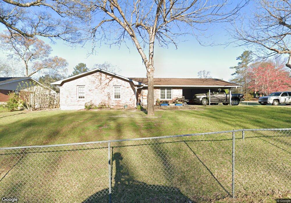
222 Randy Cir Warner Robins, GA 31088
Estimated Value: $160,000 - $179,345
--
Bed
2
Baths
1,344
Sq Ft
$124/Sq Ft
Est. Value
About This Home
This home is located at 222 Randy Cir, Warner Robins, GA 31088 and is currently estimated at $166,586, approximately $123 per square foot. 222 Randy Cir is a home located in Houston County with nearby schools including Russell Elementary School, Warner Robins Middle School, and Warner Robins High School.
Ownership History
Date
Name
Owned For
Owner Type
Purchase Details
Closed on
Apr 29, 2005
Sold by
Crisp Bert M
Bought by
Johnson Miles A and Johnson Barbara A
Current Estimated Value
Home Financials for this Owner
Home Financials are based on the most recent Mortgage that was taken out on this home.
Original Mortgage
$71,900
Outstanding Balance
$37,850
Interest Rate
5.99%
Mortgage Type
New Conventional
Estimated Equity
$128,736
Purchase Details
Closed on
May 1, 1990
Sold by
Crisp Bert M and Crisp Sue L
Bought by
Crisp Bert M
Purchase Details
Closed on
Mar 4, 1985
Sold by
Crisp Bert M
Bought by
Crisp Bert M and Crisp Sue L
Purchase Details
Closed on
Apr 5, 1978
Sold by
George William H
Bought by
Crisp Bert M
Purchase Details
Closed on
Mar 3, 1978
Sold by
Glessner Richard L and Glessner Jacqeline
Bought by
George William H
Purchase Details
Closed on
Oct 25, 1974
Sold by
The Citizens & Southern Bank
Bought by
Glessner Richard L and Glessner Jacqeline M
Purchase Details
Closed on
Aug 2, 1974
Sold by
Hudson Albert
Bought by
The Citizens & Southern Bank
Purchase Details
Closed on
Jan 5, 1973
Sold by
Williams Eugene
Bought by
Hudson Albert
Create a Home Valuation Report for This Property
The Home Valuation Report is an in-depth analysis detailing your home's value as well as a comparison with similar homes in the area
Home Values in the Area
Average Home Value in this Area
Purchase History
| Date | Buyer | Sale Price | Title Company |
|---|---|---|---|
| Johnson Miles A | $89,900 | None Available | |
| Crisp Bert M | -- | -- | |
| Crisp Bert M | -- | -- | |
| Crisp Bert M | -- | -- | |
| George William H | -- | -- | |
| Glessner Richard L | -- | -- | |
| The Citizens & Southern Bank | -- | -- | |
| Hudson Albert | -- | -- |
Source: Public Records
Mortgage History
| Date | Status | Borrower | Loan Amount |
|---|---|---|---|
| Open | Johnson Miles A | $71,900 | |
| Closed | Johnson Miles A | $18,000 |
Source: Public Records
Tax History Compared to Growth
Tax History
| Year | Tax Paid | Tax Assessment Tax Assessment Total Assessment is a certain percentage of the fair market value that is determined by local assessors to be the total taxable value of land and additions on the property. | Land | Improvement |
|---|---|---|---|---|
| 2024 | $1,406 | $56,640 | $8,000 | $48,640 |
| 2023 | $1,126 | $42,800 | $8,000 | $34,800 |
| 2022 | $810 | $37,240 | $5,400 | $31,840 |
| 2021 | $682 | $31,520 | $5,400 | $26,120 |
| 2020 | $677 | $31,160 | $5,400 | $25,760 |
| 2019 | $677 | $31,160 | $5,400 | $25,760 |
| 2018 | $677 | $31,160 | $5,400 | $25,760 |
| 2017 | $678 | $31,160 | $5,400 | $25,760 |
| 2016 | $679 | $31,160 | $5,400 | $25,760 |
| 2015 | -- | $32,560 | $5,400 | $27,160 |
| 2014 | $332 | $32,560 | $5,400 | $27,160 |
| 2013 | $332 | $33,200 | $5,400 | $27,800 |
Source: Public Records
Map
Nearby Homes
- 77 Oliver Dr
- 107 Melody Ln
- 216 Self St
- 1850 Russell Pkwy
- 0 Russell Pkwy Unit 10656199
- 213 Self St
- 127 Sonja Dr
- 118 Fox Glove Ct
- 119 Fox Glove Ct
- 212 Palomino Ln
- 25 & 26 Lot
- 211 Palomino Ln
- 206 Sonja Dr
- 205 Sonja Dr
- 304 Palomino Ln
- 305 Bonnie Dr
- 302 Creek Ridge Dr
- 201 Belmont Dr
- 108 Woodsdale Dr
- 115 Glendale Ct