Estimated Value: $3,704,000 - $5,620,000
5
Beds
5
Baths
7,152
Sq Ft
$668/Sq Ft
Est. Value
About This Home
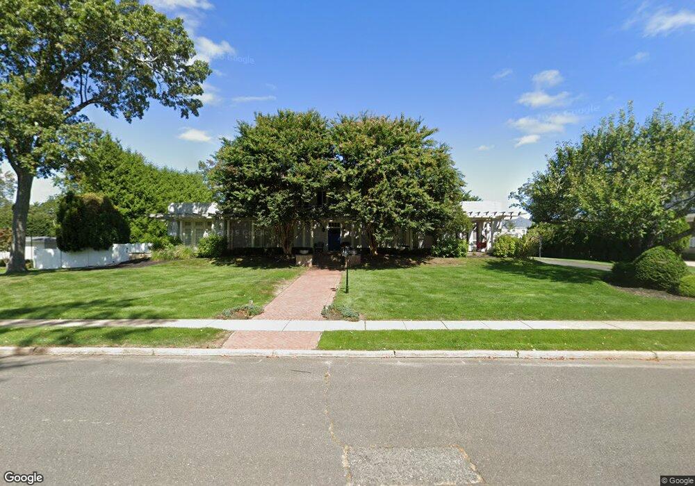
This home is located at 222 Runyan Ave, Deal, NJ 07723 and is currently estimated at $4,778,625, approximately $668 per square foot. 222 Runyan Ave is a home located in Monmouth County with nearby schools including Ocean Township High School, St. Mary of the Assumption School, and Bnot Shirah of Deal.
Ownership History
Date
Name
Owned For
Owner Type
Purchase Details
Closed on
Feb 1, 1999
Sold by
Shamah Isaac
Bought by
Adjmi Ronald and Adjmi Adele
Current Estimated Value
Home Financials for this Owner
Home Financials are based on the most recent Mortgage that was taken out on this home.
Original Mortgage
$200,000
Interest Rate
6.74%
Create a Home Valuation Report for This Property
The Home Valuation Report is an in-depth analysis detailing your home's value as well as a comparison with similar homes in the area
Home Values in the Area
Average Home Value in this Area
Purchase History
| Date | Buyer | Sale Price | Title Company |
|---|---|---|---|
| Adjmi Ronald | $580,000 | -- |
Source: Public Records
Mortgage History
| Date | Status | Borrower | Loan Amount |
|---|---|---|---|
| Previous Owner | Adjmi Ronald | $200,000 |
Source: Public Records
Tax History
| Year | Tax Paid | Tax Assessment Tax Assessment Total Assessment is a certain percentage of the fair market value that is determined by local assessors to be the total taxable value of land and additions on the property. | Land | Improvement |
|---|---|---|---|---|
| 2025 | $58,171 | $4,418,700 | $2,466,000 | $1,952,700 |
| 2024 | $52,601 | $4,079,300 | $2,266,000 | $1,813,300 |
Source: Public Records
Map
Nearby Homes
- 1 Country Club Dr
- 10 Campbell Ct
- 15 Joanna Ct
- 26 Wyckoff St
- 504 Crosby Ave
- 404 Brookside Ave
- 244 Overbrook Ave
- 0 Overbrook Ave
- 339 Elberon Blvd
- 18 Lady Bess Dr
- 328 Elberon Blvd
- 160 Ocean Ave
- 306 Roosevelt Ave
- 267 Roosevelt Ave
- 611 Blanchard Pkwy
- 296 Garfield Ave
- 210 Larchwood Ave
- 510 Blanchard Pkwy
- 274 Michael Ave
- 57 Hathaway Ave
- 200 Runyan Ave
- 234 Runyan Ave
- 207 Parker Ave
- 209 Parker Ave
- 201 Parker Ave
- 217 Runyan Ave
- 225 Runyan Ave
- 333 Holly Terrace
- 211 Parker Ave
- 203 Holly Terrace
- 250 Golf Rd
- 300 Golf Rd
- 289 Parker Ave
- 300 Holly Terrace
- 330 Holly Terrace
- 210 Parker Ave
- 232 Crosby Ave
- 250 Parker Ave
- 234 Crosby Ave
- 230 Crosby Ave
Your Personal Tour Guide
Ask me questions while you tour the home.