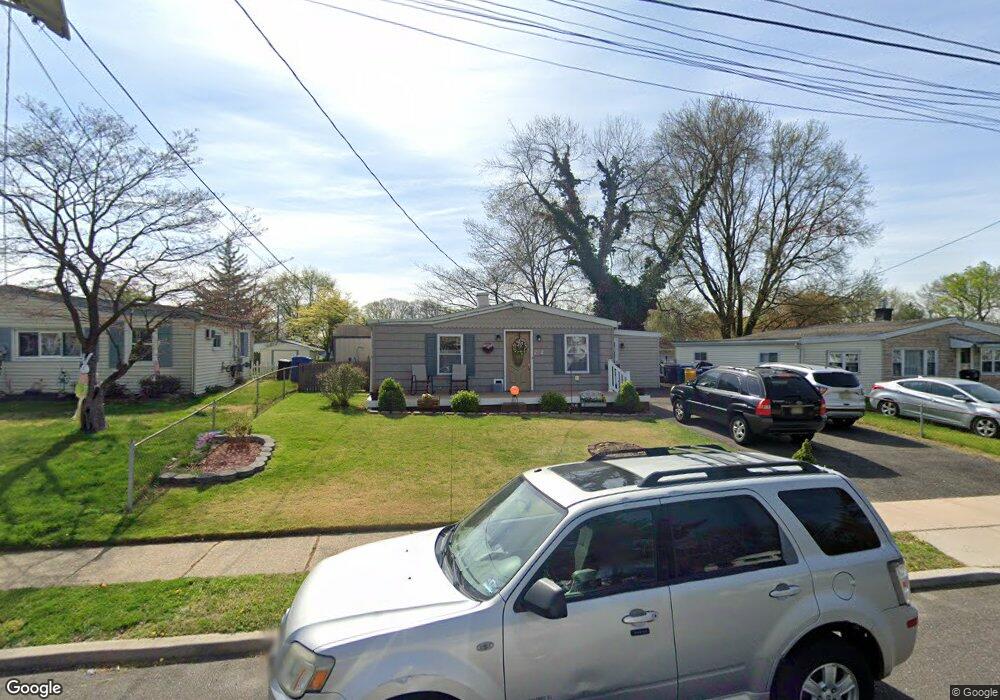
222 Ruth Ave Maple Shade, NJ 08052
Estimated Value: $279,000 - $305,839
--
Bed
--
Bath
1,162
Sq Ft
$252/Sq Ft
Est. Value
About This Home
This home is located at 222 Ruth Ave, Maple Shade, NJ 08052 and is currently estimated at $292,960, approximately $252 per square foot. 222 Ruth Ave is a home located in Burlington County with nearby schools including Maude M. Wilkins Elementary School, Ralph J Steinhauer Elementary School, and Howard R Yocum School.
Ownership History
Date
Name
Owned For
Owner Type
Purchase Details
Closed on
Feb 28, 2006
Sold by
Press Robert and Press Debra K
Bought by
Haessler Robert and Haessler Elizabeth
Current Estimated Value
Home Financials for this Owner
Home Financials are based on the most recent Mortgage that was taken out on this home.
Original Mortgage
$193,000
Outstanding Balance
$109,719
Interest Rate
6.27%
Mortgage Type
Fannie Mae Freddie Mac
Estimated Equity
$183,241
Purchase Details
Closed on
Jan 28, 2004
Sold by
Cerasi Grace C
Bought by
Press Robert T and Press Debra K
Home Financials for this Owner
Home Financials are based on the most recent Mortgage that was taken out on this home.
Original Mortgage
$130,000
Interest Rate
5.65%
Mortgage Type
Stand Alone First
Purchase Details
Closed on
Feb 1, 2000
Sold by
Barraclough Heather L
Bought by
Cerasi Grace C
Create a Home Valuation Report for This Property
The Home Valuation Report is an in-depth analysis detailing your home's value as well as a comparison with similar homes in the area
Home Values in the Area
Average Home Value in this Area
Purchase History
| Date | Buyer | Sale Price | Title Company |
|---|---|---|---|
| Haessler Robert | $193,000 | Federation Title Agency Inc | |
| Press Robert T | $148,000 | Surety Title Corporation | |
| Cerasi Grace C | $84,900 | Congress Title Corp |
Source: Public Records
Mortgage History
| Date | Status | Borrower | Loan Amount |
|---|---|---|---|
| Open | Haessler Robert | $193,000 | |
| Previous Owner | Press Robert T | $130,000 |
Source: Public Records
Tax History Compared to Growth
Tax History
| Year | Tax Paid | Tax Assessment Tax Assessment Total Assessment is a certain percentage of the fair market value that is determined by local assessors to be the total taxable value of land and additions on the property. | Land | Improvement |
|---|---|---|---|---|
| 2025 | $5,113 | $134,700 | $46,300 | $88,400 |
| 2024 | $4,965 | $134,700 | $46,300 | $88,400 |
| 2023 | $4,965 | $134,700 | $46,300 | $88,400 |
| 2022 | $4,888 | $134,700 | $46,300 | $88,400 |
| 2021 | $4,841 | $134,700 | $46,300 | $88,400 |
| 2020 | $4,855 | $134,700 | $46,300 | $88,400 |
| 2019 | $4,677 | $134,700 | $46,300 | $88,400 |
| 2018 | $4,596 | $134,700 | $46,300 | $88,400 |
| 2017 | $4,542 | $134,700 | $46,300 | $88,400 |
| 2016 | $4,475 | $134,700 | $46,300 | $88,400 |
| 2015 | $4,378 | $134,700 | $46,300 | $88,400 |
| 2014 | $4,244 | $134,700 | $46,300 | $88,400 |
Source: Public Records
Map
Nearby Homes
- 306 E Rudderow Ave
- 200 E Rudderow Ave
- 621 S Forklanding Rd
- 226 S Pine Ave
- 410 S Forklanding Rd
- 120 E Center Ave
- 44 S Pine Ave
- 52 S Fellowship Rd
- 477 Buttonwood Ave
- 112 S Maple Ave
- 31 S Boulevard Ave
- 15 S Pine Ave
- 702 E Main St
- 115 E Kings Hwy Unit 386
- 115 E Kings Hwy Unit 410
- 115 E Kings Hwy Unit 444
- 115 E Kings Hwy Unit 443
- 107 S Forklanding Rd
- 103 Lincoln Ave S
- 114 Grant Ave