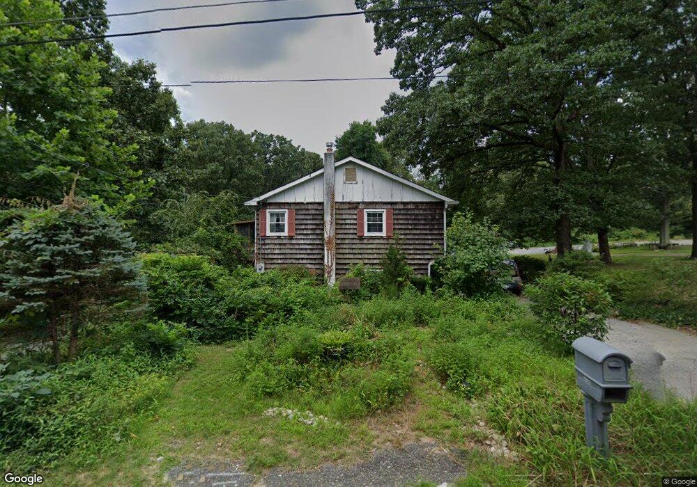
222 Taylor Ave Mantua, NJ 08051
Mantua Township NeighborhoodEstimated Value: $349,457 - $434,000
--
Bed
--
Bath
2,352
Sq Ft
$170/Sq Ft
Est. Value
About This Home
This home is located at 222 Taylor Ave, Mantua, NJ 08051 and is currently estimated at $400,364, approximately $170 per square foot. 222 Taylor Ave is a home located in Gloucester County with nearby schools including Centre City School, Clearview Regional Middle School, and Clearview Regional High School.
Ownership History
Date
Name
Owned For
Owner Type
Purchase Details
Closed on
Jun 30, 1997
Sold by
Williams William C and Williams Victoria A
Bought by
Mcdermott Edward A and Mcdermott Sally L
Current Estimated Value
Home Financials for this Owner
Home Financials are based on the most recent Mortgage that was taken out on this home.
Original Mortgage
$128,250
Outstanding Balance
$18,967
Interest Rate
7.86%
Estimated Equity
$381,397
Create a Home Valuation Report for This Property
The Home Valuation Report is an in-depth analysis detailing your home's value as well as a comparison with similar homes in the area
Home Values in the Area
Average Home Value in this Area
Purchase History
| Date | Buyer | Sale Price | Title Company |
|---|---|---|---|
| Mcdermott Edward A | $135,000 | Congress Title Corp |
Source: Public Records
Mortgage History
| Date | Status | Borrower | Loan Amount |
|---|---|---|---|
| Open | Mcdermott Edward A | $128,250 |
Source: Public Records
Tax History Compared to Growth
Tax History
| Year | Tax Paid | Tax Assessment Tax Assessment Total Assessment is a certain percentage of the fair market value that is determined by local assessors to be the total taxable value of land and additions on the property. | Land | Improvement |
|---|---|---|---|---|
| 2025 | $6,484 | $251,800 | $81,700 | $170,100 |
| 2024 | $6,416 | $251,800 | $81,700 | $170,100 |
| 2023 | $6,416 | $251,800 | $81,700 | $170,100 |
| 2022 | $7,265 | $207,700 | $61,700 | $146,000 |
| 2021 | $7,319 | $207,700 | $61,700 | $146,000 |
| 2020 | $7,261 | $207,700 | $61,700 | $146,000 |
| 2019 | $7,139 | $207,700 | $61,700 | $146,000 |
| 2018 | $7,037 | $207,700 | $61,700 | $146,000 |
| 2017 | $6,931 | $207,700 | $61,700 | $146,000 |
| 2016 | $6,852 | $207,700 | $61,700 | $146,000 |
| 2015 | $6,684 | $207,700 | $61,700 | $146,000 |
| 2014 | $6,459 | $207,700 | $61,700 | $146,000 |
Source: Public Records
Map
Nearby Homes
- 119 Monroe Ave
- 41 Woodbrook Dr Unit C041
- 325 Bridgeton Pike
- 485 Harrison Ave
- 204 W Landing Rd
- 17 Oakton Dr
- 36 Bluebird Rd
- 590 Bridgeton Pike
- 8 Barry Dr
- 1433 Tristram Cir
- 284 Columbus Dr
- 333 Jackson Rd
- 155 Whippoorwill Way
- 1215 Tristram Cir
- 19 Marathon Dr
- 1145 Tristram Cir
- 1147 Tristram Cir Unit 1147
- 1134 Tristram Cir Unit 4
- 131 Firth Dr
- 1121 Tristram Cir Unit 1
- 212 Taylor Ave
- 228 Taylor Ave
- 225 Taylor Ave
- 211 Taylor Ave
- 229 Taylor Ave
- 207 Taylor Ave
- 200 Taylor Ave
- 231 Mount Royal Rd
- 195 Mount Royal Rd
- 187 Mount Royal Rd
- 219 Monroe Ave
- 206 Monroe Ave
- 203 Taylor Ave
- 202 Monroe Ave
- 215 Monroe Ave
- 100 Vermont Ave Unit 100
- 263 Mount Royal Rd
- 120 Taylor Ave
- 1 Woodstream Ct
- 205 Monroe Ave