222 W 2280 N, Unit 201 Provo, UT 84604
Riverside NeighborhoodEstimated Value: $604,000 - $734,000
2
Beds
2
Baths
1,909
Sq Ft
$344/Sq Ft
Est. Value
About This Home
This home is located at 222 W 2280 N Unit 201, Provo, UT 84604 and is currently estimated at $656,847, approximately $344 per square foot. 222 W 2280 N Unit 201 is a home located in Utah County with nearby schools including Canyon Crest Elementary School, Centennial Middle School, and Timpview High School.
Ownership History
Date
Name
Owned For
Owner Type
Purchase Details
Closed on
Jan 13, 2011
Sold by
Preston Stanley and Preston Cheryl
Bought by
Preston Stanley J and Preston Cheryl B
Current Estimated Value
Purchase Details
Closed on
Dec 10, 2010
Sold by
Dimick Dave and Dimick Judith M
Bought by
Preston Stanley and Preston Cheryl
Purchase Details
Closed on
Nov 15, 2006
Sold by
Trellis On The Green Llc
Bought by
Dimick Dave and Dimick Judith M
Create a Home Valuation Report for This Property
The Home Valuation Report is an in-depth analysis detailing your home's value as well as a comparison with similar homes in the area
Home Values in the Area
Average Home Value in this Area
Purchase History
| Date | Buyer | Sale Price | Title Company |
|---|---|---|---|
| Preston Stanley J | -- | None Available | |
| Preston Stanley | -- | Title West Spanish Fork | |
| Dimick Dave | -- | Century Title Company |
Source: Public Records
Tax History Compared to Growth
Tax History
| Year | Tax Paid | Tax Assessment Tax Assessment Total Assessment is a certain percentage of the fair market value that is determined by local assessors to be the total taxable value of land and additions on the property. | Land | Improvement |
|---|---|---|---|---|
| 2025 | $3,121 | $324,775 | $65,600 | $524,900 |
| 2024 | $3,121 | $307,175 | $0 | $0 |
| 2023 | $3,314 | $321,585 | $0 | $0 |
| 2022 | $3,416 | $334,290 | $0 | $0 |
| 2021 | $2,872 | $490,100 | $58,800 | $431,300 |
| 2020 | $2,832 | $453,100 | $54,400 | $398,700 |
| 2019 | $2,464 | $410,000 | $54,500 | $355,500 |
| 2018 | $2,208 | $372,600 | $53,000 | $319,600 |
| 2017 | $1,922 | $178,200 | $0 | $0 |
| 2016 | $1,909 | $165,000 | $0 | $0 |
| 2015 | $1,820 | $158,950 | $0 | $0 |
| 2014 | $1,746 | $158,950 | $0 | $0 |
Source: Public Records
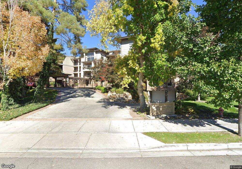
About This Building
Map
Nearby Homes
- 2244 N Canyon Rd Unit 305
- 2244 N Canyon Rd Unit 207
- 186 E 2100 N
- 182 E 2090 N
- 96 Marrcrest S
- 2888 Marrcrest W
- 1939 N 700 W
- 2254 N 390 E
- 2939 N Marrcrest Dr W
- 2295 N 470 E
- 1311 S 1100 E
- 2774 N 370 E
- 3057 N 100 W
- 360 Sumac Ln
- 1559 N Riverside Ave Unit 4
- 814 E 1740 S
- 784 E 1700 S
- 2241 N 1060 W
- 1009 W 2000 N
- 614 E Normandy Dr
- 222 W 2280 N
- 222 W 2280 N
- 222 W 2280 N
- 222 W 2280 N Unit 407
- 222 W 2280 N
- 222 W 2280 N
- 222 W 2280 N Unit 403
- 222 W 2280 N Unit 402
- 222 W 2280 N Unit 401
- 222 W 2280 N
- 222 W 2280 N
- 222 W 2280 N
- 222 W 2280 N
- 222 W 2280 N
- 222 W 2280 N
- 222 W 2280 N
- 222 W 2280 N
- 222 W 2280 N
- 222 W 2280 N
- 222 W 2280 N Unit 301