Estimated Value: $556,011 - $704,000
2
Beds
2
Baths
1,717
Sq Ft
$371/Sq Ft
Est. Value
About This Home
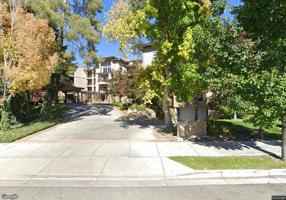
This home is located at 222 W 2280 N, Provo, UT 84604 and is currently estimated at $637,670, approximately $371 per square foot. 222 W 2280 N is a home located in Utah County with nearby schools including Canyon Crest Elementary School, Centennial Middle School, and Timpview High School.
Ownership History
Date
Name
Owned For
Owner Type
Purchase Details
Closed on
May 26, 2023
Sold by
Staker Scott
Bought by
Sanpitch Trust
Current Estimated Value
Purchase Details
Closed on
Jul 11, 2016
Sold by
Green Llc
Bought by
White Jacque
Home Financials for this Owner
Home Financials are based on the most recent Mortgage that was taken out on this home.
Original Mortgage
$205,500
Interest Rate
3.64%
Mortgage Type
New Conventional
Purchase Details
Closed on
Jun 2, 2015
Sold by
Trellis On The Green Llc
Bought by
Staker Scott
Create a Home Valuation Report for This Property
The Home Valuation Report is an in-depth analysis detailing your home's value as well as a comparison with similar homes in the area
Home Values in the Area
Average Home Value in this Area
Purchase History
| Date | Buyer | Sale Price | Title Company |
|---|---|---|---|
| Sanpitch Trust | -- | None Listed On Document | |
| White Jacque | -- | Atlas Title | |
| Staker Scott | -- | Atlas Title |
Source: Public Records
Mortgage History
| Date | Status | Borrower | Loan Amount |
|---|---|---|---|
| Previous Owner | White Jacque | $205,500 |
Source: Public Records
Tax History
| Year | Tax Paid | Tax Assessment Tax Assessment Total Assessment is a certain percentage of the fair market value that is determined by local assessors to be the total taxable value of land and additions on the property. | Land | Improvement |
|---|---|---|---|---|
| 2025 | $3,054 | $309,925 | -- | -- |
| 2024 | $3,054 | $300,575 | $0 | $0 |
| 2023 | $3,222 | $312,675 | $0 | $0 |
| 2022 | $3,333 | $326,095 | $0 | $0 |
| 2021 | $2,802 | $478,100 | $57,400 | $420,700 |
| 2020 | $2,763 | $442,000 | $53,000 | $389,000 |
| 2019 | $2,404 | $400,000 | $53,000 | $347,000 |
| 2018 | $2,113 | $356,500 | $53,000 | $303,500 |
| 2017 | $1,839 | $170,500 | $0 | $0 |
| 2016 | $1,826 | $157,850 | $0 | $0 |
| 2015 | $1,606 | $140,250 | $0 | $0 |
| 2014 | $1,540 | $140,250 | $0 | $0 |
Source: Public Records
About This Building
Map
Nearby Homes
- 431 W 2310 N
- 2735 N Country Club Dr
- 186 E 2100 N
- 182 E 2090 N
- 96 Marrcrest S
- 264 W 1625 N
- 2254 N 390 E
- 2939 N Marrcrest Dr W
- 2999 N Marrcrest West Dr
- 3013 N 100 W
- 2774 N 370 E
- 3057 N 100 W
- 360 Sumac Ln
- 1360 S Carterville Rd
- 784 E 1700 S
- 2241 N 1060 W
- 1009 W 2000 N
- 1661 Willowbrook Dr
- 1674 Hickory Ln
- 3240 Shadowbrook Dr
- 222 W 2280 N
- 222 W 2280 N
- 222 W 2280 N
- 222 W 2280 N Unit 407
- 222 W 2280 N
- 222 W 2280 N
- 222 W 2280 N Unit 403
- 222 W 2280 N Unit 402
- 222 W 2280 N Unit 401
- 222 W 2280 N
- 222 W 2280 N
- 222 W 2280 N
- 222 W 2280 N
- 222 W 2280 N
- 222 W 2280 N
- 222 W 2280 N
- 222 W 2280 N
- 222 W 2280 N
- 222 W 2280 N
- 222 W 2280 N Unit 301
Your Personal Tour Guide
Ask me questions while you tour the home.