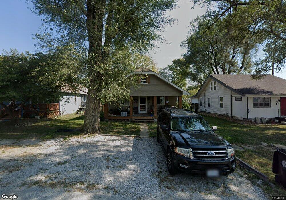
222 Walnut St Pleasant Hill, MO 64080
Estimated Value: $129,000 - $190,000
2
Beds
1
Bath
864
Sq Ft
$184/Sq Ft
Est. Value
About This Home
This home is located at 222 Walnut St, Pleasant Hill, MO 64080 and is currently estimated at $158,831, approximately $183 per square foot. 222 Walnut St is a home located in Cass County with nearby schools including Pleasant Hill Primary School, Pleasant Hill Elementary School, and Pleasant Hill Middle School.
Ownership History
Date
Name
Owned For
Owner Type
Purchase Details
Closed on
Nov 20, 2014
Sold by
Younce Thomas and Younce Thomas Scott
Bought by
Younce Diana
Current Estimated Value
Home Financials for this Owner
Home Financials are based on the most recent Mortgage that was taken out on this home.
Original Mortgage
$16,500
Outstanding Balance
$12,561
Interest Rate
3.99%
Mortgage Type
Credit Line Revolving
Estimated Equity
$146,270
Purchase Details
Closed on
Mar 12, 2013
Sold by
Younce Thomas
Bought by
Younce Diana
Create a Home Valuation Report for This Property
The Home Valuation Report is an in-depth analysis detailing your home's value as well as a comparison with similar homes in the area
Home Values in the Area
Average Home Value in this Area
Purchase History
| Date | Buyer | Sale Price | Title Company |
|---|---|---|---|
| Younce Diana | -- | Coffelt Land Title Inc | |
| Younce Diana | -- | None Available |
Source: Public Records
Mortgage History
| Date | Status | Borrower | Loan Amount |
|---|---|---|---|
| Open | Younce Diana | $16,500 |
Source: Public Records
Tax History
| Year | Tax Paid | Tax Assessment Tax Assessment Total Assessment is a certain percentage of the fair market value that is determined by local assessors to be the total taxable value of land and additions on the property. | Land | Improvement |
|---|---|---|---|---|
| 2025 | $689 | $10,910 | $700 | $10,210 |
| 2024 | $689 | $9,550 | $630 | $8,920 |
| 2023 | $684 | $9,550 | $630 | $8,920 |
| 2022 | $601 | $8,240 | $630 | $7,610 |
| 2021 | $585 | $8,240 | $630 | $7,610 |
| 2020 | $536 | $7,730 | $630 | $7,100 |
| 2019 | $528 | $7,730 | $630 | $7,100 |
| 2018 | $488 | $7,050 | $590 | $6,460 |
| 2017 | $469 | $7,050 | $590 | $6,460 |
| 2016 | $469 | $6,740 | $590 | $6,150 |
| 2015 | $475 | $6,740 | $590 | $6,150 |
| 2014 | $477 | $6,740 | $590 | $6,150 |
| 2013 | -- | $6,740 | $590 | $6,150 |
Source: Public Records
Map
Nearby Homes
- 220 Walnut St
- 224 Walnut St
- 218 Walnut St
- 218 Walnut St
- 212 Walnut St
- 227 S Front St
- 229 S Front St
- 223 Walnut St
- 219 S Front St
- 219 Walnut St
- 112 W Commercial St
- 215 Walnut St
- 110 W Commercial St
- 208 Walnut St
- 213 Walnut St
- 206 W Commercial St
- 108 W Commercial St
- 118 W Main St
- 207 S Front St
- 200 Walnut St
Your Personal Tour Guide
Ask me questions while you tour the home.