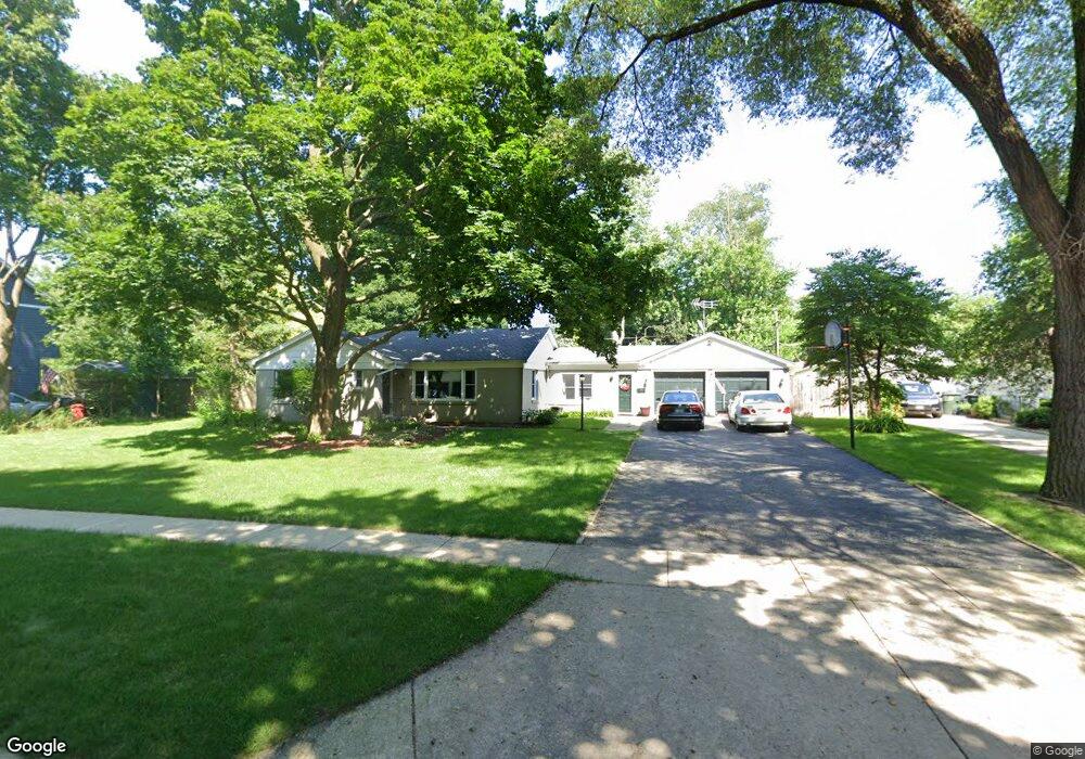
222 Woodland Rd Libertyville, IL 60048
North Mundelein NeighborhoodEstimated Value: $420,000 - $479,000
--
Bed
2
Baths
1,738
Sq Ft
$252/Sq Ft
Est. Value
About This Home
This home is located at 222 Woodland Rd, Libertyville, IL 60048 and is currently estimated at $437,108, approximately $251 per square foot. 222 Woodland Rd is a home located in Lake County with nearby schools including Butterfield School, Highland Middle School, and Libertyville High School.
Ownership History
Date
Name
Owned For
Owner Type
Purchase Details
Closed on
Aug 24, 1998
Sold by
Lawler John Jordan and Lawler Aimee H
Bought by
Ohara Robert W and Ohara Margaret E
Current Estimated Value
Home Financials for this Owner
Home Financials are based on the most recent Mortgage that was taken out on this home.
Original Mortgage
$183,800
Outstanding Balance
$37,679
Interest Rate
7.02%
Estimated Equity
$399,429
Create a Home Valuation Report for This Property
The Home Valuation Report is an in-depth analysis detailing your home's value as well as a comparison with similar homes in the area
Home Values in the Area
Average Home Value in this Area
Purchase History
| Date | Buyer | Sale Price | Title Company |
|---|---|---|---|
| Ohara Robert W | $193,500 | -- |
Source: Public Records
Mortgage History
| Date | Status | Borrower | Loan Amount |
|---|---|---|---|
| Open | Ohara Robert W | $183,800 |
Source: Public Records
Tax History Compared to Growth
Tax History
| Year | Tax Paid | Tax Assessment Tax Assessment Total Assessment is a certain percentage of the fair market value that is determined by local assessors to be the total taxable value of land and additions on the property. | Land | Improvement |
|---|---|---|---|---|
| 2024 | $8,970 | $134,611 | $37,563 | $97,048 |
| 2023 | $8,849 | $119,381 | $33,313 | $86,068 |
| 2022 | $8,849 | $116,646 | $32,019 | $84,627 |
| 2021 | $8,516 | $114,135 | $31,330 | $82,805 |
| 2020 | $8,194 | $112,216 | $30,803 | $81,413 |
| 2019 | $7,990 | $111,149 | $30,510 | $80,639 |
| 2018 | $6,500 | $94,527 | $35,844 | $58,683 |
| 2017 | $6,406 | $91,542 | $34,712 | $56,830 |
| 2016 | $6,183 | $86,795 | $32,912 | $53,883 |
| 2015 | $6,113 | $81,125 | $30,762 | $50,363 |
| 2014 | $6,204 | $80,654 | $30,349 | $50,305 |
| 2012 | $5,803 | $81,353 | $30,612 | $50,741 |
Source: Public Records
Map
Nearby Homes
- 223 Kenloch Ave
- 1330 W Park Ave
- 20924 & 20902 W Park Ave
- 1137 Pine Tree Ln
- 533 Drake St
- 551 W Park Ave Unit E
- 832 Interlaken Ln
- 423 Ames St
- 0 Ames St
- 420 W Cook Ave
- 505 Lange Ct
- 308 Mckinley Ave
- 847 Mckinley Ave
- 212 Elm Ct
- 777 Garfield Ave Unit A
- 747 Garfield Ave Unit C
- 1754 Glenmore Rd
- 694 Parkside Ct
- 2245 Hazeltime Dr
- 662 Parkside Ct
- 214 Woodland Rd
- 230 Woodland Rd
- 219 Kenloch Ave
- 212 Woodland Rd
- 227 Kenloch Ave
- 213 Kenloch Ave
- 238 Woodland Rd
- 231 Kenloch Ave
- 209 Kenloch Ave
- 227 Woodland Rd
- 219 Woodland Rd
- 239 Kenloch Ave
- 204 Woodland Rd
- 205 Kenloch Ave
- 211 Woodland Rd
- 237 Woodland Rd
- 244 Woodland Rd
- 245 Kenloch Ave
- 207 Woodland Rd
- 1304 Willow Ave