

2220 Dublin Rd Scranton, AR 72863
Estimated payment $2,160/month
Highlights
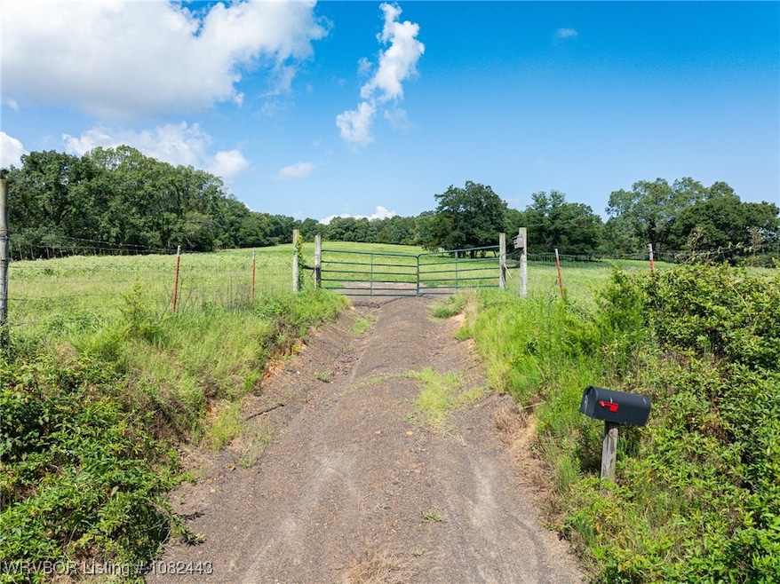
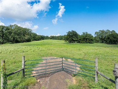
- 98.38 Acre Lot
- Wooded Lot
- Partially Fenced Property
About This Lot
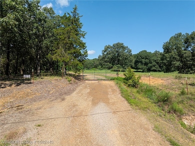
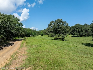
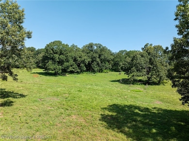
98.38 Acres m/l beautiful country land- wooded and cleared with a pond. Discover the perfect blend of seclusion and versatility on this stunning property nestled in the peaceful countryside. Whether you are looking for a recreational getaway, a future homesite or a smart investment, this property has it all. Enjoy the privacy of mature timber along with open, cleared areas ideal for building, farming or grazing. A tranquil pond offers the perfect spot for fishing, wildlife watching or just relaxing by the water. It's quiet, private and surrounded by nature, yet still within reasonable distance to town and amenities. You don't want to miss the endless possibilities of hunting, camping, exploring trails, running livestock or building the home of your dreams.
Property Details
Property Type
- Land
Est. Annual Taxes
- $195
Lot Details
- 98.38 Acre Lot
- Property fronts a county road
- Rural Setting
- Partially Fenced Property
- Sloped Lot
- Wooded Lot
- Landscaped with Trees
Home Design
- Mixed Use
Schools
- Scranton Elementary And Middle School
- Scranton High School
Additional Features
- Outside City Limits
- Mobile Home Allowed
- Not Connected to Water Source
Listing and Financial Details
- Legal Lot and Block / / /
Map
Tax History
| Year | Tax Paid | Tax Assessment Tax Assessment Total Assessment is a certain percentage of the fair market value that is determined by local assessors to be the total taxable value of land and additions on the property. | Land | Improvement |
|---|---|---|---|---|
| 2024 | $531 | $29,640 | $1,270 | $28,370 |
| 2023 | $1,031 | $29,640 | $1,270 | $28,370 |
| 2022 | $656 | $29,640 | $1,270 | $28,370 |
| 2021 | $656 | $29,640 | $1,270 | $28,370 |
| 2020 | $656 | $29,640 | $1,270 | $28,370 |
| 2019 | $1,031 | $22,700 | $730 | $21,970 |
| 2018 | $680 | $22,700 | $730 | $21,970 |
| 2017 | $1,030 | $22,700 | $730 | $21,970 |
| 2016 | $680 | $22,700 | $730 | $21,970 |
| 2015 | -- | $22,510 | $2,010 | $20,500 |
| 2014 | -- | $22,510 | $2,010 | $20,500 |
| 2013 | -- | $22,510 | $2,010 | $20,500 |
Property History
| Date | Event | Price | List to Sale | Price per Sq Ft |
|---|---|---|---|---|
| 07/14/2025 07/14/25 | For Sale | $416,500 | -- | -- |
Purchase History
| Date | Type | Sale Price | Title Company |
|---|---|---|---|
| Deed | -- | -- |
Source: Western River Valley Board of REALTORS®
MLS Number: 1082443
APN: 100-02129-001
- 458 W Dublin Bay Rd
- 000 Fritsche Rd
- 527 Thompson Bay Rd
- 0000 Dublin Rd
- 000 Dublin Rd
- 548 Boyd Dr
- 465 Boyd Dr
- 106 Lakeside Dr
- 1164 Mountain Spring Rd
- na Spring Lake Rd
- 501 Main St
- 19958 E State Highway 22
- 19958 Arkansas 22
- 132 Elizabeth Hall Rd
- 208 11th St
- 1102 Olive St
- 274 Sanders Dr
- 356 River Port Rd
- 136 Masonic Way
- 148 Riverwood Dr

Ask me questions while you tour the home.