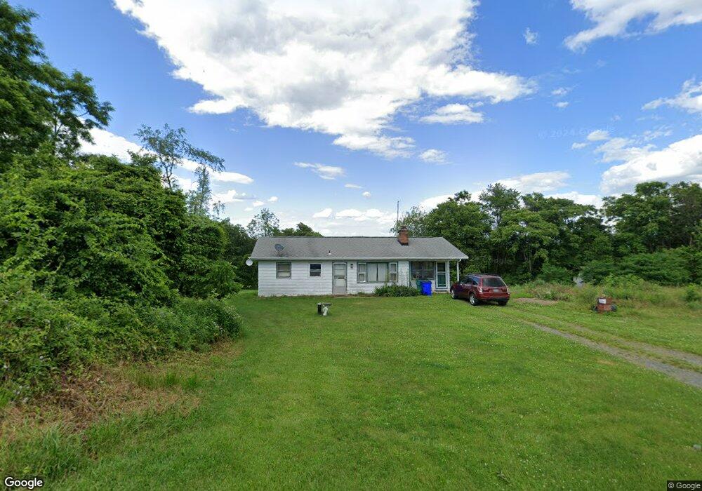
2220 Michael Rd Myersville, MD 21773
Estimated Value: $287,046 - $442,000
--
Bed
1
Bath
884
Sq Ft
$420/Sq Ft
Est. Value
About This Home
This home is located at 2220 Michael Rd, Myersville, MD 21773 and is currently estimated at $371,512, approximately $420 per square foot. 2220 Michael Rd is a home located in Frederick County with nearby schools including Myersville Elementary School, Middletown Middle School, and Middletown High School.
Ownership History
Date
Name
Owned For
Owner Type
Purchase Details
Closed on
Sep 6, 2018
Sold by
Hicks Edward Robert and Hicks Carole Ann
Bought by
Hicks Tracey Edward and Hicks Family Trust
Current Estimated Value
Purchase Details
Closed on
Jun 3, 1985
Sold by
Morrison Edna B
Bought by
Hicks Edward R and Hicks Carole A
Home Financials for this Owner
Home Financials are based on the most recent Mortgage that was taken out on this home.
Original Mortgage
$50,000
Interest Rate
12.71%
Create a Home Valuation Report for This Property
The Home Valuation Report is an in-depth analysis detailing your home's value as well as a comparison with similar homes in the area
Home Values in the Area
Average Home Value in this Area
Purchase History
| Date | Buyer | Sale Price | Title Company |
|---|---|---|---|
| Hicks Tracey Edward | -- | None Available | |
| Hicks Edward R | $68,300 | -- |
Source: Public Records
Mortgage History
| Date | Status | Borrower | Loan Amount |
|---|---|---|---|
| Closed | Hicks Edward R | $50,000 |
Source: Public Records
Tax History Compared to Growth
Tax History
| Year | Tax Paid | Tax Assessment Tax Assessment Total Assessment is a certain percentage of the fair market value that is determined by local assessors to be the total taxable value of land and additions on the property. | Land | Improvement |
|---|---|---|---|---|
| 2025 | $2,756 | $238,700 | -- | -- |
| 2024 | $2,756 | $221,600 | $0 | $0 |
| 2023 | $2,523 | $204,500 | $97,500 | $107,000 |
| 2022 | $2,416 | $195,367 | $0 | $0 |
| 2021 | $2,256 | $186,233 | $0 | $0 |
| 2020 | $2,205 | $177,100 | $88,500 | $88,600 |
| 2019 | $2,195 | $176,267 | $0 | $0 |
| 2018 | $2,056 | $175,433 | $0 | $0 |
| 2017 | $2,149 | $174,600 | $0 | $0 |
| 2016 | $2,206 | $172,267 | $0 | $0 |
| 2015 | $2,206 | $169,933 | $0 | $0 |
| 2014 | $2,206 | $167,600 | $0 | $0 |
Source: Public Records
Map
Nearby Homes
- 10433 Grindstone Run Rd
- 2710A Monument Rd
- 2703 Meadowridge Ct
- 2763 Flintridge Dr
- 2820 Milt Summers Rd
- 218 Mountain Terrace
- 421 Main St
- 3 Poplar St
- 14 Deerwoods Ct
- 33 Fox Rock Dr
- Lot 1 Wolfsville Rd
- Lot 2 Wolfsville Rd
- 3101 Brethren Church Rd
- 55 Fox Rock Dr
- 6408 Zittlestown Rd
- 10306 Church Hill Rd
- 6346 Zittlestown Rd
- 21335 Keadle Rd
- 10444 Church Hill Rd
- 21877 Boonsboro Mountain Rd
- 2228 Michael Rd
- 2203 Michael Rd
- 2223 Michael Rd
- 2223 Michael Rd
- 2303 Michael Rd
- 2114 Michael Rd
- 2107 Michael Rd
- 2338 Michael Rd
- 2338 Michael Rd Unit "FARM"
- 2320 Michael Rd
- 2084 Michael Rd
- 2343 Michael Rd
- 2315 Michael Rd
- 2347 Michael Rd
- 2317 Michael Rd
- 2074 Michael Rd
- 2127 Monument Rd
- 2127 Monument Rd Unit A
- 2060 Michael Rd
- 9710 Mount Tabor Rd
