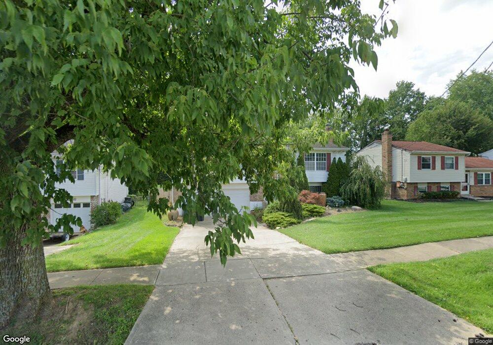
2220 Miles Rd Cincinnati, OH 45231
New Burlington NeighborhoodEstimated Value: $226,000 - $252,000
3
Beds
2
Baths
1,528
Sq Ft
$155/Sq Ft
Est. Value
About This Home
This home is located at 2220 Miles Rd, Cincinnati, OH 45231 and is currently estimated at $236,469, approximately $154 per square foot. 2220 Miles Rd is a home located in Hamilton County with nearby schools including Mt Healthy High School, Hamilton County Mathematics and Science Academy, and Central Montessori Academy.
Ownership History
Date
Name
Owned For
Owner Type
Purchase Details
Closed on
Jan 17, 2004
Sold by
Lewis Donnovan A and Lewis Renata Y
Bought by
Lewis Donnovan A and Lewis Renata Y
Current Estimated Value
Purchase Details
Closed on
Jul 25, 2001
Sold by
Brennan Gaile M
Bought by
Lewis Donnovan A
Home Financials for this Owner
Home Financials are based on the most recent Mortgage that was taken out on this home.
Original Mortgage
$122,900
Outstanding Balance
$45,744
Interest Rate
7.15%
Mortgage Type
VA
Estimated Equity
$190,725
Create a Home Valuation Report for This Property
The Home Valuation Report is an in-depth analysis detailing your home's value as well as a comparison with similar homes in the area
Home Values in the Area
Average Home Value in this Area
Purchase History
| Date | Buyer | Sale Price | Title Company |
|---|---|---|---|
| Lewis Donnovan A | -- | Southeast Equity Title | |
| Lewis Donnovan A | $122,900 | -- |
Source: Public Records
Mortgage History
| Date | Status | Borrower | Loan Amount |
|---|---|---|---|
| Open | Lewis Donnovan A | $122,900 |
Source: Public Records
Tax History
| Year | Tax Paid | Tax Assessment Tax Assessment Total Assessment is a certain percentage of the fair market value that is determined by local assessors to be the total taxable value of land and additions on the property. | Land | Improvement |
|---|---|---|---|---|
| 2025 | $3,315 | $61,811 | $7,613 | $54,198 |
| 2023 | $3,145 | $61,811 | $7,613 | $54,198 |
| 2022 | $2,315 | $32,942 | $6,944 | $25,998 |
| 2021 | $2,248 | $32,942 | $6,944 | $25,998 |
| 2020 | $2,278 | $32,942 | $6,944 | $25,998 |
| 2019 | $2,095 | $27,917 | $5,884 | $22,033 |
| 2018 | $2,108 | $27,917 | $5,884 | $22,033 |
| 2017 | $1,996 | $27,917 | $5,884 | $22,033 |
| 2016 | $2,085 | $28,858 | $7,466 | $21,392 |
| 2015 | $2,099 | $28,858 | $7,466 | $21,392 |
| 2014 | $2,087 | $28,858 | $7,466 | $21,392 |
| 2013 | $2,262 | $31,367 | $8,113 | $23,254 |
Source: Public Records
Map
Nearby Homes
- 9846 Pinedale Dr
- 9925 Grasscreek Ct
- 2528 Mariposa St
- 2317 Magdalena Dr
- 2473 Schon Dr
- 9978 Greenriver Dr
- 2005 Miles Rd
- 9500 Ridgemoor Ave
- 2329 Garrison Dr
- 9391 Jericho Dr
- 10073 Pippin Rd
- 10061 Sturgeon Ln
- 2788 Hazelton Ct
- 2792 Wheatfield Dr
- 2752 Mancelona Ct
- 2175 Carlsbory Dr
- 9287 Coogan Dr
- 9561 Trafalgar Ct
- 10228 Springbeauty Ln
- 10123 Manistee Way
- 2212 Miles Rd
- 9822 Pinedale Dr
- 2234 Miles Rd
- 9814 Pinedale Dr
- 2206 Miles Rd
- 9830 Pinedale Dr
- 2238 Miles Rd
- 2200 Miles Rd
- 2219 Miles Rd
- 2211 Miles Rd
- 9798 Sacramento St
- 9806 Pinedale Dr
- 2227 Miles Rd
- 9838 Pinedale Dr
- 2205 Miles Rd
- 2196 Miles Rd
- 2244 Miles Rd
- 9786 Sacramento St
- 9813 Pinedale Dr
- 2452 Wenning Rd
Your Personal Tour Guide
Ask me questions while you tour the home.