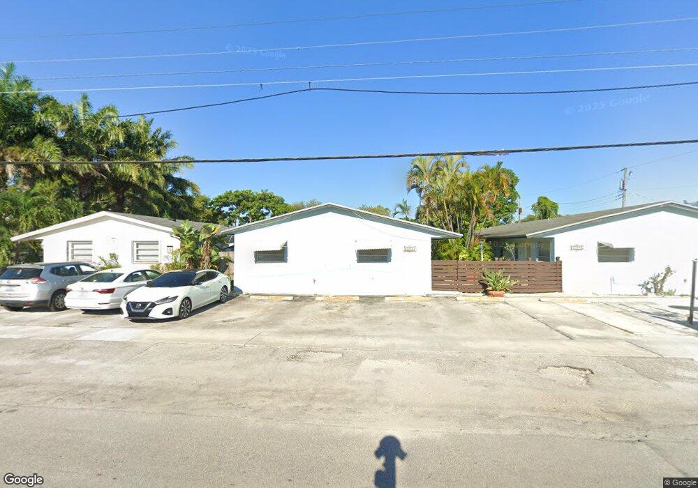
2220 N 19th Ave Hollywood, FL 33020
Royal Poinciana NeighborhoodEstimated Value: $657,000 - $891,000
4
Beds
4
Baths
2,244
Sq Ft
$339/Sq Ft
Est. Value
About This Home
This home is located at 2220 N 19th Ave, Hollywood, FL 33020 and is currently estimated at $761,333, approximately $339 per square foot. 2220 N 19th Ave is a home located in Broward County with nearby schools including Dania Elementary School, Olsen Middle School, and South Broward High School.
Ownership History
Date
Name
Owned For
Owner Type
Purchase Details
Closed on
Oct 10, 2001
Sold by
Pasternak Alfred
Bought by
Dacko Peter and Pasternak Elizabeth A
Current Estimated Value
Home Financials for this Owner
Home Financials are based on the most recent Mortgage that was taken out on this home.
Original Mortgage
$260,000
Interest Rate
6.87%
Mortgage Type
Seller Take Back
Create a Home Valuation Report for This Property
The Home Valuation Report is an in-depth analysis detailing your home's value as well as a comparison with similar homes in the area
Home Values in the Area
Average Home Value in this Area
Purchase History
| Date | Buyer | Sale Price | Title Company |
|---|---|---|---|
| Dacko Peter | $300,000 | -- |
Source: Public Records
Mortgage History
| Date | Status | Borrower | Loan Amount |
|---|---|---|---|
| Previous Owner | Dacko Peter | $260,000 |
Source: Public Records
Tax History Compared to Growth
Tax History
| Year | Tax Paid | Tax Assessment Tax Assessment Total Assessment is a certain percentage of the fair market value that is determined by local assessors to be the total taxable value of land and additions on the property. | Land | Improvement |
|---|---|---|---|---|
| 2025 | $7,538 | $264,340 | -- | -- |
| 2024 | $7,041 | $264,340 | -- | -- |
| 2023 | $7,041 | $218,470 | $0 | $0 |
| 2022 | $6,450 | $198,610 | $0 | $0 |
| 2021 | $5,867 | $180,560 | $0 | $0 |
| 2020 | $5,273 | $257,280 | $43,730 | $213,550 |
| 2019 | $4,925 | $223,510 | $43,730 | $179,780 |
| 2018 | $4,417 | $190,770 | $43,730 | $147,040 |
| 2017 | $3,836 | $123,340 | $0 | $0 |
| 2016 | $3,594 | $112,130 | $0 | $0 |
| 2015 | $3,302 | $101,940 | $0 | $0 |
| 2014 | $3,127 | $92,680 | $0 | $0 |
| 2013 | -- | $86,680 | $43,610 | $43,070 |
Source: Public Records
Map
Nearby Homes
- 1954 Thomas St
- 1955 Thomas St
- 1818 Sherman St
- 1924 Sheridan St
- 1518 SW 2nd Ave
- 1820 Coolidge St
- 1812 Coolidge St
- 1913 Harding St
- 1917 Harding St
- 1409 S Federal Hwy
- 1401 SW 3rd Ave
- 1853 Taft St
- 1341 SE 3rd Ave Unit 206
- 1341 SE 3rd Ave Unit 210
- 1918 Taft St
- 1777 N 17th Ct
- 1670 Harding St
- 309 SW 13th St
- 2001 N 22nd Ave
- 1807 N 17th Ave
- 2220 N 19th Ave Unit 6
- 2220 N 19th Ave Unit 8
- 2220 N 19th Ave Unit 10
- 2220 N 19th Ave Unit 9
- 2220 N 19th Ave Unit 12
- 2220 N 19th Ave Unit 7
- 2224 N 19th Ave Unit 5
- 2224 N 19th Ave Unit 9
- 2224 N 19th Ave Unit 12
- 2224 N 19th Ave Unit 10
- 2224 N 19th Ave
- 1901 Lee St
- 1901 Liberty St
- 1901 Liberty St Unit 1
- 1901 Liberty St Unit 3
- 1911 Liberty St
- 1911 Lee St
- 1919 Lee St Unit 1
- 2228 N 19th Ave Unit 1
- 2228 N 19th Ave Unit E