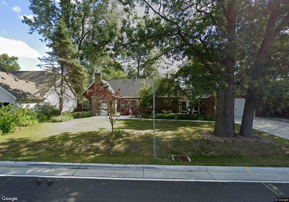
2220 N Mccord Rd Toledo, OH 43615
Estimated Value: $253,712 - $304,000
3
Beds
1
Bath
1,932
Sq Ft
$143/Sq Ft
Est. Value
About This Home
This home is located at 2220 N Mccord Rd, Toledo, OH 43615 and is currently estimated at $275,428, approximately $142 per square foot. 2220 N Mccord Rd is a home located in Lucas County with nearby schools including Stranahan Elementary School, Sylvania Timberstone Junior High School, and Sylvania Southview High School.
Ownership History
Date
Name
Owned For
Owner Type
Purchase Details
Closed on
Apr 1, 2021
Sold by
Piel Debra A
Bought by
Piel Debra A and Debra A Piel Living Trust
Current Estimated Value
Purchase Details
Closed on
Nov 30, 2018
Sold by
Piel Annaline M Trustee
Bought by
Piel Debra A Trustee Of The & Fami
Purchase Details
Closed on
Oct 4, 1999
Sold by
Piel William J and Piel Annaline M
Bought by
Piel William J and Piel Annaline M
Create a Home Valuation Report for This Property
The Home Valuation Report is an in-depth analysis detailing your home's value as well as a comparison with similar homes in the area
Home Values in the Area
Average Home Value in this Area
Purchase History
| Date | Buyer | Sale Price | Title Company |
|---|---|---|---|
| Piel Debra A | -- | None Available | |
| Piel Debra A | -- | None Available | |
| Piel Debra A Trustee Of The & Fami | -- | -- | |
| Piel William J | -- | -- |
Source: Public Records
Tax History Compared to Growth
Tax History
| Year | Tax Paid | Tax Assessment Tax Assessment Total Assessment is a certain percentage of the fair market value that is determined by local assessors to be the total taxable value of land and additions on the property. | Land | Improvement |
|---|---|---|---|---|
| 2024 | $2,318 | $71,680 | $6,755 | $64,925 |
| 2023 | $3,833 | $50,750 | $7,735 | $43,015 |
| 2022 | $3,832 | $50,750 | $7,735 | $43,015 |
| 2021 | $4,016 | $50,750 | $7,735 | $43,015 |
| 2020 | $4,114 | $46,060 | $6,300 | $39,760 |
| 2019 | $3,967 | $46,060 | $6,300 | $39,760 |
| 2018 | $3,090 | $46,060 | $6,300 | $39,760 |
| 2017 | $3,280 | $44,170 | $6,125 | $38,045 |
| 2016 | $3,218 | $126,200 | $17,500 | $108,700 |
| 2015 | $3,036 | $126,200 | $17,500 | $108,700 |
| 2014 | $2,835 | $42,460 | $5,880 | $36,580 |
| 2013 | $2,835 | $42,460 | $5,880 | $36,580 |
Source: Public Records
Map
Nearby Homes
- 6820 Cloister Ct Unit 6820
- 6952 Leicester Rd
- 6616 Elmer Dr
- 6843 Kristi Lynne Ln
- 6968 Shooters Hill Rd
- 6850 Kristi Lynne Ln
- 1802 Deer Trail Dr
- 1714 Deer Trail Dr
- 2515 Orchard Hills Blvd
- 7035 Mourning Dove Ct
- 2822 Page Lindsay Ln
- 1128 Plum Grove Ln
- 1053 Plum Grove Ln
- 1715 Brooklynn Park W
- 2537 Vaness Dr
- 2150 Fieldbrook Dr
- 1032 Saturn Dr
- 7335 Friarton Cir
- 2015 Oakside Rd
- 2010 Oakside Rd
- 2226 N Mccord Rd
- 2232 N Mccord Rd
- 2221 Manoa Rd
- 2236 N Mccord Rd
- 2231 Manoa Rd
- 2242 N Mccord Rd
- 6721 Cloister Ct
- 2246 N Mccord Rd
- 2226 Manoa Rd
- 6720 Cloister Ct
- 6620 W Bancroft St
- 6725 Cloister Ct
- 2236 Manoa Rd
- 2256 N Mccord Rd
- 6661 W Bancroft St
- 2253 Manoa Rd
- 2253 Manoa Rd
- 2207 Ronaldo Rd
- 2207 Ronaldo Rd
- 6724 Cloister Ct