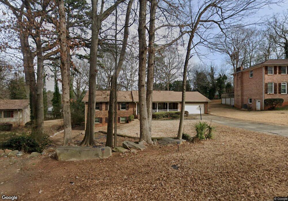
2220 Riverbrook Rd Decatur, GA 30035
Southwest DeKalb NeighborhoodEstimated Value: $254,266 - $308,000
3
Beds
2
Baths
1,804
Sq Ft
$158/Sq Ft
Est. Value
About This Home
This home is located at 2220 Riverbrook Rd, Decatur, GA 30035 and is currently estimated at $284,567, approximately $157 per square foot. 2220 Riverbrook Rd is a home located in DeKalb County with nearby schools including Canby Lane Elementary School, Mary McLeod Bethune Middle School, and Towers High School.
Ownership History
Date
Name
Owned For
Owner Type
Purchase Details
Closed on
Aug 3, 1998
Sold by
Sims Jasmine A
Bought by
Sims Sylvia B
Current Estimated Value
Create a Home Valuation Report for This Property
The Home Valuation Report is an in-depth analysis detailing your home's value as well as a comparison with similar homes in the area
Home Values in the Area
Average Home Value in this Area
Purchase History
| Date | Buyer | Sale Price | Title Company |
|---|---|---|---|
| Sims Sylvia B | -- | -- |
Source: Public Records
Tax History Compared to Growth
Tax History
| Year | Tax Paid | Tax Assessment Tax Assessment Total Assessment is a certain percentage of the fair market value that is determined by local assessors to be the total taxable value of land and additions on the property. | Land | Improvement |
|---|---|---|---|---|
| 2025 | $471 | $103,600 | $12,000 | $91,600 |
| 2024 | $459 | $101,920 | $10,120 | $91,800 |
| 2023 | $459 | $92,320 | $10,120 | $82,200 |
| 2022 | $349 | $74,080 | $10,120 | $63,960 |
| 2021 | $349 | $64,120 | $10,120 | $54,000 |
| 2020 | $349 | $61,640 | $10,120 | $51,520 |
| 2019 | $349 | $51,920 | $10,120 | $41,800 |
| 2018 | $349 | $46,280 | $10,120 | $36,160 |
| 2017 | $349 | $35,480 | $10,120 | $25,360 |
| 2016 | $349 | $34,480 | $10,120 | $24,360 |
| 2014 | $349 | $29,080 | $10,120 | $18,960 |
Source: Public Records
Map
Nearby Homes
- 2393 Winshire Dr
- 2401 Winshire Dr
- 4353 Langdon Dr
- 2370 Wingfoot Place
- 2146 Wingfoot Place
- 4373 Buckingham Cir
- 2432 Stratford Ct
- 4491 Buckingham Cir
- 4225 Wesley Hall Ln
- 4568 Dorset Cir
- 4469 Wellington Terrace Unit 1
- 4211 Wingfoot Ct
- 2323 Wingfoot Place
- 4379 Cross Ln
- 2303 Wingfoot Place
- 4190 Wingfoot Ct Unit 2
- 4371 Aldergate Dr
- 4214 Canby Ln
- 2428 Marsh Rabbit Bend
- 2228 Riverbrook Rd
- 2212 Riverbrook Rd
- 2333 Pebble Rock W
- 2325 Pebble Rock W
- 2341 Pebble Rock W
- 2317 Pebble Rock W
- 2204 Riverbrook Rd
- 2236 Riverbrook Rd Unit 3
- 2309 Pebble Rock W
- 2501 S Hairston Rd
- 2227 Riverbrook Rd
- 2219 Riverbrook Rd
- 2235 Riverbrook Rd
- 2211 Riverbrook Rd Unit 4
- 2196 Riverbrook Rd
- 2332 Pebble Rock W
- 2324 Pebble Rock W
- 2301 Pebble Rock W
- 2203 Riverbrook Rd
- 2529 S Hairston Rd Unit 3