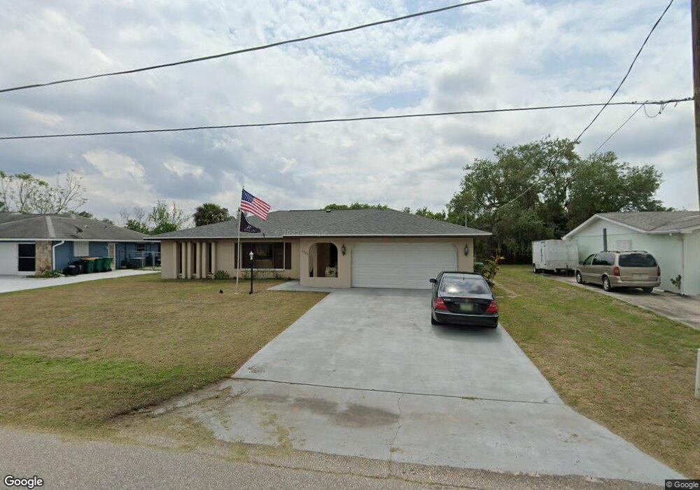
22207 Mamaroneck Ave Port Charlotte, FL 33952
Estimated Value: $269,684 - $336,000
3
Beds
3
Baths
2,924
Sq Ft
$102/Sq Ft
Est. Value
About This Home
This home is located at 22207 Mamaroneck Ave, Port Charlotte, FL 33952 and is currently estimated at $297,421, approximately $101 per square foot. 22207 Mamaroneck Ave is a home located in Charlotte County with nearby schools including Peace River Elementary School, Port Charlotte Middle School, and Charlotte High School.
Ownership History
Date
Name
Owned For
Owner Type
Purchase Details
Closed on
Apr 11, 2017
Sold by
Craig Minnie H
Bought by
Bolt David A
Current Estimated Value
Home Financials for this Owner
Home Financials are based on the most recent Mortgage that was taken out on this home.
Original Mortgage
$164,350
Outstanding Balance
$136,350
Interest Rate
4.1%
Mortgage Type
New Conventional
Estimated Equity
$161,071
Purchase Details
Closed on
Sep 6, 2006
Sold by
Family Trust Of Richard A Craig & Minnie
Bought by
Craig Richard A and Craig Minnie H
Purchase Details
Closed on
Apr 13, 1998
Sold by
Brown Irene H
Bought by
Family Tr Of Richard A Craig & Minnie H
Create a Home Valuation Report for This Property
The Home Valuation Report is an in-depth analysis detailing your home's value as well as a comparison with similar homes in the area
Home Values in the Area
Average Home Value in this Area
Purchase History
| Date | Buyer | Sale Price | Title Company |
|---|---|---|---|
| Bolt David A | $173,000 | First International Title In | |
| Craig Richard A | -- | None Available | |
| Family Tr Of Richard A Craig & Minnie H | $77,500 | -- |
Source: Public Records
Mortgage History
| Date | Status | Borrower | Loan Amount |
|---|---|---|---|
| Open | Bolt David A | $164,350 |
Source: Public Records
Tax History Compared to Growth
Tax History
| Year | Tax Paid | Tax Assessment Tax Assessment Total Assessment is a certain percentage of the fair market value that is determined by local assessors to be the total taxable value of land and additions on the property. | Land | Improvement |
|---|---|---|---|---|
| 2023 | $3,067 | $192,996 | $0 | $0 |
| 2022 | $3,024 | $187,375 | $0 | $0 |
| 2021 | $3,019 | $181,917 | $0 | $0 |
| 2020 | $2,964 | $179,405 | $10,200 | $169,205 |
| 2019 | $2,871 | $175,833 | $10,200 | $165,633 |
| 2018 | $2,660 | $173,109 | $10,200 | $162,909 |
| 2017 | $2,972 | $174,328 | $8,500 | $165,828 |
| 2016 | $2,725 | $121,109 | $0 | $0 |
| 2015 | $2,467 | $110,099 | $0 | $0 |
| 2014 | $2,277 | $100,090 | $0 | $0 |
Source: Public Records
Map
Nearby Homes
- 22237 Lockport Ave
- 3255 Geneva St
- 22220 & 22228 Lockport Ave
- 3335 Brooklyn Ave
- 22158 Riverhead Ave
- 22271 Morris Ave
- 3246 Oswego St
- 3295 Brooklyn Ave
- 3122 Scranton St
- 22357 Nyack Ave
- 22381 Nyack Ave
- 3303 Jamestown St
- 3090 Lockwood St
- 22201 Olean Blvd
- 22217 Olean Blvd
- 3404 Depew Ave
- 22242 Elmira Blvd
- 22400 Lacombe Ave
- 22267 Elmira Blvd
- 22309 Nyack Ave
- 22199 Mamaroneck Ave
- 22219 Mamaroneck Ave
- 22191 Mamaroneck Ave
- 22200 Mamaroneck Ave
- 22220 Mamaroneck Ave
- 3200 Tarytown St
- 22183 Mamaroneck Ave
- 22192 Mamaroneck Ave
- 3244 Depew Ave
- 3236 Depew Ave
- 3192 Tarytown St
- 22215 Lancaster Ave
- 22207 Lancaster Ave
- 22184 Mamaroneck Ave
- 22175 Mamaroneck Ave
- 22199 Lancaster Ave
- 22225 Lancaster Ave
- 3184 Street
- 3184 Tarytown St
- 22191 Lancaster Ave