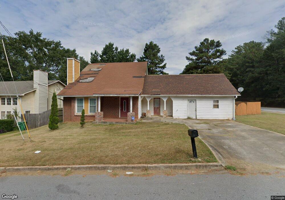
2221 Hampton Dr Decatur, GA 30035
Southwest DeKalb NeighborhoodEstimated Value: $222,914 - $264,000
3
Beds
2
Baths
1,767
Sq Ft
$132/Sq Ft
Est. Value
About This Home
This home is located at 2221 Hampton Dr, Decatur, GA 30035 and is currently estimated at $233,979, approximately $132 per square foot. 2221 Hampton Dr is a home located in DeKalb County with nearby schools including Flat Rock Elementary School, Miller Grove Middle School, and Miller Grove High School.
Ownership History
Date
Name
Owned For
Owner Type
Purchase Details
Closed on
Sep 14, 2010
Sold by
Us Bank Na Rasc 2006Ks2
Bought by
James Georgia V
Current Estimated Value
Purchase Details
Closed on
Aug 3, 2010
Sold by
Thomas Roger and Thomas Sharon
Bought by
Us Bank Na Rasc 2006Ks2
Purchase Details
Closed on
Oct 1, 1993
Sold by
Lopez Jose R Aurora
Bought by
Thomas Roger Sharon
Home Financials for this Owner
Home Financials are based on the most recent Mortgage that was taken out on this home.
Original Mortgage
$75,450
Interest Rate
10%
Mortgage Type
FHA
Create a Home Valuation Report for This Property
The Home Valuation Report is an in-depth analysis detailing your home's value as well as a comparison with similar homes in the area
Home Values in the Area
Average Home Value in this Area
Purchase History
| Date | Buyer | Sale Price | Title Company |
|---|---|---|---|
| James Georgia V | $24,000 | -- | |
| Us Bank Na Rasc 2006Ks2 | $44,926 | -- | |
| Thomas Roger Sharon | $11,000 | -- |
Source: Public Records
Mortgage History
| Date | Status | Borrower | Loan Amount |
|---|---|---|---|
| Previous Owner | Thomas Roger Sharon | $75,450 | |
| Closed | Thomas Roger Sharon | $5,000 |
Source: Public Records
Tax History Compared to Growth
Tax History
| Year | Tax Paid | Tax Assessment Tax Assessment Total Assessment is a certain percentage of the fair market value that is determined by local assessors to be the total taxable value of land and additions on the property. | Land | Improvement |
|---|---|---|---|---|
| 2025 | $4,523 | $93,040 | $15,200 | $77,840 |
| 2024 | $4,959 | $103,080 | $15,200 | $87,880 |
| 2023 | $4,959 | $89,240 | $7,600 | $81,640 |
| 2022 | $4,012 | $83,520 | $7,600 | $75,920 |
| 2021 | $2,863 | $57,360 | $3,840 | $53,520 |
| 2020 | $2,017 | $38,080 | $3,840 | $34,240 |
| 2019 | $1,857 | $34,440 | $3,840 | $30,600 |
| 2018 | $1,653 | $34,600 | $3,840 | $30,760 |
| 2017 | $1,648 | $25,920 | $3,840 | $22,080 |
| 2016 | $1,620 | $28,840 | $3,840 | $25,000 |
| 2014 | $940 | $13,120 | $3,840 | $9,280 |
Source: Public Records
Map
Nearby Homes
- 5042 Chadwick Ct
- 5051 Chadwick Ct
- 5071 Donnell Way
- 2267 Hampton Dr Unit 1
- 5035 Chadwick Ct
- 5139 Miller Woods Trail
- 2180 Hidden Creek Dr
- 5655 Covington Hwy
- 2322 Wilkins Ct
- 2332 Wilkins Ct Unit 1
- 4817 Hidden Creek Place Unit 2B
- 5208 Shawn Ln
- 2098 Moss Hill Rd
- 2317 Wilkins Ct
- 2086 Moss Hill Rd
- 2088 Moss Hill Rd
- 2084 Moss Hill Rd
- 2082 Moss Hill Rd
- 2080 Moss Hill Rd
- 2078 Moss Hill Rd
- 2229 Hampton Dr
- 2233 Hampton Dr
- 2222 Hampton Dr
- 5099 Donnell Way
- 2239 Hampton Dr
- 5093 Donnell Way
- 2243 Hampton Dr
- 2240 Hampton Dr
- 5087 Donnell Way Unit 1
- 5096 Donnell Way
- 2249 Hampton Dr
- 2246 Hampton Dr Unit 1
- 5083 Donnell Way Unit 1
- 5090 Donnell Way
- 2255 Miller Rd
- 2250 Hampton Dr
- 2253 Hampton Dr
- 5056 Chadwick Ct
- 5050 Chadwick Ct
- 5079 Donnell Way