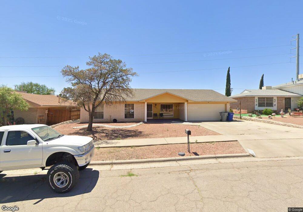
2221 Mermaid Dr El Paso, TX 79936
Glen Cove NeighborhoodEstimated Value: $245,402 - $276,000
4
Beds
2
Baths
1,780
Sq Ft
$144/Sq Ft
Est. Value
About This Home
This home is located at 2221 Mermaid Dr, El Paso, TX 79936 and is currently estimated at $255,601, approximately $143 per square foot. 2221 Mermaid Dr is a home located in El Paso County with nearby schools including Glen Cove Elementary School, J.M. Hanks Middle School, and J M Hanks High School.
Ownership History
Date
Name
Owned For
Owner Type
Purchase Details
Closed on
Aug 15, 2018
Sold by
Maestas Stephanie N
Bought by
Carrasco Jacob
Current Estimated Value
Home Financials for this Owner
Home Financials are based on the most recent Mortgage that was taken out on this home.
Original Mortgage
$61,800
Outstanding Balance
$53,671
Interest Rate
4.5%
Mortgage Type
Stand Alone First
Estimated Equity
$201,930
Create a Home Valuation Report for This Property
The Home Valuation Report is an in-depth analysis detailing your home's value as well as a comparison with similar homes in the area
Home Values in the Area
Average Home Value in this Area
Purchase History
| Date | Buyer | Sale Price | Title Company |
|---|---|---|---|
| Carrasco Jacob | -- | Stewart Title |
Source: Public Records
Mortgage History
| Date | Status | Borrower | Loan Amount |
|---|---|---|---|
| Open | Carrasco Jacob | $61,800 |
Source: Public Records
Tax History Compared to Growth
Tax History
| Year | Tax Paid | Tax Assessment Tax Assessment Total Assessment is a certain percentage of the fair market value that is determined by local assessors to be the total taxable value of land and additions on the property. | Land | Improvement |
|---|---|---|---|---|
| 2025 | $3,909 | $229,682 | -- | -- |
| 2024 | $3,909 | $208,802 | -- | -- |
| 2023 | $3,613 | $189,820 | $0 | $0 |
| 2022 | $5,359 | $172,564 | $0 | $0 |
| 2021 | $5,099 | $156,876 | $24,176 | $132,700 |
| 2020 | $4,819 | $152,569 | $20,829 | $131,740 |
| 2018 | $4,754 | $152,876 | $20,829 | $132,047 |
| 2017 | $4,272 | $139,743 | $20,829 | $118,914 |
| 2016 | $3,941 | $128,933 | $20,829 | $108,104 |
| 2015 | $3,708 | $128,933 | $20,829 | $108,104 |
| 2014 | $3,708 | $129,604 | $20,829 | $108,775 |
Source: Public Records
Map
Nearby Homes
- 2308 Tom Watson Ct
- 2604 Anise Dr
- 2348 Sea Side Dr
- 11008 Johnny Miller Dr
- 11013 Bob Stone Dr
- 11016 Bob Stone Dr
- 11012 Bob Stone Dr
- 1913 Seagull Dr
- 2009 Bobby Jones Dr Unit B
- 11132 Wharf Cove Dr
- 2001 Bobby Jones Dr Unit A
- 1868 Tom Bolt Dr
- 2825 Wong Place Unit A/D
- 11201 Skipper Dr
- 1901 Bobby Jones Dr
- 1817 Hugh Royer Place
- 11276 Skipper Dr
- 2325 Ken Venturi Ln
- 2820 Beachcomber Dr
- 2101 E Glen Dr
- 2217 Mermaid Dr
- 2225 Mermaid Dr
- 2205 Mermaid Dr
- 2220 Mermaid Dr
- 2229 Mermaid Dr
- 2220 Lee Elder Dr
- 2216 Lee Elder Dr
- 11100 Sam Snead Dr
- 2209 Mermaid Dr
- 2224 Lee Elder Dr
- 2212 Lee Elder Dr
- 2214 Mermaid Dr
- 2218 Mermaid Dr
- 2216 2216 Dr
- 2208 Lee Elder Dr
- 11104 Sea Foam Way
- 2213 Mermaid Dr
- 11108 Sea Foam Way
- 11112 Sea Foam Way
- 2201 Sea Side Dr