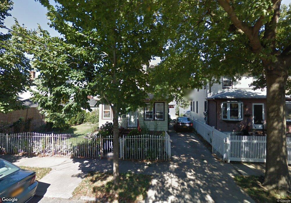
22215 Davenport Ave Queens Village, NY 11428
Queens Village NeighborhoodEstimated Value: $729,000 - $872,000
--
Bed
--
Bath
1,387
Sq Ft
$583/Sq Ft
Est. Value
About This Home
This home is located at 22215 Davenport Ave, Queens Village, NY 11428 and is currently estimated at $808,893, approximately $583 per square foot. 22215 Davenport Ave is a home located in Queens County with nearby schools including Independence Elementary School, P.S. 33 Edward M. Funk, and Jean Nuzzi Intermediate School.
Ownership History
Date
Name
Owned For
Owner Type
Purchase Details
Closed on
Jul 12, 2001
Sold by
Singh Charles H and Singh Maria
Bought by
Laurente Manuel A and Laurente Presentacion P
Current Estimated Value
Home Financials for this Owner
Home Financials are based on the most recent Mortgage that was taken out on this home.
Original Mortgage
$256,500
Outstanding Balance
$99,136
Interest Rate
7.18%
Estimated Equity
$709,757
Purchase Details
Closed on
Sep 1, 1995
Sold by
Garguillo Joseph and Garguillo Ruth F
Bought by
Singh Charles H and Singh Maria
Home Financials for this Owner
Home Financials are based on the most recent Mortgage that was taken out on this home.
Original Mortgage
$156,750
Interest Rate
7.89%
Create a Home Valuation Report for This Property
The Home Valuation Report is an in-depth analysis detailing your home's value as well as a comparison with similar homes in the area
Home Values in the Area
Average Home Value in this Area
Purchase History
| Date | Buyer | Sale Price | Title Company |
|---|---|---|---|
| Laurente Manuel A | -- | -- | |
| Singh Charles H | $165,000 | First American Title Ins Co |
Source: Public Records
Mortgage History
| Date | Status | Borrower | Loan Amount |
|---|---|---|---|
| Open | Laurente Manuel A | $256,500 | |
| Previous Owner | Singh Charles H | $156,750 |
Source: Public Records
Tax History Compared to Growth
Tax History
| Year | Tax Paid | Tax Assessment Tax Assessment Total Assessment is a certain percentage of the fair market value that is determined by local assessors to be the total taxable value of land and additions on the property. | Land | Improvement |
|---|---|---|---|---|
| 2025 | $6,574 | $34,396 | $12,344 | $22,052 |
| 2024 | $6,586 | $34,133 | $12,250 | $21,883 |
| 2023 | $6,187 | $32,203 | $11,614 | $20,589 |
| 2022 | $4,923 | $44,400 | $17,700 | $26,700 |
| 2021 | $5,736 | $42,420 | $17,700 | $24,720 |
| 2020 | $4,756 | $36,480 | $17,700 | $18,780 |
| 2019 | $5,657 | $34,260 | $17,700 | $16,560 |
| 2018 | $5,173 | $26,836 | $13,938 | $12,898 |
| 2017 | $4,861 | $25,318 | $12,164 | $13,154 |
| 2016 | $4,465 | $25,318 | $12,164 | $13,154 |
| 2015 | $2,661 | $23,886 | $13,438 | $10,448 |
| 2014 | $2,661 | $23,704 | $15,998 | $7,706 |
Source: Public Records
Map
Nearby Homes
- 22235 Davenport Ave
- 224-11 Edmore Ave
- 22417 Fairbury Ave
- 224-30 Edmore Ave
- 224-27 Fairbury Ave
- 237-12 92nd Rd
- 8948 Pontiac St
- 22114 Fairbury Ave
- 222-26 93rd Ave
- 8922 Moline St
- 22258 Braddock Ave
- 222-89 Braddock Ave Unit 4B
- 222-89 Braddock Ave Unit 2-E
- 222-89 Braddock Ave Unit 1G
- 222-89 Braddock Ave Unit 5A
- 222-89 Braddock Ave Unit 6-D
- 221-18 91st Rd
- 220-46 93rd Rd
- 22018 91st Rd
- 8830 Pontiac St Unit 2 Family
- 22217 Davenport Ave
- 222-17 Davenport Ave
- 9235 222nd St
- 22219 Davenport Ave
- 22219 Davenport Ave
- 9231 222nd St
- 9239 222nd St
- 22214 92nd Rd
- 22216 92nd Rd
- 22210 92nd Rd
- 22218 92nd Rd
- 22223 Davenport Ave
- 22206 92nd Rd
- 22222 92nd Rd
- 222-22 92nd Rd
- 222-12 Davenport Ave
- 9241 222nd St
- 22202 92nd Rd
- 22212 Davenport Ave
- 22216 Davenport Ave