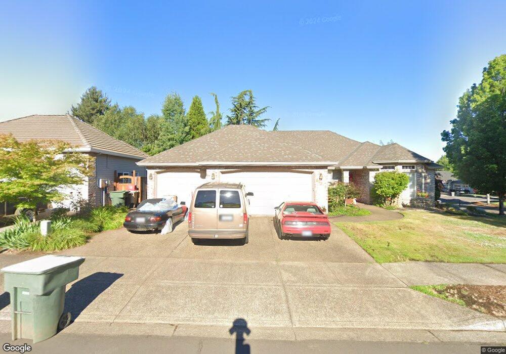
22215 SW 102nd Place Tualatin, OR 97062
Estimated Value: $695,726 - $827,000
3
Beds
2
Baths
2,199
Sq Ft
$349/Sq Ft
Est. Value
About This Home
This home is located at 22215 SW 102nd Place, Tualatin, OR 97062 and is currently estimated at $766,932, approximately $348 per square foot. 22215 SW 102nd Place is a home located in Washington County with nearby schools including Byrom Elementary School, Hazelbrook Middle School, and Tualatin High School.
Ownership History
Date
Name
Owned For
Owner Type
Purchase Details
Closed on
Dec 6, 1995
Sold by
J C Reeves Corp
Bought by
Sullivan Michael M and Sullivan Mary E
Current Estimated Value
Home Financials for this Owner
Home Financials are based on the most recent Mortgage that was taken out on this home.
Original Mortgage
$203,150
Outstanding Balance
$1,409
Interest Rate
7.48%
Estimated Equity
$765,523
Create a Home Valuation Report for This Property
The Home Valuation Report is an in-depth analysis detailing your home's value as well as a comparison with similar homes in the area
Home Values in the Area
Average Home Value in this Area
Purchase History
| Date | Buyer | Sale Price | Title Company |
|---|---|---|---|
| Sullivan Michael M | $258,400 | Fidelity National Title Co |
Source: Public Records
Mortgage History
| Date | Status | Borrower | Loan Amount |
|---|---|---|---|
| Open | Sullivan Michael M | $203,150 |
Source: Public Records
Tax History Compared to Growth
Tax History
| Year | Tax Paid | Tax Assessment Tax Assessment Total Assessment is a certain percentage of the fair market value that is determined by local assessors to be the total taxable value of land and additions on the property. | Land | Improvement |
|---|---|---|---|---|
| 2026 | $7,589 | $459,590 | -- | -- |
| 2025 | $7,589 | $446,210 | -- | -- |
| 2024 | $7,391 | $433,220 | -- | -- |
| 2023 | $7,391 | $420,610 | $0 | $0 |
| 2022 | $7,071 | $420,610 | $0 | $0 |
| 2021 | $6,899 | $396,470 | $0 | $0 |
| 2020 | $6,694 | $384,930 | $0 | $0 |
| 2019 | $6,514 | $373,720 | $0 | $0 |
| 2018 | $6,250 | $362,840 | $0 | $0 |
| 2017 | $5,884 | $352,280 | $0 | $0 |
| 2016 | $5,610 | $342,020 | $0 | $0 |
| 2015 | $5,384 | $332,060 | $0 | $0 |
| 2014 | $5,230 | $322,390 | $0 | $0 |
Source: Public Records
Map
Nearby Homes
- 10335 SW Meier Dr
- 22380 SW 102nd Place
- 10727 SW Nelson St
- 22040 SW Grahams Ferry Rd Unit B
- 10220 SW Paulina Dr
- 22538 SW 96th Dr
- 11060 SW Byrom Terrace
- 10871 SW Brown St
- 21565 SW Alsea Ct
- 8823 SW Chokecherry Ln
- 22950 SW 110th Place
- 20900 SW Winema Dr
- 8918 SW Salinan St
- 8904 SW Salinan St
- 8836 SW Salinan St
- 9495 SW Cherry Ln
- 22919 SW Cowlitz Dr
- 20752 SW 104th Ave
- 23045 SW 89th Ave
- 8715 SW Tachi Ct
- 22255 SW 102nd Place
- 22330 SW Taylors Dr
- 22230 SW 103rd Dr
- 22315 SW Taylors Dr
- 22210 SW 102nd Place
- 22275 SW 102nd Place
- 22240 SW 102nd Place
- 22250 SW 103rd Dr
- 22260 SW 102nd Place
- 22295 SW Taylors Dr
- 22295 SW 102nd Place
- 22290 SW Taylors Dr
- 10315 SW Meier Dr
- 22280 SW 103rd Dr
- 10165 SW Luster Ct
- 22145 SW 103rd Ave
- 22185 SW Cole Ct
- 10320 SW Meier Dr
- 22280 SW Taylors Dr
- 22320 SW 102nd Place